Grünwald elevation
Grünwald (Bavaria, Upper Bavaria), Germany elevation is 595 meters and Grünwald elevation in feet is 1952 ft above sea level [src 1]. Grünwald is a seat of a fourth-order administrative division (feature code) with elevation that is 337 meters (1106 ft) bigger than average city elevation in Germany.
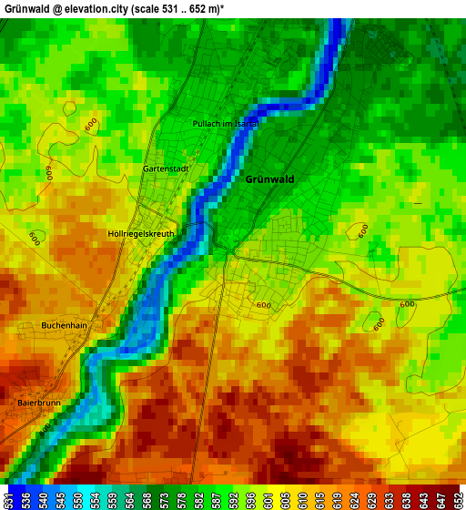
Below is the Elevation map of Grünwald, which displays elevation range with different colors. Scale of the first map is from 531 to 652 m (1742 to 2139 ft) with average elevation of 598.1 meters (=1962 ft) [note 1]
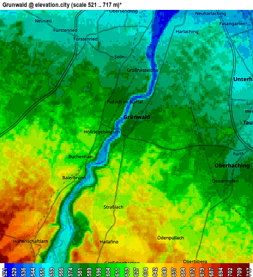
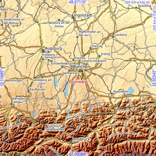
These maps also provides idea of topography and contour of this city, they are displayed at different zoom levels. More info about maps, scale and edge coordinates you can find below images.
| \ | Map #1 | Map #2 | Topo.Map |
| Scale [m] | 531..652 m | 521..717 m | × |
| Scale [ft] | 1742..2139 ft | 1709..2352 ft | × |
| Average | 598.1 m = 1962 ft | 599.5 m = 1967 ft | × |
| Width | 6.53 km = 4.1 mi | 13.07 km = 8.1 mi | 209.1 km = 129.9 mi |
| Height | 6.53 km = 4.1 mi | 13.07 km = 8.1 mi | 209.1 km = 129.9 mi |
| ↑Max Latitude | 48.068844° | 48.098202° | 48.97115° |
| Latitude at center | 48.03947° | 48.03947° | 48.03947° |
| ↓Min Latitude | 48.010079° | 47.980671° | 47.09064° |
| ← Min Longitude | 11.479255° | 11.435309° | 10.11695° |
| Longitude center | 11.5232° | 11.5232° | 11.5232° |
| →Max Longitude | 11.567145° | 11.611091° | 12.92945° |
Nearby cities:
Cities around Grünwald sort by population:
• Unterhaching elevation 562 m
7.5 km,  66°
66°
• Ottobrunn 558 m
10.8 km, 74°
• Taufkirchen 561 m
7 km,  81°
81°
• Gräfelfing 543 m
11.2 km,  321°
321°
• Neubiberg 548 m
10.9 km, 67°
• Oberhaching 581 m
5.8 km,  106°
106°
• Planegg 547 m
10.5 km, 315°
• Pullach im Isartal 582 m
2.4 km,  356°
356°
• Neuried 558 m
7.4 km, 324°
• Schäftlarn 658 m
7.4 km,  222°
222°
• Straßlach-Dingharting 634 m
3.9 km,  189°
189°
• Baierbrunn 619 m
3.4 km,  231°
231°
Multilingual:
 En español:
Grünwald elevación 595 m.
 En France:
Grünwald élévation 595 m.
 Auf Deutsch:
Grünwald höhe über dem Meeresspiegel ist 595 m.

Sources and notes:
- [note 1] Map square and city borders are not equal. Map elevation data is calculated only from area inside that square.
- [src 1] Elevation data from geonames database provided with same terms of usage.
- [src 2] The elevation map of Grünwald is generated using elevation data from NASA's 3 arcsec (90m) resolution SRTM data.
- [src 3] Base (background) map © OpenStreetMap contributors tiles are generated by Geofabrik and OpenTopoMap.
Copyright & License:
This Grünwald Elevation Map is licensed under CC BY-SA. You may reuse any part from this page, if you give a proper credit by linking to this URL:
 More info on terms of use page.