Schäftlarn elevation
Schäftlarn (Bavaria, Upper Bavaria), Germany elevation is 658 meters and Schäftlarn elevation in feet is 2159 ft above sea level [src 1]. Schäftlarn is a seat of a fourth-order administrative division (feature code) with elevation that is 400 meters (1312 ft) bigger than average city elevation in Germany.
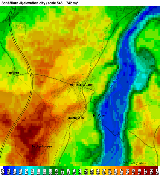
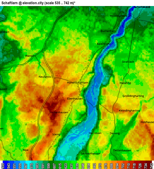
Below is the Elevation map of Schäftlarn, which displays elevation range with different colors. Scale of the first map is from 545 to 742 m (1788 to 2434 ft) with average elevation of 649 meters (=2129 ft) [note 1]
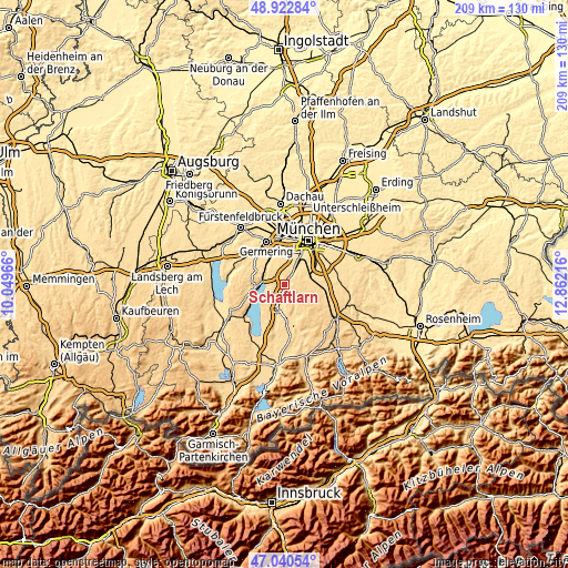
These maps also provides idea of topography and contour of this city, they are displayed at different zoom levels. More info about maps, scale and edge coordinates you can find below images.
| \ | Map #1 | Map #2 | Topo.Map |
| Scale [m] | 545..742 m | 535..742 m | × |
| Scale [ft] | 1788..2434 ft | 1755..2434 ft | × |
| Average | 649 m = 2129 ft | 639.5 m = 2098 ft | × |
| Width | 6.54 km = 4.1 mi | 13.08 km = 8.1 mi | 209.3 km = 130.1 mi |
| Height | 6.54 km = 4.1 mi | 13.08 km = 8.1 mi | 209.3 km = 130.1 mi |
| ↑Max Latitude | 48.019672° | 48.049058° | 48.92284° |
| Latitude at center | 47.99027° | 47.99027° | 47.99027° |
| ↓Min Latitude | 47.960851° | 47.931415° | 47.04054° |
| ← Min Longitude | 11.411965° | 11.368019° | 10.04966° |
| Longitude center | 11.45591° | 11.45591° | 11.45591° |
| →Max Longitude | 11.499855° | 11.543801° | 12.86216° |
Nearby cities:
Cities around Schäftlarn sort by population:
• Starnberg elevation 592 m
8.4 km,  278°
278°
• Gauting 583 m
10.6 km,  326°
326°
• Wolfratshausen 578 m
9 km,  196°
196°
• Oberhaching 581 m
11.2 km,  70°
70°
• Grünwald 595 m
7.4 km,  42°
42°
• Pullach im Isartal 582 m
9.3 km,  31°
31°
• Neuried 558 m
11.5 km,  3°
3°
• Pöcking 673 m
11.9 km,  257°
257°
• Egling 611 m
8.3 km,  153°
153°
• Icking 654 m
4.8 km, 200°
• Straßlach-Dingharting 634 m
4.6 km, 69°
• Baierbrunn 619 m
4.1 km, 34°
Multilingual:
 En español:
Schäftlarn elevación 658 m.
 En France:
Schäftlarn élévation 658 m.
 Auf Deutsch:
Schäftlarn höhe über dem Meeresspiegel ist 658 m.

Sources and notes:
- [note 1] Map square and city borders are not equal. Map elevation data is calculated only from area inside that square.
- [src 1] Elevation data from geonames database provided with same terms of usage.
- [src 2] The elevation map of Schäftlarn is generated using elevation data from NASA's 3 arcsec (90m) resolution SRTM data.
- [src 3] Base (background) map © OpenStreetMap contributors tiles are generated by Geofabrik and OpenTopoMap.
Copyright & License:
This Schäftlarn Elevation Map is licensed under CC BY-SA. You may reuse any part from this page, if you give a proper credit by linking to this URL:
 More info on terms of use page.