Haar elevation
Haar (Bavaria, Upper Bavaria), Germany elevation is 545 meters and Haar elevation in feet is 1788 ft above sea level [src 1]. Haar is a populated place (feature code) with elevation that is 287 meters (942 ft) bigger than average city elevation in Germany.
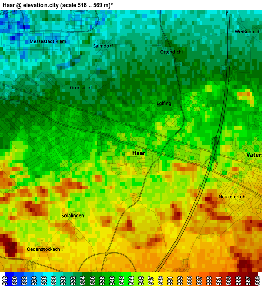
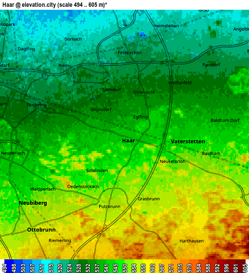
Below is the Elevation map of Haar, which displays elevation range with different colors. Scale of the first map is from 518 to 569 m (1699 to 1867 ft) with average elevation of 541.6 meters (=1777 ft) [note 1]
These maps also provides idea of topography and contour of this city, they are displayed at different zoom levels. More info about maps, scale and edge coordinates you can find below images.
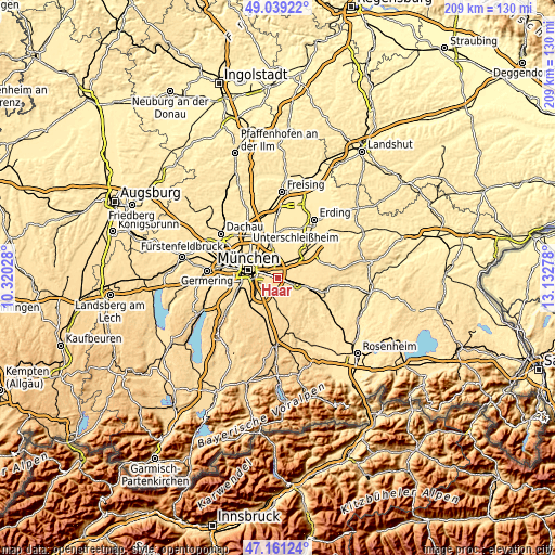
| \ | Map #1 | Map #2 | Topo.Map |
| Scale [m] | 518..569 m | 494..605 m | × |
| Scale [ft] | 1699..1867 ft | 1621..1985 ft | × |
| Average | 541.6 m = 1777 ft | 541.4 m = 1776 ft | × |
| Width | 6.53 km = 4.1 mi | 13.05 km = 8.1 mi | 208.8 km = 129.7 mi |
| Height | 6.53 km = 4.1 mi | 13.05 km = 8.1 mi | 208.8 km = 129.7 mi |
| ↑Max Latitude | 48.138145° | 48.167463° | 49.03922° |
| Latitude at center | 48.10881° | 48.10881° | 48.10881° |
| ↓Min Latitude | 48.079459° | 48.05009° | 47.16124° |
| ← Min Longitude | 11.682585° | 11.638639° | 10.32028° |
| Longitude center | 11.72653° | 11.72653° | 11.72653° |
| →Max Longitude | 11.770475° | 11.814421° | 13.13278° |
Nearby cities:
Cities around Haar sort by population:
• Bogenhausen elevation 521 m
9.5 km,  300°
300°
• Vaterstetten 547 m
3.1 km,  97°
97°
• Unterhaching 562 m
9.5 km,  239°
239°
• Ottobrunn 558 m
6.8 km,  223°
223°
• Neubiberg 548 m
6.2 km, 235°
• Kirchheim bei München 511 m
7.8 km,  15°
15°
• Hohenbrunn 571 m
7 km,  194°
194°
• Zorneding 563 m
7.8 km,  110°
110°
• Aschheim 515 m
7 km,  354°
354°
• Putzbrunn 556 m
3.8 km, 192°
• Grasbrunn 555 m
3.5 km,  159°
159°
• Feldkirchen 525 m
4.4 km,  4°
4°
Multilingual:
 En español:
Haar elevación 545 m.
 En France:
Haar élévation 545 m.


Sources and notes:
- [note 1] Map square and city borders are not equal. Map elevation data is calculated only from area inside that square.
- [src 1] Elevation data from geonames database provided with same terms of usage.
- [src 2] The elevation map of Haar is generated using elevation data from NASA's 3 arcsec (90m) resolution SRTM data.
- [src 3] Base (background) map © OpenStreetMap contributors tiles are generated by Geofabrik and OpenTopoMap.
Copyright & License:
This Haar Elevation Map is licensed under CC BY-SA. You may reuse any part from this page, if you give a proper credit by linking to this URL:
 More info on terms of use page.