Hausen elevation
Hausen (Bavaria, Regierungsbezirk Unterfranken), Germany elevation is 185 meters and Hausen elevation in feet is 607 ft above sea level [src 1]. Hausen is a seat of a fourth-order administrative division (feature code) with elevation that is 73 meters (240 ft) smaller than average city elevation in Germany.
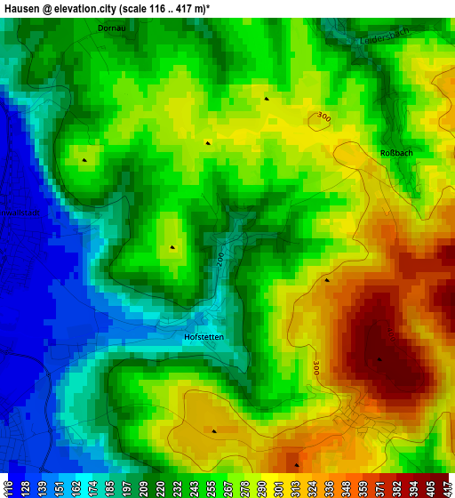
Below is the Elevation map of Hausen, which displays elevation range with different colors. Scale of the first map is from 116 to 417 m (381 to 1368 ft) with average elevation of 249 meters (=817 ft) [note 1]
These maps also provides idea of topography and contour of this city, they are displayed at different zoom levels. More info about maps, scale and edge coordinates you can find below images.
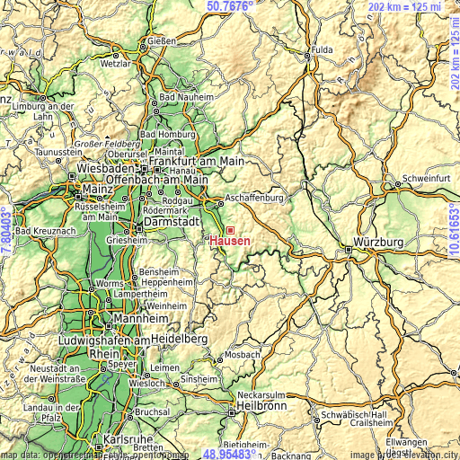
| \ | Map #1 | Topo.Map |
| Scale [m] | 116..417 m | × |
| Scale [ft] | 381..1368 ft | × |
| Average | 249 m = 817 ft | × |
| Width | 6.3 km = 3.9 mi | 201.6 km = 125.3 mi |
| Height | 6.3 km = 3.9 mi | 201.5 km = 125.2 mi |
| ↑Max Latitude | 49.898036° | 50.7676° |
| Latitude at center | 49.86972° | 49.86972° |
| ↓Min Latitude | 49.841388° | 48.95483° |
| ← Min Longitude | 9.166335° | 7.80403° |
| Longitude center | 9.21028° | 9.21028° |
| →Max Longitude | 9.254225° | 10.61653° |
Nearby cities:
Cities around Hausen sort by population:
• Erlenbach am Main elevation 138 m
8.1 km,  204°
204°
• Obernburg am Main 181 m
6.8 km,  236°
236°
• Elsenfeld 125 m
4.5 km,  228°
228°
• Sulzbach am Main 129 m
6.2 km,  318°
318°
• Kleinwallstadt 124 m
3 km,  280°
280°
• Leidersbach 188 m
3.6 km,  13°
13°
• Wörth am Main 124 m
9 km,  206°
206°
• Niedernberg 122 m
7.1 km,  311°
311°
• Eschau 177 m
6.7 km,  148°
148°
• Großwallstadt 127 m
4.2 km, 284°
• Mespelbrunn 278 m
7.7 km,  49°
49°
• Heimbuchenthal 230 m
6.5 km,  70°
70°
Multilingual:
 En español:
Hausen elevación 185 m.
 En France:
Hausen élévation 185 m.


Sources and notes:
- [note 1] Map square and city borders are not equal. Map elevation data is calculated only from area inside that square.
- [src 1] Elevation data from geonames database provided with same terms of usage.
- [src 2] The elevation map of Hausen is generated using elevation data from NASA's 3 arcsec (90m) resolution SRTM data.
- [src 3] Base (background) map © OpenStreetMap contributors tiles are generated by Geofabrik and OpenTopoMap.
Copyright & License:
This Hausen Elevation Map is licensed under CC BY-SA. You may reuse any part from this page, if you give a proper credit by linking to this URL:
 More info on terms of use page.