Helmbrechts elevation
Helmbrechts (Bavaria, Upper Franconia), Germany elevation is 621 meters and Helmbrechts elevation in feet is 2037 ft above sea level [src 1]. Helmbrechts is a populated place (feature code) with elevation that is 363 meters (1191 ft) bigger than average city elevation in Germany.
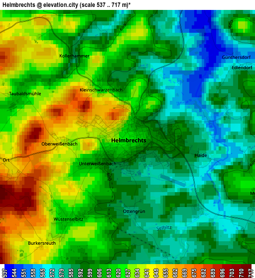
Below is the Elevation map of Helmbrechts, which displays elevation range with different colors. Scale of the first map is from 537 to 717 m (1762 to 2352 ft) with average elevation of 608.9 meters (=1998 ft) [note 1]
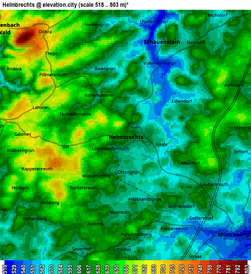
These maps also provides idea of topography and contour of this city, they are displayed at different zoom levels. More info about maps, scale and edge coordinates you can find below images.
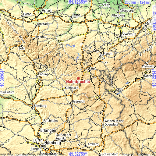
| \ | Map #1 | Map #2 | Topo.Map |
| Scale [m] | 537..717 m | 518..803 m | × |
| Scale [ft] | 1762..2352 ft | 1699..2635 ft | × |
| Average | 608.9 m = 1998 ft | 614.6 m = 2016 ft | × |
| Width | 6.25 km = 3.9 mi | 12.5 km = 7.8 mi | 200 km = 124.3 mi |
| Height | 6.25 km = 3.9 mi | 12.5 km = 7.8 mi | 200 km = 124.3 mi |
| ↑Max Latitude | 50.263671° | 50.291755° | 51.12659° |
| Latitude at center | 50.23557° | 50.23557° | 50.23557° |
| ↓Min Latitude | 50.207453° | 50.179319° | 49.32759° |
| ← Min Longitude | 11.671945° | 11.627999° | 10.30964° |
| Longitude center | 11.71589° | 11.71589° | 11.71589° |
| →Max Longitude | 11.759835° | 11.803781° | 13.12214° |
Nearby cities:
Cities around Helmbrechts sort by population:
• Münchberg elevation 536 m
7.3 km,  134°
134°
• Naila 515 m
10.6 km,  355°
355°
• Selbitz 532 m
9.4 km,  15°
15°
• Marktleugast 551 m
9.1 km,  220°
220°
• Konradsreuth 545 m
10.1 km,  70°
70°
• Steinbach 535 m
10.3 km,  206°
206°
• Stammbach 550 m
10.2 km,  189°
189°
• Presseck 645 m
11.5 km,  265°
265°
• Schauenstein 594 m
5.1 km, 21°
• Weißdorf 551 m
11.2 km,  121°
121°
• Leupoldsgrün 631 m
9.3 km,  39°
39°
• Grafengehaig 575 m
9.4 km,  247°
247°
Multilingual:
 En español:
Helmbrechts elevación 621 m.
 En France:
Helmbrechts élévation 621 m.
 Auf Deutsch:
Helmbrechts höhe über dem Meeresspiegel ist 621 m.

Sources and notes:
- [note 1] Map square and city borders are not equal. Map elevation data is calculated only from area inside that square.
- [src 1] Elevation data from geonames database provided with same terms of usage.
- [src 2] The elevation map of Helmbrechts is generated using elevation data from NASA's 3 arcsec (90m) resolution SRTM data.
- [src 3] Base (background) map © OpenStreetMap contributors tiles are generated by Geofabrik and OpenTopoMap.
Copyright & License:
This Helmbrechts Elevation Map is licensed under CC BY-SA. You may reuse any part from this page, if you give a proper credit by linking to this URL:
 More info on terms of use page.