Münchberg elevation
Münchberg (Bavaria, Upper Franconia), Germany elevation is 536 meters and Münchberg elevation in feet is 1759 ft above sea level [src 1]. Münchberg is a populated place (feature code) with elevation that is 278 meters (912 ft) bigger than average city elevation in Germany.
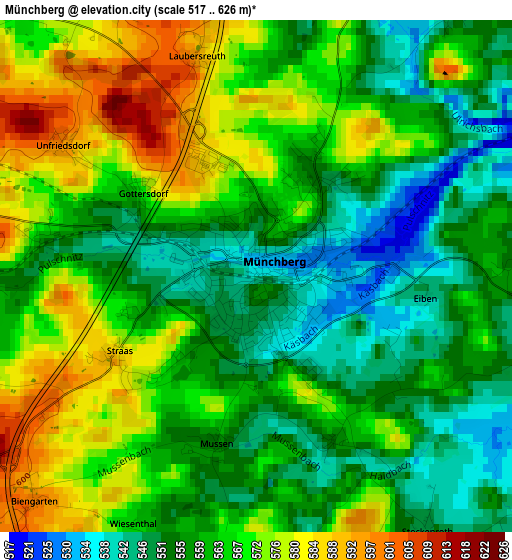
Below is the Elevation map of Münchberg, which displays elevation range with different colors. Scale of the first map is from 517 to 626 m (1696 to 2054 ft) with average elevation of 563 meters (=1847 ft) [note 1]
These maps also provides idea of topography and contour of this city, they are displayed at different zoom levels. More info about maps, scale and edge coordinates you can find below images.
| \ | Map #1 | Map #2 | Topo.Map |
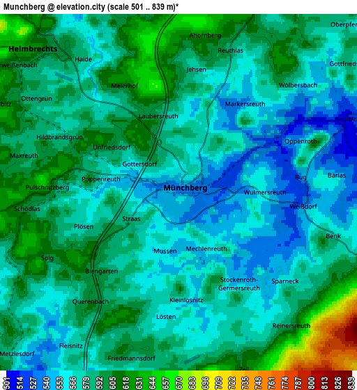
| Scale [m] | 517..626 m | 501..839 m | × |
| Scale [ft] | 1696..2054 ft | 1644..2753 ft | × |
| Average | 563 m = 1847 ft | 582.7 m = 1912 ft | × |
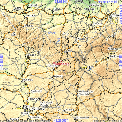
| Width | 6.26 km = 3.9 mi | 12.51 km = 7.8 mi | 200.2 km = 124.4 mi |
| Height | 6.26 km = 3.9 mi | 12.51 km = 7.8 mi | 200.2 km = 124.4 mi |
| ↑Max Latitude | 50.217648° | 50.245759° | 51.0814° |
| Latitude at center | 50.18952° | 50.18952° | 50.18952° |
| ↓Min Latitude | 50.161376° | 50.133215° | 49.28067° |
| ← Min Longitude | 11.744285° | 11.700339° | 10.38198° |
| Longitude center | 11.78823° | 11.78823° | 11.78823° |
| →Max Longitude | 11.832175° | 11.876121° | 13.19448° |
Nearby cities:
Cities around Münchberg sort by population:
• Schwarzenbach an der Saale elevation 498 m
11.1 km,  70°
70°
• Helmbrechts 621 m
7.3 km,  314°
314°
• Gefrees 498 m
11.1 km,  198°
198°
• Oberhaid 629 m
7.1 km,  170°
170°
• Marktleugast 551 m
11.1 km,  260°
260°
• Konradsreuth 545 m
9.6 km,  27°
27°
• Steinbach 535 m
10.6 km,  247°
247°
• Stammbach 550 m
8.5 km,  234°
234°
• Zell im Fichtelgebirge 621 m
6.5 km,  157°
157°
• Schauenstein 594 m
10.4 km,  341°
341°
• Sparneck 563 m
5 km,  127°
127°
• Weißdorf 551 m
4.5 km,  98°
98°
Multilingual:
 En español:
Münchberg elevación 536 m.
 En France:
Münchberg élévation 536 m.
 Auf Deutsch:
Münchberg höhe über dem Meeresspiegel ist 536 m.

Sources and notes:
- [note 1] Map square and city borders are not equal. Map elevation data is calculated only from area inside that square.
- [src 1] Elevation data from geonames database provided with same terms of usage.
- [src 2] The elevation map of Münchberg is generated using elevation data from NASA's 3 arcsec (90m) resolution SRTM data.
- [src 3] Base (background) map © OpenStreetMap contributors tiles are generated by Geofabrik and OpenTopoMap.
Copyright & License:
This Münchberg Elevation Map is licensed under CC BY-SA. You may reuse any part from this page, if you give a proper credit by linking to this URL:
 More info on terms of use page.