Naila elevation
Naila (Bavaria, Upper Franconia), Germany elevation is 515 meters and Naila elevation in feet is 1690 ft above sea level [src 1]. Naila is a populated place (feature code) with elevation that is 257 meters (843 ft) bigger than average city elevation in Germany.
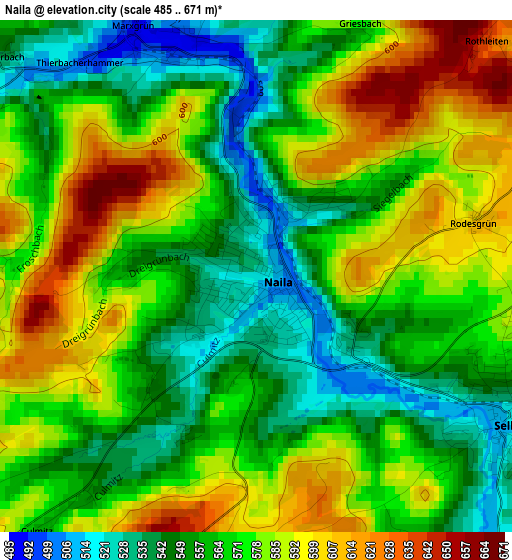
Below is the Elevation map of Naila, which displays elevation range with different colors. Scale of the first map is from 485 to 671 m (1591 to 2201 ft) with average elevation of 570.5 meters (=1872 ft) [note 1]
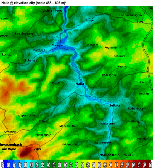
These maps also provides idea of topography and contour of this city, they are displayed at different zoom levels. More info about maps, scale and edge coordinates you can find below images.
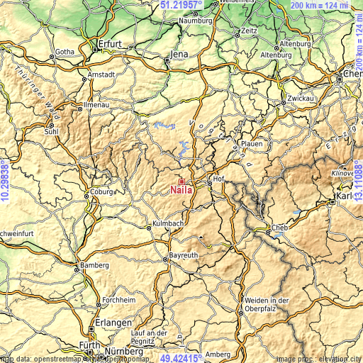
| \ | Map #1 | Map #2 | Topo.Map |
| Scale [m] | 485..671 m | 455..803 m | × |
| Scale [ft] | 1591..2201 ft | 1493..2635 ft | × |
| Average | 570.5 m = 1872 ft | 596.1 m = 1956 ft | × |
| Width | 6.24 km = 3.9 mi | 12.48 km = 7.8 mi | 199.6 km = 124 mi |
| Height | 6.24 km = 3.9 mi | 12.48 km = 7.8 mi | 199.6 km = 124 mi |
| ↑Max Latitude | 50.358385° | 50.386413° | 51.21957° |
| Latitude at center | 50.33034° | 50.33034° | 50.33034° |
| ↓Min Latitude | 50.302279° | 50.274201° | 49.42415° |
| ← Min Longitude | 11.660685° | 11.616739° | 10.29838° |
| Longitude center | 11.70463° | 11.70463° | 11.70463° |
| →Max Longitude | 11.748575° | 11.792521° | 13.11088° |
Nearby cities:
Cities around Naila sort by population:
• Helmbrechts elevation 621 m
10.6 km,  175°
175°
• Bad Lobenstein 506 m
14.3 km,  341°
341°
• Selbitz 532 m
3.6 km,  114°
114°
• Bad Steben 582 m
5.9 km,  313°
313°
• Konradsreuth 545 m
12.5 km,  124°
124°
• Geroldsgrün 618 m
7.4 km,  272°
272°
• Köditz 514 m
10.3 km,  88°
88°
• Berg 625 m
7.2 km,  46°
46°
• Schauenstein 594 m
6.4 km,  155°
155°
• Leupoldsgrün 631 m
7.6 km, 116°
• Lichtenberg 561 m
6.2 km, 341°
• Töpen 525 m
13.7 km,  60°
60°
Multilingual:
 En español:
Naila elevación 515 m.
 En France:
Naila élévation 515 m.


Sources and notes:
- [note 1] Map square and city borders are not equal. Map elevation data is calculated only from area inside that square.
- [src 1] Elevation data from geonames database provided with same terms of usage.
- [src 2] The elevation map of Naila is generated using elevation data from NASA's 3 arcsec (90m) resolution SRTM data.
- [src 3] Base (background) map © OpenStreetMap contributors tiles are generated by Geofabrik and OpenTopoMap.
Copyright & License:
This Naila Elevation Map is licensed under CC BY-SA. You may reuse any part from this page, if you give a proper credit by linking to this URL:
 More info on terms of use page.