Holle elevation
Holle (Lower Saxony), Germany elevation is 111 meters and Holle elevation in feet is 364 ft above sea level [src 1]. Holle is a seat of a fourth-order administrative division (feature code) with elevation that is 147 meters (482 ft) smaller than average city elevation in Germany.
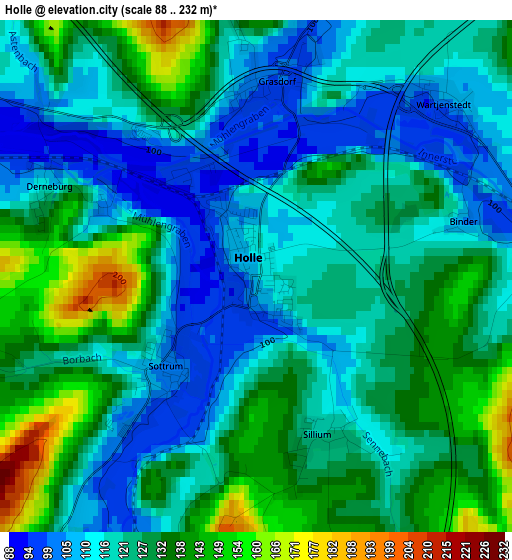
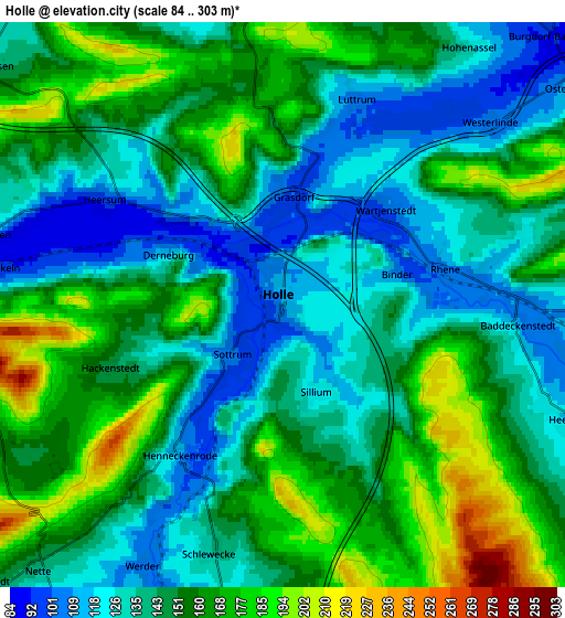
Below is the Elevation map of Holle, which displays elevation range with different colors. Scale of the first map is from 88 to 232 m (289 to 761 ft) with average elevation of 124.3 meters (=408 ft) [note 1]
These maps also provides idea of topography and contour of this city, they are displayed at different zoom levels. More info about maps, scale and edge coordinates you can find below images.
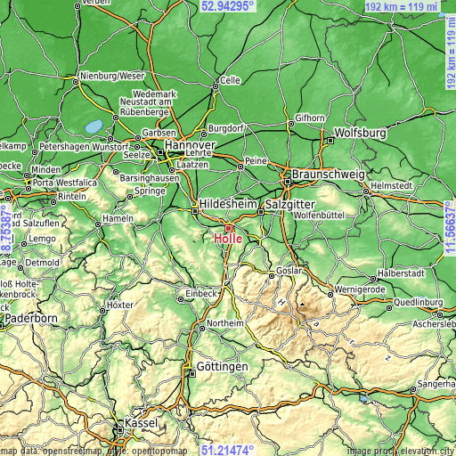
| \ | Map #1 | Map #2 | Topo.Map |
| Scale [m] | 88..232 m | 84..303 m | × |
| Scale [ft] | 289..761 ft | 276..994 ft | × |
| Average | 124.3 m = 408 ft | 148.7 m = 488 ft | × |
| Width | 6 km = 3.7 mi | 12.01 km = 7.5 mi | 192.2 km = 119.4 mi |
| Height | 6 km = 3.7 mi | 12.01 km = 7.5 mi | 192.1 km = 119.4 mi |
| ↑Max Latitude | 52.114205° | 52.141183° | 52.94295° |
| Latitude at center | 52.08721° | 52.08721° | 52.08721° |
| ↓Min Latitude | 52.060199° | 52.033172° | 51.21474° |
| ← Min Longitude | 10.116175° | 10.072229° | 8.75387° |
| Longitude center | 10.16012° | 10.16012° | 10.16012° |
| →Max Longitude | 10.204065° | 10.248011° | 11.56637° |
Nearby cities:
Cities around Holle sort by population:
• Bad Salzdetfurth elevation 110 m
11 km,  252°
252°
• Bockenem 122 m
8.8 km,  192°
192°
• Schellerten 91 m
11.6 km,  340°
340°
• Söhlde 99 m
12.3 km,  23°
23°
• Baddeckenstedt 110 m
5 km,  94°
94°
• Lutter am Barenberge 160 m
13.2 km,  145°
145°
• Elbe 111 m
8.4 km, 92°
• Haverlah 129 m
2.3 km,  168°
168°
• Heere 113 m
6.6 km,  110°
110°
• Alt Wallmoden 136 m
12.3 km,  127°
127°
• Sehlde 133 m
9 km, 126°
• Sehlem 145 m
15.1 km,  236°
236°
Multilingual:
 En español:
Holle elevación 111 m.
 En France:
Holle élévation 111 m.


Sources and notes:
- [note 1] Map square and city borders are not equal. Map elevation data is calculated only from area inside that square.
- [src 1] Elevation data from geonames database provided with same terms of usage.
- [src 2] The elevation map of Holle is generated using elevation data from NASA's 3 arcsec (90m) resolution SRTM data.
- [src 3] Base (background) map © OpenStreetMap contributors tiles are generated by Geofabrik and OpenTopoMap.
Copyright & License:
This Holle Elevation Map is licensed under CC BY-SA. You may reuse any part from this page, if you give a proper credit by linking to this URL:
 More info on terms of use page.