Söhlde elevation
Söhlde (Lower Saxony), Germany elevation is 99 meters and Söhlde elevation in feet is 325 ft above sea level [src 1]. Söhlde is a seat of a fourth-order administrative division (feature code) with elevation that is 159 meters (522 ft) smaller than average city elevation in Germany.
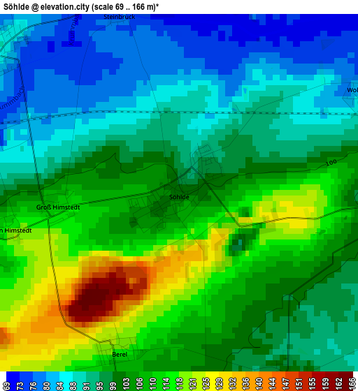
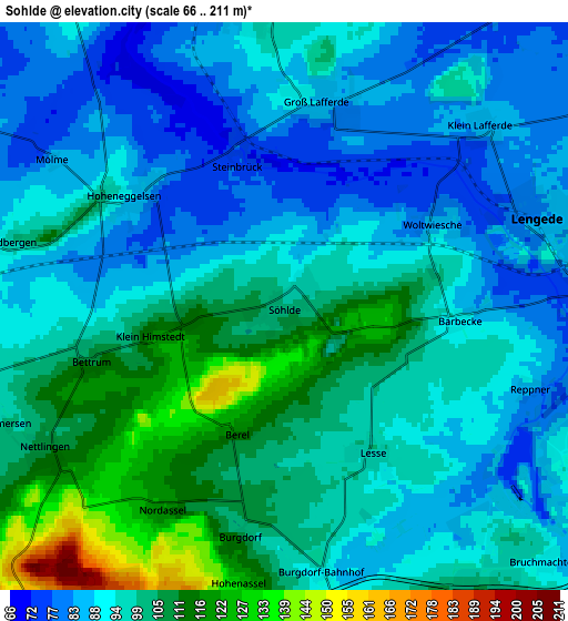
Below is the Elevation map of Söhlde, which displays elevation range with different colors. Scale of the first map is from 69 to 166 m (226 to 545 ft) with average elevation of 100.6 meters (=330 ft) [note 1]
These maps also provides idea of topography and contour of this city, they are displayed at different zoom levels. More info about maps, scale and edge coordinates you can find below images.
| \ | Map #1 | Map #2 | Topo.Map |
| Scale [m] | 69..166 m | 66..211 m | × |
| Scale [ft] | 226..545 ft | 217..692 ft | × |
| Average | 100.6 m = 330 ft | 96.1 m = 315 ft | × |
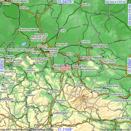
| Width | 5.99 km = 3.7 mi | 11.98 km = 7.4 mi | 191.7 km = 119.1 mi |
| Height | 5.99 km = 3.7 mi | 11.98 km = 7.4 mi | 191.7 km = 119.1 mi |
| ↑Max Latitude | 52.215913° | 52.242829° | 53.04276° |
| Latitude at center | 52.18898° | 52.18898° | 52.18898° |
| ↓Min Latitude | 52.162031° | 52.135065° | 51.31849° |
| ← Min Longitude | 10.188445° | 10.144499° | 8.82614° |
| Longitude center | 10.23239° | 10.23239° | 10.23239° |
| →Max Longitude | 10.276335° | 10.320281° | 11.63864° |
Nearby cities:
Cities around Söhlde sort by population:
• Salzgitter elevation 99 m
13 km,  105°
105°
• Peine 68 m
14.5 km,  0°
0°
• Vechelde 82 m
12 km,  48°
48°
• Lengede 82 m
5.4 km,  71°
71°
• Ilsede 74 m
8.6 km,  344°
344°
• Hohenhameln 104 m
13.8 km,  303°
303°
• Schellerten 91 m
8.9 km,  267°
267°
• Holle 111 m
12.3 km,  203°
203°
• Baddeckenstedt 110 m
11.7 km,  179°
179°
• Elbe 111 m
12.3 km,  163°
163°
• Haverlah 129 m
14.3 km, 198°
• Heere 113 m
13.7 km,  174°
174°
Multilingual:
 En español:
Söhlde elevación 99 m.
 En France:
Söhlde élévation 99 m.


Sources and notes:
- [note 1] Map square and city borders are not equal. Map elevation data is calculated only from area inside that square.
- [src 1] Elevation data from geonames database provided with same terms of usage.
- [src 2] The elevation map of Söhlde is generated using elevation data from NASA's 3 arcsec (90m) resolution SRTM data.
- [src 3] Base (background) map © OpenStreetMap contributors tiles are generated by Geofabrik and OpenTopoMap.
Copyright & License:
This Söhlde Elevation Map is licensed under CC BY-SA. You may reuse any part from this page, if you give a proper credit by linking to this URL:
 More info on terms of use page.