Holzappel elevation
Holzappel (Rheinland-Pfalz), Germany elevation is 302 meters and Holzappel elevation in feet is 991 ft above sea level [src 1]. Holzappel is a seat of a fourth-order administrative division (feature code) with elevation that is 44 meters (144 ft) bigger than average city elevation in Germany.
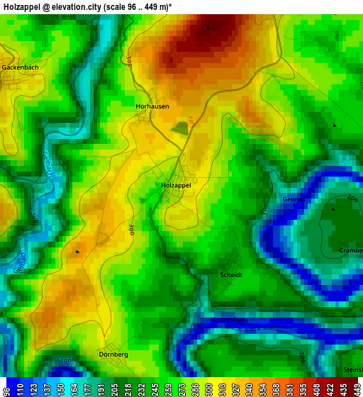
Below is the Elevation map of Holzappel, which displays elevation range with different colors. Scale of the first map is from 96 to 449 m (315 to 1473 ft) with average elevation of 252.4 meters (=828 ft) [note 1]
These maps also provides idea of topography and contour of this city, they are displayed at different zoom levels. More info about maps, scale and edge coordinates you can find below images.
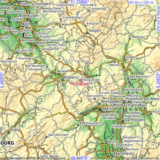
| \ | Map #1 | Topo.Map |
| Scale [m] | 96..449 m | × |
| Scale [ft] | 315..1473 ft | × |
| Average | 252.4 m = 828 ft | × |
| Width | 6.24 km = 3.9 mi | 199.5 km = 124 mi |
| Height | 6.24 km = 3.9 mi | 199.5 km = 124 mi |
| ↑Max Latitude | 50.378033° | 51.23886° |
| Latitude at center | 50.35° | 50.35° |
| ↓Min Latitude | 50.32195° | 49.44418° |
| ← Min Longitude | 7.856055° | 6.49375° |
| Longitude center | 7.9° | 7.9° |
| →Max Longitude | 7.943945° | 9.30625° |
Nearby cities:
Cities around Holzappel sort by population:
• Diez elevation 129 m
8.1 km,  70°
70°
• Nassau 102 m
8.1 km,  240°
240°
• Altendiez 156 m
6.2 km, 72°
• Nentershausen 295 m
7.8 km,  17°
17°
• Singhofen 301 m
9.6 km,  209°
209°
• Niederelbert 273 m
9.1 km,  315°
315°
• Birlenbach 179 m
7.3 km,  82°
82°
• Dausenau 240 m
9.6 km,  258°
258°
• Holler 222 m
8.8 km,  327°
327°
• Heistenbach 157 m
6.9 km,  61°
61°
• Oberelbert 318 m
7.5 km,  308°
308°
• Gückingen 185 m
8.9 km, 59°
Multilingual:
 En español:
Holzappel elevación 302 m.
 En France:
Holzappel élévation 302 m.
 Auf Deutsch:
Holzappel höhe über dem Meeresspiegel ist 302 m.

Sources and notes:
- [note 1] Map square and city borders are not equal. Map elevation data is calculated only from area inside that square.
- [src 1] Elevation data from geonames database provided with same terms of usage.
- [src 2] The elevation map of Holzappel is generated using elevation data from NASA's 3 arcsec (90m) resolution SRTM data.
- [src 3] Base (background) map © OpenStreetMap contributors tiles are generated by Geofabrik and OpenTopoMap.
Copyright & License:
This Holzappel Elevation Map is licensed under CC BY-SA. You may reuse any part from this page, if you give a proper credit by linking to this URL:
 More info on terms of use page.