Nentershausen elevation
Nentershausen (Rheinland-Pfalz), Germany elevation is 295 meters and Nentershausen elevation in feet is 968 ft above sea level [src 1]. Nentershausen is a seat of a fourth-order administrative division (feature code) with elevation that is 37 meters (121 ft) bigger than average city elevation in Germany.
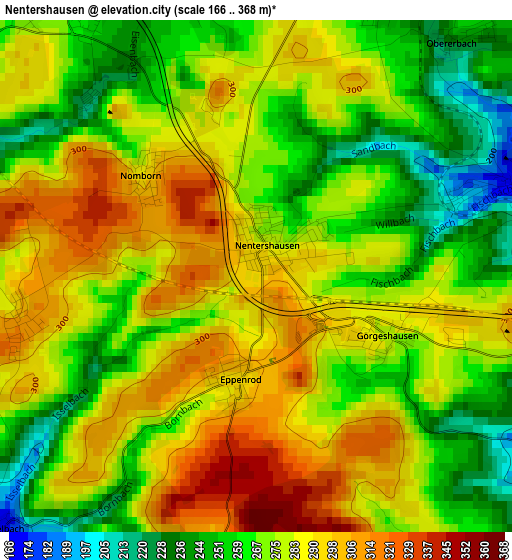
Below is the Elevation map of Nentershausen, which displays elevation range with different colors. Scale of the first map is from 166 to 368 m (545 to 1207 ft) with average elevation of 276.7 meters (=908 ft) [note 1]
These maps also provides idea of topography and contour of this city, they are displayed at different zoom levels. More info about maps, scale and edge coordinates you can find below images.
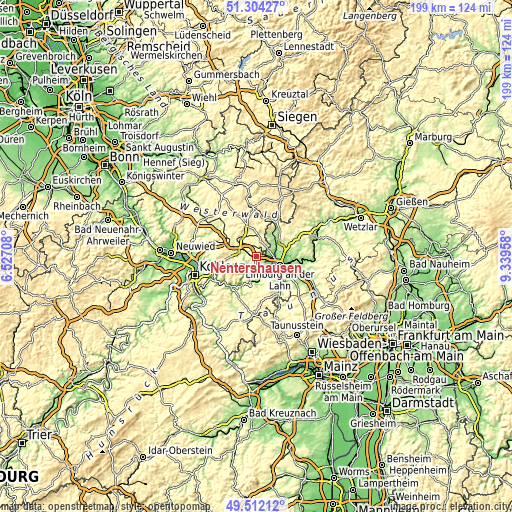
| \ | Map #1 | Topo.Map |
| Scale [m] | 166..368 m | × |
| Scale [ft] | 545..1207 ft | × |
| Average | 276.7 m = 908 ft | × |
| Width | 6.23 km = 3.9 mi | 199.3 km = 123.8 mi |
| Height | 6.23 km = 3.9 mi | 199.3 km = 123.8 mi |
| ↑Max Latitude | 50.444664° | 51.30427° |
| Latitude at center | 50.41667° | 50.41667° |
| ↓Min Latitude | 50.38866° | 49.51212° |
| ← Min Longitude | 7.889385° | 6.52708° |
| Longitude center | 7.93333° | 7.93333° |
| →Max Longitude | 7.977275° | 9.33958° |
Nearby cities:
Cities around Nentershausen sort by population:
• Diez elevation 129 m
7.1 km,  131°
131°
• Elz 159 m
7.1 km,  90°
90°
• Altendiez 156 m
6.6 km,  147°
147°
• Hundsangen 263 m
5.1 km,  43°
43°
• Heiligenroth 225 m
6 km,  308°
308°
• Girod 256 m
3.9 km,  342°
342°
• Ruppach-Goldhausen 301 m
6.6 km,  327°
327°
• Heistenbach 157 m
5.6 km,  137°
137°
• Dreikirchen 254 m
2.2 km,  32°
32°
• Gückingen 185 m
6 km,  118°
118°
• Niedererbach 170 m
3.1 km,  70°
70°
• Großholbach 313 m
5.1 km,  316°
316°
Multilingual:
 En español:
Nentershausen elevación 295 m.
 En France:
Nentershausen élévation 295 m.
 Auf Deutsch:
Nentershausen höhe über dem Meeresspiegel ist 295 m.

Sources and notes:
- [note 1] Map square and city borders are not equal. Map elevation data is calculated only from area inside that square.
- [src 1] Elevation data from geonames database provided with same terms of usage.
- [src 2] The elevation map of Nentershausen is generated using elevation data from NASA's 3 arcsec (90m) resolution SRTM data.
- [src 3] Base (background) map © OpenStreetMap contributors tiles are generated by Geofabrik and OpenTopoMap.
Copyright & License:
This Nentershausen Elevation Map is licensed under CC BY-SA. You may reuse any part from this page, if you give a proper credit by linking to this URL:
 More info on terms of use page.