Kirchberg elevation
Kirchberg (Rheinland-Pfalz), Germany elevation is 435 meters and Kirchberg elevation in feet is 1427 ft above sea level [src 1]. Kirchberg is a populated place (feature code) with elevation that is 177 meters (581 ft) bigger than average city elevation in Germany.
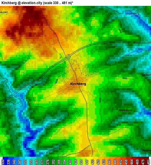
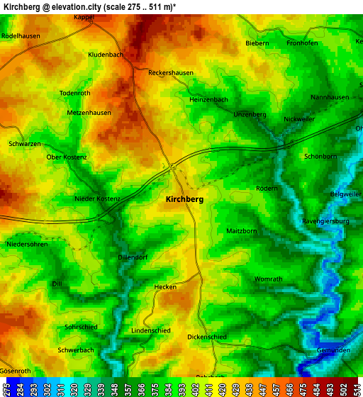
Below is the Elevation map of Kirchberg, which displays elevation range with different colors. Scale of the first map is from 330 to 481 m (1083 to 1578 ft) with average elevation of 397.8 meters (=1305 ft) [note 1]
These maps also provides idea of topography and contour of this city, they are displayed at different zoom levels. More info about maps, scale and edge coordinates you can find below images.
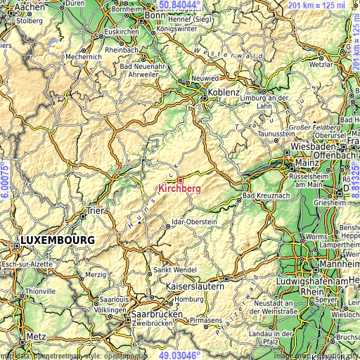
| \ | Map #1 | Map #2 | Topo.Map |
| Scale [m] | 330..481 m | 275..511 m | × |
| Scale [ft] | 1083..1578 ft | 902..1677 ft | × |
| Average | 397.8 m = 1305 ft | 395.3 m = 1297 ft | × |
| Width | 6.29 km = 3.9 mi | 12.58 km = 7.8 mi | 201.3 km = 125.1 mi |
| Height | 6.29 km = 3.9 mi | 12.58 km = 7.8 mi | 201.2 km = 125 mi |
| ↑Max Latitude | 49.972222° | 50.000478° | 50.84044° |
| Latitude at center | 49.94395° | 49.94395° | 49.94395° |
| ↓Min Latitude | 49.915661° | 49.887356° | 49.03046° |
| ← Min Longitude | 7.363055° | 7.319109° | 6.00075° |
| Longitude center | 7.407° | 7.407° | 7.407° |
| →Max Longitude | 7.450945° | 7.494891° | 8.81325° |
Nearby cities:
Cities around Kirchberg sort by population:
• Simmern elevation 333 m
9.3 km,  63°
63°
• Kastellaun 413 m
14.1 km,  10°
10°
• Sohren 429 m
6.6 km,  259°
259°
• Rhaunen 344 m
10.1 km,  207°
207°
• Blankenrath 399 m
13 km,  324°
324°
• Büchenbeuren 446 m
9.4 km,  254°
254°
• Argenthal 485 m
14 km,  79°
79°
• Bell 434 m
13.1 km,  2°
2°
• Hennweiler 358 m
14.3 km,  172°
172°
• Gemünden 283 m
7.5 km,  137°
137°
• Mastershausen 413 m
14.2 km,  343°
343°
• Bundenbach 393 m
11.4 km,  190°
190°
Multilingual:
 En español:
Kirchberg elevación 435 m.
 En France:
Kirchberg élévation 435 m.
 Auf Deutsch:
Kirchberg (Hunsrück) höhe über dem Meeresspiegel ist 435 m.

Sources and notes:
- [note 1] Map square and city borders are not equal. Map elevation data is calculated only from area inside that square.
- [src 1] Elevation data from geonames database provided with same terms of usage.
- [src 2] The elevation map of Kirchberg is generated using elevation data from NASA's 3 arcsec (90m) resolution SRTM data.
- [src 3] Base (background) map © OpenStreetMap contributors tiles are generated by Geofabrik and OpenTopoMap.
Copyright & License:
This Kirchberg Elevation Map is licensed under CC BY-SA. You may reuse any part from this page, if you give a proper credit by linking to this URL:
 More info on terms of use page.