Kirchzell elevation
Kirchzell (Bavaria, Regierungsbezirk Unterfranken), Germany elevation is 197 meters and Kirchzell elevation in feet is 646 ft above sea level [src 1]. Kirchzell is a populated place (feature code) with elevation that is 61 meters (200 ft) smaller than average city elevation in Germany.
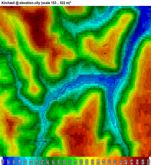
Below is the Elevation map of Kirchzell, which displays elevation range with different colors. Scale of the first map is from 153 to 522 m (502 to 1713 ft) with average elevation of 332.9 meters (=1092 ft) [note 1]
These maps also provides idea of topography and contour of this city, they are displayed at different zoom levels. More info about maps, scale and edge coordinates you can find below images.
| \ | Map #1 | Topo.Map |
| Scale [m] | 153..522 m | × |
| Scale [ft] | 502..1713 ft | × |
| Average | 332.9 m = 1092 ft | × |
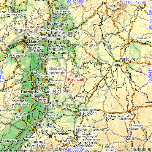
| Width | 6.33 km = 3.9 mi | 202.6 km = 125.9 mi |
| Height | 6.33 km = 3.9 mi | 202.6 km = 125.9 mi |
| ↑Max Latitude | 49.646463° | 50.52058° |
| Latitude at center | 49.618° | 49.618° |
| ↓Min Latitude | 49.58952° | 48.69839° |
| ← Min Longitude | 9.133905° | 7.7716° |
| Longitude center | 9.17785° | 9.17785° |
| →Max Longitude | 9.221795° | 10.5841° |
Nearby cities:
Cities around Kirchzell sort by population:
• Buchen in Odenwald elevation 344 m
14.8 km,  134°
134°
• Michelstadt 207 m
14.1 km,  297°
297°
• Erbach 222 m
14.1 km,  290°
290°
• Walldürn 417 m
14.1 km,  105°
105°
• Miltenberg 145 m
11.6 km,  33°
33°
• Großheubach 133 m
12.7 km,  14°
14°
• Mudau 452 m
9.5 km,  168°
168°
• Bürgstadt 138 m
12.6 km, 31°
• Kleinheubach 129 m
11.7 km, 12°
• Eichenbühl 179 m
14.6 km,  48°
48°
• Weilbach 152 m
6.2 km, 26°
• Laudenbach 133 m
14.2 km,  359°
359°
Multilingual:
 En español:
Kirchzell elevación 197 m.
 En France:
Kirchzell élévation 197 m.
 Auf Deutsch:
Kirchzell höhe über dem Meeresspiegel ist 197 m.

Sources and notes:
- [note 1] Map square and city borders are not equal. Map elevation data is calculated only from area inside that square.
- [src 1] Elevation data from geonames database provided with same terms of usage.
- [src 2] The elevation map of Kirchzell is generated using elevation data from NASA's 3 arcsec (90m) resolution SRTM data.
- [src 3] Base (background) map © OpenStreetMap contributors tiles are generated by Geofabrik and OpenTopoMap.
Copyright & License:
This Kirchzell Elevation Map is licensed under CC BY-SA. You may reuse any part from this page, if you give a proper credit by linking to this URL:
 More info on terms of use page.