Walldürn elevation
Walldürn (Baden-Württemberg, Karlsruhe Region), Germany elevation is 417 meters and Walldürn elevation in feet is 1368 ft above sea level [src 1]. Walldürn is a populated place (feature code) with elevation that is 159 meters (522 ft) bigger than average city elevation in Germany.
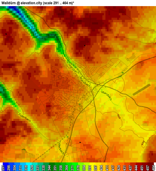
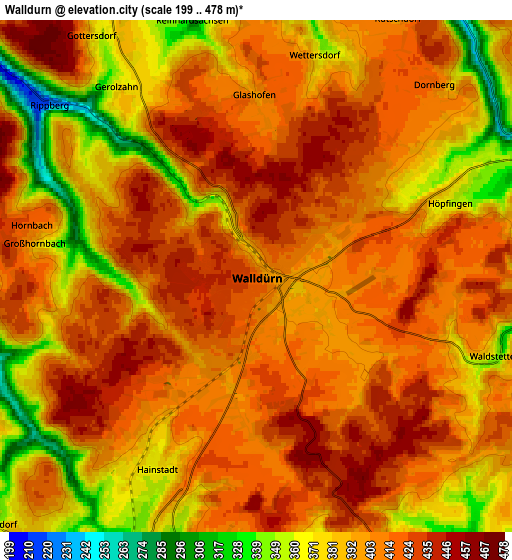
Below is the Elevation map of Walldürn, which displays elevation range with different colors. Scale of the first map is from 291 to 464 m (955 to 1522 ft) with average elevation of 417.3 meters (=1369 ft) [note 1]
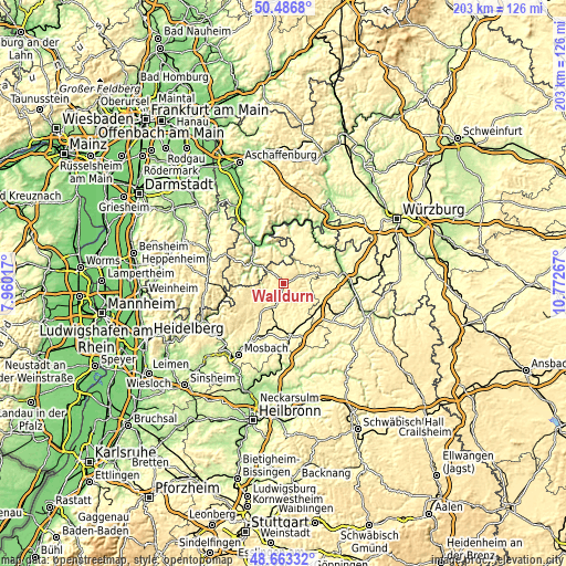
These maps also provides idea of topography and contour of this city, they are displayed at different zoom levels. More info about maps, scale and edge coordinates you can find below images.
| \ | Map #1 | Map #2 | Topo.Map |
| Scale [m] | 291..464 m | 199..478 m | × |
| Scale [ft] | 955..1522 ft | 653..1568 ft | × |
| Average | 417.3 m = 1369 ft | 400.5 m = 1314 ft | × |
| Width | 6.34 km = 3.9 mi | 12.67 km = 7.9 mi | 202.8 km = 126 mi |
| Height | 6.34 km = 3.9 mi | 12.67 km = 7.9 mi | 202.7 km = 126 mi |
| ↑Max Latitude | 49.612063° | 49.64053° | 50.4868° |
| Latitude at center | 49.58358° | 49.58358° | 49.58358° |
| ↓Min Latitude | 49.55508° | 49.526564° | 48.66332° |
| ← Min Longitude | 9.322475° | 9.278529° | 7.96017° |
| Longitude center | 9.36642° | 9.36642° | 9.36642° |
| →Max Longitude | 9.410365° | 9.454311° | 10.77267° |
Nearby cities:
Cities around Walldürn sort by population:
• Buchen in Odenwald elevation 344 m
7.3 km,  205°
205°
• Miltenberg 145 m
15.2 km,  332°
332°
• Hardheim 294 m
8.2 km,  67°
67°
• Külsheim 320 m
14.8 km,  49°
49°
• Mudau 452 m
12.9 km,  244°
244°
• Seckach 269 m
15.9 km,  188°
188°
• Bürgstadt 138 m
16.2 km, 334°
• Höpfingen 383 m
5 km,  64°
64°
• Eichenbühl 179 m
13.8 km,  348°
348°
• Kirchzell 197 m
14.1 km,  285°
285°
• Buch am Ahorn 373 m
14.5 km,  109°
109°
• Weilbach 152 m
14.3 km,  311°
311°
Multilingual:
 En español:
Walldürn elevación 417 m.
 En France:
Walldürn élévation 417 m.
 Auf Deutsch:
Walldürn höhe über dem Meeresspiegel ist 417 m.

Sources and notes:
- [note 1] Map square and city borders are not equal. Map elevation data is calculated only from area inside that square.
- [src 1] Elevation data from geonames database provided with same terms of usage.
- [src 2] The elevation map of Walldürn is generated using elevation data from NASA's 3 arcsec (90m) resolution SRTM data.
- [src 3] Base (background) map © OpenStreetMap contributors tiles are generated by Geofabrik and OpenTopoMap.
Copyright & License:
This Walldürn Elevation Map is licensed under CC BY-SA. You may reuse any part from this page, if you give a proper credit by linking to this URL:
 More info on terms of use page.