Kist elevation
Kist (Bavaria, Regierungsbezirk Unterfranken), Germany elevation is 364 meters and Kist elevation in feet is 1194 ft above sea level [src 1]. Kist is a seat of a fourth-order administrative division (feature code) with elevation that is 106 meters (348 ft) bigger than average city elevation in Germany.
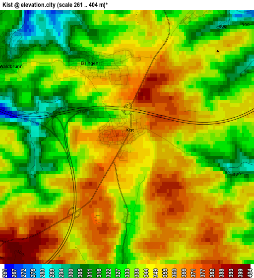
Below is the Elevation map of Kist, which displays elevation range with different colors. Scale of the first map is from 261 to 404 m (856 to 1325 ft) with average elevation of 342.3 meters (=1123 ft) [note 1]
These maps also provides idea of topography and contour of this city, they are displayed at different zoom levels. More info about maps, scale and edge coordinates you can find below images.
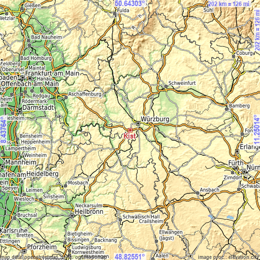
| \ | Map #1 | Topo.Map |
| Scale [m] | 261..404 m | × |
| Scale [ft] | 856..1325 ft | × |
| Average | 342.3 m = 1123 ft | × |
| Width | 6.32 km = 3.9 mi | 202.1 km = 125.6 mi |
| Height | 6.32 km = 3.9 mi | 202.1 km = 125.6 mi |
| ↑Max Latitude | 49.77117° | 50.64303° |
| Latitude at center | 49.74278° | 49.74278° |
| ↓Min Latitude | 49.714373° | 48.82551° |
| ← Min Longitude | 9.799945° | 8.43764° |
| Longitude center | 9.84389° | 9.84389° |
| →Max Longitude | 9.887835° | 11.25014° |
Nearby cities:
Cities around Kist sort by population:
• Würzburg elevation 204 m
9.6 km,  53°
53°
• Höchberg 265 m
5.4 km,  30°
30°
• Waldbüttelbrunn 323 m
5.1 km,  2°
2°
• Zell am Main 177 m
7.9 km,  13°
13°
• Reichenberg 234 m
5.2 km,  103°
103°
• Hettstadt 285 m
6.6 km,  341°
341°
• Eisingen 316 m
2.1 km,  334°
334°
• Waldbrunn 316 m
3.4 km,  301°
301°
• Kirchheim 280 m
9.7 km,  174°
174°
• Kleinrinderfeld 309 m
4.7 km,  179°
179°
• Greußenheim 268 m
9.9 km, 325°
• Geroldshausen 316 m
7.8 km,  147°
147°
Multilingual:
 En español:
Kist elevación 364 m.
 En France:
Kist élévation 364 m.


Sources and notes:
- [note 1] Map square and city borders are not equal. Map elevation data is calculated only from area inside that square.
- [src 1] Elevation data from geonames database provided with same terms of usage.
- [src 2] The elevation map of Kist is generated using elevation data from NASA's 3 arcsec (90m) resolution SRTM data.
- [src 3] Base (background) map © OpenStreetMap contributors tiles are generated by Geofabrik and OpenTopoMap.
Copyright & License:
This Kist Elevation Map is licensed under CC BY-SA. You may reuse any part from this page, if you give a proper credit by linking to this URL:
 More info on terms of use page.