Langenwetzendorf elevation
Langenwetzendorf (Thuringia), Germany elevation is 341 meters and Langenwetzendorf elevation in feet is 1119 ft above sea level [src 1]. Langenwetzendorf is a seat of a fourth-order administrative division (feature code) with elevation that is 83 meters (272 ft) bigger than average city elevation in Germany.
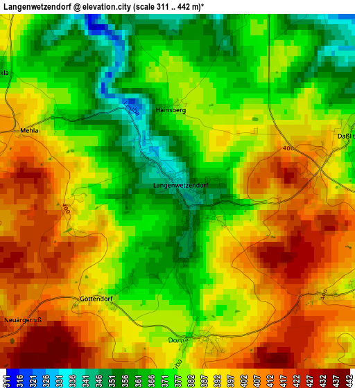
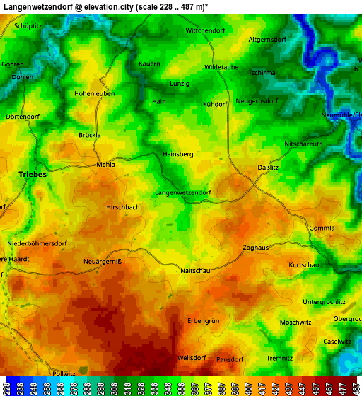
Below is the Elevation map of Langenwetzendorf, which displays elevation range with different colors. Scale of the first map is from 311 to 442 m (1020 to 1450 ft) with average elevation of 385.1 meters (=1263 ft) [note 1]
These maps also provides idea of topography and contour of this city, they are displayed at different zoom levels. More info about maps, scale and edge coordinates you can find below images.
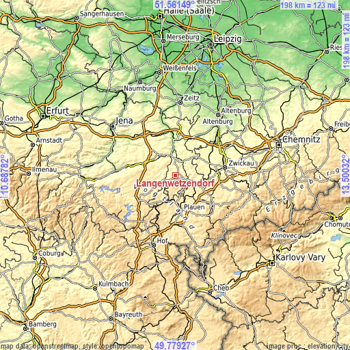
| \ | Map #1 | Map #2 | Topo.Map |
| Scale [m] | 311..442 m | 228..487 m | × |
| Scale [ft] | 1020..1450 ft | 748..1598 ft | × |
| Average | 385.1 m = 1263 ft | 373.3 m = 1225 ft | × |
| Width | 6.19 km = 3.8 mi | 12.39 km = 7.7 mi | 198.2 km = 123.2 mi |
| Height | 6.19 km = 3.8 mi | 12.38 km = 7.7 mi | 198.1 km = 123.1 mi |
| ↑Max Latitude | 50.706678° | 50.7345° | 51.56149° |
| Latitude at center | 50.67884° | 50.67884° | 50.67884° |
| ↓Min Latitude | 50.650985° | 50.623114° | 49.77927° |
| ← Min Longitude | 12.050125° | 12.006179° | 10.68782° |
| Longitude center | 12.09407° | 12.09407° | 12.09407° |
| →Max Longitude | 12.138015° | 12.181961° | 13.50032° |
Nearby cities:
Cities around Langenwetzendorf sort by population:
• Greiz elevation 269 m
7.8 km,  107°
107°
• Zeulenroda 411 m
8.3 km,  249°
249°
• Weida 239 m
10.9 km,  347°
347°
• Elsterberg 290 m
9.4 km,  146°
146°
• Netzschkau 379 m
12.8 km,  124°
124°
• Triebes 354 m
5.2 km,  277°
277°
• Pausa 444 m
12.8 km,  212°
212°
• Berga 240 m
9.5 km,  31°
31°
• Mohlsdorf 313 m
12.1 km,  94°
94°
• Teichwolframsdorf 314 m
11.7 km,  66°
66°
• Hohenleuben 393 m
4.6 km,  322°
322°
• Reuth 403 m
11.1 km,  128°
128°
Multilingual:
 En español:
Langenwetzendorf elevación 341 m.
 En France:
Langenwetzendorf élévation 341 m.
 Auf Deutsch:
Langenwetzendorf höhe über dem Meeresspiegel ist 341 m.

Sources and notes:
- [note 1] Map square and city borders are not equal. Map elevation data is calculated only from area inside that square.
- [src 1] Elevation data from geonames database provided with same terms of usage.
- [src 2] The elevation map of Langenwetzendorf is generated using elevation data from NASA's 3 arcsec (90m) resolution SRTM data.
- [src 3] Base (background) map © OpenStreetMap contributors tiles are generated by Geofabrik and OpenTopoMap.
Copyright & License:
This Langenwetzendorf Elevation Map is licensed under CC BY-SA. You may reuse any part from this page, if you give a proper credit by linking to this URL:
 More info on terms of use page.