Netzschkau elevation
Netzschkau (Saxony), Germany elevation is 379 meters and Netzschkau elevation in feet is 1243 ft above sea level [src 1]. Netzschkau is a populated place (feature code) with elevation that is 121 meters (397 ft) bigger than average city elevation in Germany.
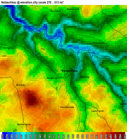
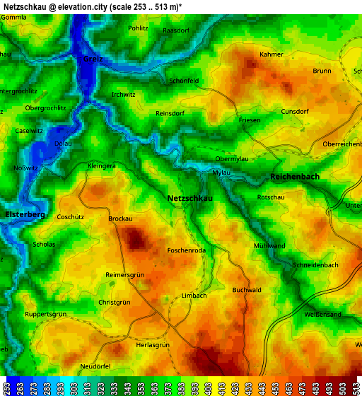
Below is the Elevation map of Netzschkau, which displays elevation range with different colors. Scale of the first map is from 270 to 513 m (886 to 1683 ft) with average elevation of 386.2 meters (=1267 ft) [note 1]
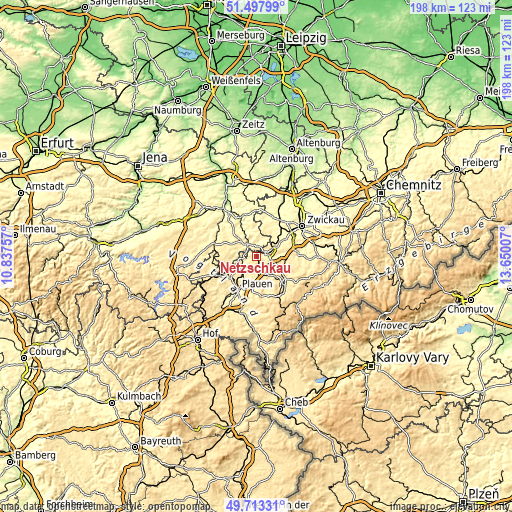
These maps also provides idea of topography and contour of this city, they are displayed at different zoom levels. More info about maps, scale and edge coordinates you can find below images.
| \ | Map #1 | Map #2 | Topo.Map |
| Scale [m] | 270..513 m | 253..513 m | × |
| Scale [ft] | 886..1683 ft | 830..1683 ft | × |
| Average | 386.2 m = 1267 ft | 386.8 m = 1269 ft | × |
| Width | 6.2 km = 3.9 mi | 12.4 km = 7.7 mi | 198.4 km = 123.3 mi |
| Height | 6.2 km = 3.9 mi | 12.4 km = 7.7 mi | 198.4 km = 123.3 mi |
| ↑Max Latitude | 50.641987° | 50.669847° | 51.49799° |
| Latitude at center | 50.61411° | 50.61411° | 50.61411° |
| ↓Min Latitude | 50.586217° | 50.558307° | 49.71331° |
| ← Min Longitude | 12.199875° | 12.155929° | 10.83757° |
| Longitude center | 12.24382° | 12.24382° | 12.24382° |
| →Max Longitude | 12.287765° | 12.331711° | 13.65007° |
Nearby cities:
Cities around Netzschkau sort by population:
• Greiz elevation 269 m
5.8 km,  327°
327°
• Reichenbach/Vogtland 381 m
4.3 km,  77°
77°
• Treuen 465 m
9 km,  152°
152°
• Lengenfeld 393 m
9.8 km,  120°
120°
• Elsterberg 290 m
5.4 km,  263°
263°
• Neumark 354 m
9.4 km,  57°
57°
• Mohlsdorf 313 m
6.4 km,  13°
13°
• Mylau 319 m
1.6 km,  71°
71°
• Teichwolframsdorf 314 m
11.9 km,  1°
1°
• Limbach 407 m
3.5 km,  172°
172°
• Waldkirchen 427 m
9.8 km,  101°
101°
• Reuth 403 m
1.9 km,  278°
278°
Multilingual:
 En español:
Netzschkau elevación 379 m.
 En France:
Netzschkau élévation 379 m.
 Auf Deutsch:
Netzschkau höhe über dem Meeresspiegel ist 379 m.

Sources and notes:
- [note 1] Map square and city borders are not equal. Map elevation data is calculated only from area inside that square.
- [src 1] Elevation data from geonames database provided with same terms of usage.
- [src 2] The elevation map of Netzschkau is generated using elevation data from NASA's 3 arcsec (90m) resolution SRTM data.
- [src 3] Base (background) map © OpenStreetMap contributors tiles are generated by Geofabrik and OpenTopoMap.
Copyright & License:
This Netzschkau Elevation Map is licensed under CC BY-SA. You may reuse any part from this page, if you give a proper credit by linking to this URL:
 More info on terms of use page.