Lauchheim elevation
Lauchheim (Baden-Württemberg, Regierungsbezirk Stuttgart), Germany elevation is 491 meters and Lauchheim elevation in feet is 1611 ft above sea level [src 1]. Lauchheim is a populated place (feature code) with elevation that is 233 meters (764 ft) bigger than average city elevation in Germany.
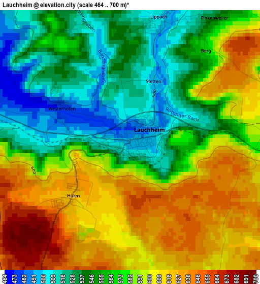
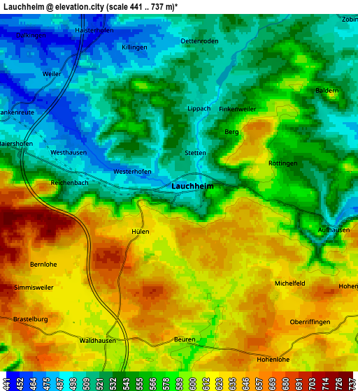
Below is the Elevation map of Lauchheim, which displays elevation range with different colors. Scale of the first map is from 464 to 700 m (1522 to 2297 ft) with average elevation of 575.9 meters (=1889 ft) [note 1]
These maps also provides idea of topography and contour of this city, they are displayed at different zoom levels. More info about maps, scale and edge coordinates you can find below images.
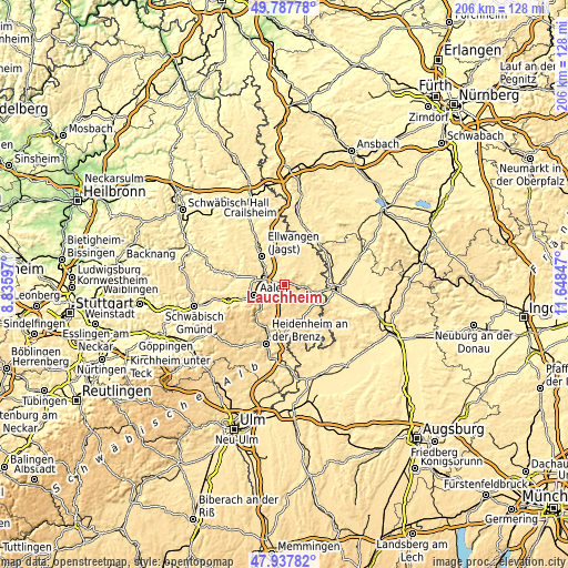
| \ | Map #1 | Map #2 | Topo.Map |
| Scale [m] | 464..700 m | 441..737 m | × |
| Scale [ft] | 1522..2297 ft | 1447..2418 ft | × |
| Average | 575.9 m = 1889 ft | 572.1 m = 1877 ft | × |
| Width | 6.43 km = 4 mi | 12.86 km = 8 mi | 205.7 km = 127.8 mi |
| Height | 6.43 km = 4 mi | 12.86 km = 8 mi | 205.7 km = 127.8 mi |
| ↑Max Latitude | 48.900247° | 48.929127° | 49.78778° |
| Latitude at center | 48.87135° | 48.87135° | 48.87135° |
| ↓Min Latitude | 48.842437° | 48.813506° | 47.93782° |
| ← Min Longitude | 10.198275° | 10.154329° | 8.83597° |
| Longitude center | 10.24222° | 10.24222° | 10.24222° |
| →Max Longitude | 10.286165° | 10.330111° | 11.64847° |
Nearby cities:
Cities around Lauchheim sort by population:
• Aalen elevation 433 m
11.5 km,  251°
251°
• Ellwangen 443 m
12.9 km,  321°
321°
• Bopfingen 463 m
8.3 km,  99°
99°
• Oberkochen 495 m
14 km,  225°
225°
• Neresheim 502 m
14.4 km,  153°
153°
• Westhausen 487 m
4.5 km,  287°
287°
• Hüttlingen 407 m
10.6 km,  282°
282°
• Unterschneidheim 475 m
11.4 km,  52°
52°
• Neuler 505 m
14.2 km,  296°
296°
• Kirchheim am Ries 498 m
11.6 km,  85°
85°
• Stödtlen 466 m
14.9 km,  16°
16°
• Tannhausen 517 m
14.8 km,  36°
36°
Multilingual:
 En español:
Lauchheim elevación 491 m.
 En France:
Lauchheim élévation 491 m.
 Auf Deutsch:
Lauchheim höhe über dem Meeresspiegel ist 491 m.

Sources and notes:
- [note 1] Map square and city borders are not equal. Map elevation data is calculated only from area inside that square.
- [src 1] Elevation data from geonames database provided with same terms of usage.
- [src 2] The elevation map of Lauchheim is generated using elevation data from NASA's 3 arcsec (90m) resolution SRTM data.
- [src 3] Base (background) map © OpenStreetMap contributors tiles are generated by Geofabrik and OpenTopoMap.
Copyright & License:
This Lauchheim Elevation Map is licensed under CC BY-SA. You may reuse any part from this page, if you give a proper credit by linking to this URL:
 More info on terms of use page.