Liebenburg elevation
Liebenburg (Lower Saxony), Germany elevation is 132 meters and Liebenburg elevation in feet is 433 ft above sea level [src 1]. Liebenburg is a seat of a fourth-order administrative division (feature code) with elevation that is 126 meters (413 ft) smaller than average city elevation in Germany.
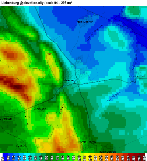
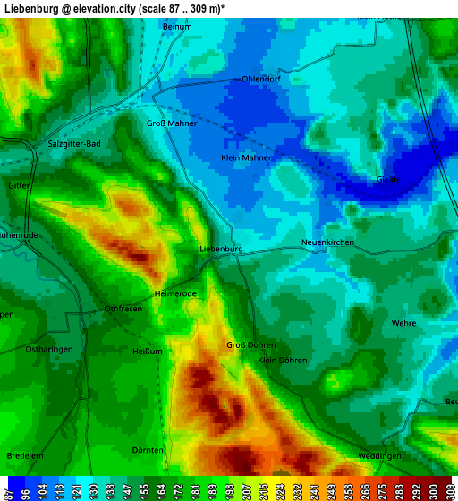
Below is the Elevation map of Liebenburg, which displays elevation range with different colors. Scale of the first map is from 94 to 297 m (308 to 974 ft) with average elevation of 156.3 meters (=513 ft) [note 1]
These maps also provides idea of topography and contour of this city, they are displayed at different zoom levels. More info about maps, scale and edge coordinates you can find below images.
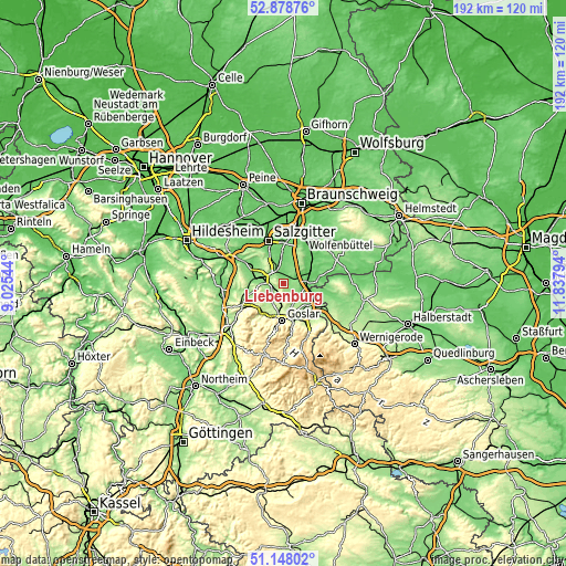
| \ | Map #1 | Map #2 | Topo.Map |
| Scale [m] | 94..297 m | 87..309 m | × |
| Scale [ft] | 308..974 ft | 285..1014 ft | × |
| Average | 156.3 m = 513 ft | 159.3 m = 523 ft | × |
| Width | 6.01 km = 3.7 mi | 12.03 km = 7.5 mi | 192.4 km = 119.6 mi |
| Height | 6.01 km = 3.7 mi | 12.03 km = 7.5 mi | 192.4 km = 119.6 mi |
| ↑Max Latitude | 52.048794° | 52.075812° | 52.87876° |
| Latitude at center | 52.02176° | 52.02176° | 52.02176° |
| ↓Min Latitude | 51.99471° | 51.967643° | 51.14802° |
| ← Min Longitude | 10.387745° | 10.343799° | 9.02544° |
| Longitude center | 10.43169° | 10.43169° | 10.43169° |
| →Max Longitude | 10.475635° | 10.519581° | 11.83794° |
Nearby cities:
Cities around Liebenburg sort by population:
• Goslar elevation 270 m
13.1 km,  181°
181°
• Langelsheim 201 m
11.5 km,  216°
216°
• Vienenburg 140 m
11.9 km,  130°
130°
• Schladen 98 m
7.4 km,  89°
89°
• Hornburg 92 m
11.9 km, 85°
• Lutter am Barenberge 160 m
11.7 km,  252°
252°
• Börßum 91 m
11.7 km,  63°
63°
• Elbe 111 m
12.2 km,  304°
304°
• Flöthe 118 m
7.7 km,  27°
27°
• Heere 113 m
13.4 km,  291°
291°
• Alt Wallmoden 136 m
8.8 km,  268°
268°
• Sehlde 133 m
11.5 km,  279°
279°
Multilingual:
 En español:
Liebenburg elevación 132 m.
 En France:
Liebenburg élévation 132 m.
 Auf Deutsch:
Liebenburg höhe über dem Meeresspiegel ist 132 m.

Sources and notes:
- [note 1] Map square and city borders are not equal. Map elevation data is calculated only from area inside that square.
- [src 1] Elevation data from geonames database provided with same terms of usage.
- [src 2] The elevation map of Liebenburg is generated using elevation data from NASA's 3 arcsec (90m) resolution SRTM data.
- [src 3] Base (background) map © OpenStreetMap contributors tiles are generated by Geofabrik and OpenTopoMap.
Copyright & License:
This Liebenburg Elevation Map is licensed under CC BY-SA. You may reuse any part from this page, if you give a proper credit by linking to this URL:
 More info on terms of use page.