Schladen elevation
Schladen (Lower Saxony), Germany elevation is 98 meters and Schladen elevation in feet is 322 ft above sea level [src 1]. Schladen is a seat of a fourth-order administrative division (feature code) with elevation that is 160 meters (525 ft) smaller than average city elevation in Germany.
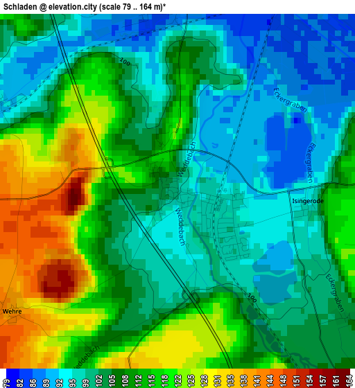
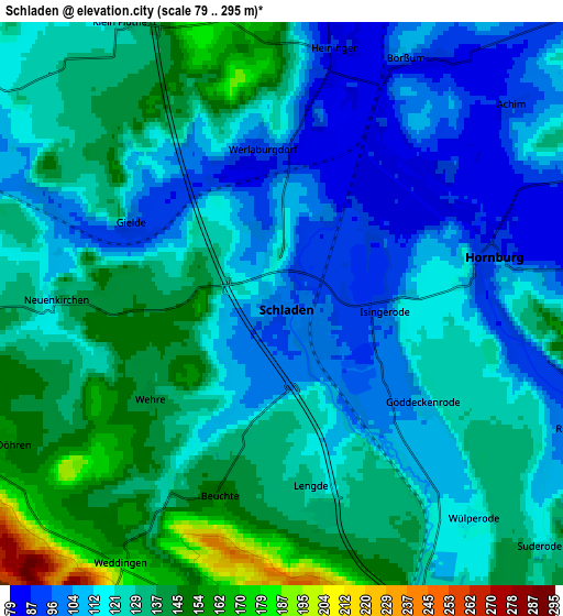
Below is the Elevation map of Schladen, which displays elevation range with different colors. Scale of the first map is from 79 to 164 m (259 to 538 ft) with average elevation of 107.4 meters (=352 ft) [note 1]
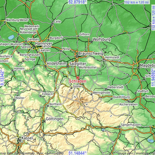
These maps also provides idea of topography and contour of this city, they are displayed at different zoom levels. More info about maps, scale and edge coordinates you can find below images.
| \ | Map #1 | Map #2 | Topo.Map |
| Scale [m] | 79..164 m | 79..295 m | × |
| Scale [ft] | 259..538 ft | 259..968 ft | × |
| Average | 107.4 m = 352 ft | 123 m = 404 ft | × |
| Width | 6.01 km = 3.7 mi | 12.03 km = 7.5 mi | 192.4 km = 119.6 mi |
| Height | 6.01 km = 3.7 mi | 12.03 km = 7.5 mi | 192.4 km = 119.6 mi |
| ↑Max Latitude | 52.049214° | 52.076231° | 52.87918° |
| Latitude at center | 52.02218° | 52.02218° | 52.02218° |
| ↓Min Latitude | 51.99513° | 51.968063° | 51.14844° |
| ← Min Longitude | 10.495725° | 10.451779° | 9.13342° |
| Longitude center | 10.53967° | 10.53967° | 10.53967° |
| →Max Longitude | 10.583615° | 10.627561° | 11.94592° |
Nearby cities:
Cities around Schladen sort by population:
• Wolfenbüttel elevation 80 m
15.8 km,  0°
0°
• Goslar 270 m
15.2 km,  210°
210°
• Bad Harzburg 262 m
15.6 km,  174°
174°
• Vienenburg 140 m
7.9 km, 168°
• Liebenburg 132 m
7.4 km,  269°
269°
• Osterwieck 119 m
13.1 km,  116°
116°
• Hornburg 92 m
4.6 km,  77°
77°
• Börßum 91 m
6.1 km,  30°
30°
• Remlingen 137 m
13.7 km,  42°
42°
• Kissenbrück 84 m
10.3 km,  19°
19°
• Wittmar 122 m
13.8 km, 29°
• Flöthe 118 m
7.8 km,  330°
330°
Multilingual:
 En español:
Schladen elevación 98 m.
 En France:
Schladen élévation 98 m.


Sources and notes:
- [note 1] Map square and city borders are not equal. Map elevation data is calculated only from area inside that square.
- [src 1] Elevation data from geonames database provided with same terms of usage.
- [src 2] The elevation map of Schladen is generated using elevation data from NASA's 3 arcsec (90m) resolution SRTM data.
- [src 3] Base (background) map © OpenStreetMap contributors tiles are generated by Geofabrik and OpenTopoMap.
Copyright & License:
This Schladen Elevation Map is licensed under CC BY-SA. You may reuse any part from this page, if you give a proper credit by linking to this URL:
 More info on terms of use page.