Lübtheen elevation
Lübtheen (Mecklenburg-Vorpommern), Germany elevation is 17 meters and Lübtheen elevation in feet is 56 ft above sea level [src 1]. Lübtheen is a populated place (feature code) with elevation that is 241 meters (791 ft) smaller than average city elevation in Germany.
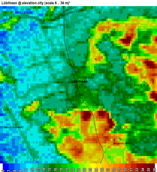
Below is the Elevation map of Lübtheen, which displays elevation range with different colors. Scale of the first map is from 6 to 36 m (20 to 118 ft) with average elevation of 16.9 meters (=55 ft) [note 1]
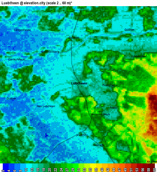
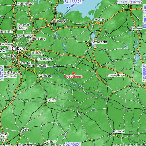
These maps also provides idea of topography and contour of this city, they are displayed at different zoom levels. More info about maps, scale and edge coordinates you can find below images.
| \ | Map #1 | Map #2 | Topo.Map |
| Scale [m] | 6..36 m | 2..60 m | × |
| Scale [ft] | 20..118 ft | 7..197 ft | × |
| Average | 16.9 m = 55 ft | 17.8 m = 58 ft | × |
| Width | 5.84 km = 3.6 mi | 11.68 km = 7.3 mi | 186.9 km = 116.1 mi |
| Height | 5.84 km = 3.6 mi | 11.68 km = 7.3 mi | 186.9 km = 116.1 mi |
| ↑Max Latitude | 53.327434° | 53.353672° | 54.13332° |
| Latitude at center | 53.30118° | 53.30118° | 53.30118° |
| ↓Min Latitude | 53.27491° | 53.248623° | 52.4525° |
| ← Min Longitude | 11.039735° | 10.995789° | 9.67743° |
| Longitude center | 11.08368° | 11.08368° | 11.08368° |
| →Max Longitude | 11.127625° | 11.171571° | 12.48993° |
Nearby cities:
Cities around Lübtheen sort by population:
• Hagenow elevation 26 m
16.1 km,  26°
26°
• Bleckede 10 m
23.3 km,  266°
266°
• Dannenberg 16 m
22.7 km,  178°
178°
• Hitzacker 28 m
16.7 km,  189°
189°
• Wittenburg 43 m
22.8 km,  359°
359°
• Dömitz 18 m
21 km,  148°
148°
• Neu Kaliß 16 m
19.9 km,  135°
135°
• Neu Darchau 15 m
15.4 km,  238°
238°
• Eldena 24 m
23.5 km,  109°
109°
• Malliß 40 m
19 km,  121°
121°
• Nahrendorf 72 m
22.9 km,  231°
231°
• Klein Gusborn 16 m
25.3 km,  163°
163°
Multilingual:
 En español:
Lübtheen elevación 17 m.
 En France:
Lübtheen élévation 17 m.


Sources and notes:
- [note 1] Map square and city borders are not equal. Map elevation data is calculated only from area inside that square.
- [src 1] Elevation data from geonames database provided with same terms of usage.
- [src 2] The elevation map of Lübtheen is generated using elevation data from NASA's 3 arcsec (90m) resolution SRTM data.
- [src 3] Base (background) map © OpenStreetMap contributors tiles are generated by Geofabrik and OpenTopoMap.
Copyright & License:
This Lübtheen Elevation Map is licensed under CC BY-SA. You may reuse any part from this page, if you give a proper credit by linking to this URL:
 More info on terms of use page.