Hitzacker elevation
Hitzacker (Lower Saxony), Germany elevation is 28 meters and Hitzacker elevation in feet is 92 ft above sea level [src 1]. Hitzacker is a populated place (feature code) with elevation that is 230 meters (755 ft) smaller than average city elevation in Germany.
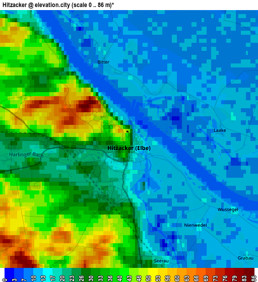
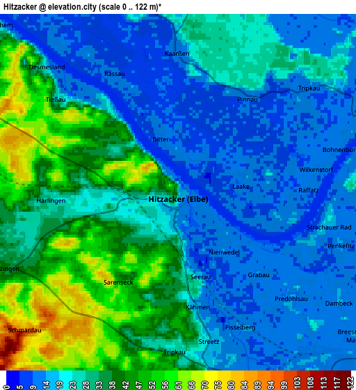
Below is the Elevation map of Hitzacker, which displays elevation range with different colors. Scale of the first map is from 0 to 86 m (0 to 282 ft) with average elevation of 23.1 meters (=76 ft) [note 1]
These maps also provides idea of topography and contour of this city, they are displayed at different zoom levels. More info about maps, scale and edge coordinates you can find below images.
| \ | Map #1 | Map #2 | Topo.Map |
| Scale [m] | 0..86 m | 0..122 m | × |
| Scale [ft] | 0..282 ft | 0..400 ft | × |
| Average | 23.1 m = 76 ft | 27.7 m = 91 ft | × |
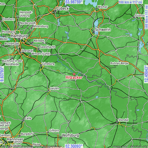
| Width | 5.86 km = 3.6 mi | 11.72 km = 7.3 mi | 187.5 km = 116.5 mi |
| Height | 5.86 km = 3.6 mi | 11.72 km = 7.3 mi | 187.5 km = 116.5 mi |
| ↑Max Latitude | 53.178885° | 53.205214° | 53.98759° |
| Latitude at center | 53.15254° | 53.15254° | 53.15254° |
| ↓Min Latitude | 53.126178° | 53.099801° | 52.30093° |
| ← Min Longitude | 11.000235° | 10.956289° | 9.63793° |
| Longitude center | 11.04418° | 11.04418° | 11.04418° |
| →Max Longitude | 11.088125° | 11.132071° | 12.45043° |
Nearby cities:
Cities around Hitzacker sort by population:
• Dannenberg elevation 16 m
6.9 km,  153°
153°
• Lübtheen 17 m
16.7 km,  9°
9°
• Dahlenburg 37 m
20.9 km,  280°
280°
• Dömitz 18 m
13.8 km,  95°
95°
• Neu Kaliß 16 m
16.9 km,  81°
81°
• Zernien 85 m
14.2 km,  228°
228°
• Neu Darchau 15 m
13.6 km,  308°
308°
• Küsten 26 m
19.5 km,  176°
176°
• Malliß 40 m
20 km,  70°
70°
• Nahrendorf 72 m
15.5 km, 278°
• Klein Gusborn 16 m
12.6 km,  127°
127°
• Jameln 29 m
11.7 km,  167°
167°
Multilingual:
 En español:
Hitzacker elevación 28 m.
 En France:
Hitzacker élévation 28 m.
 Auf Deutsch:
Hitzacker höhe über dem Meeresspiegel ist 28 m.

Sources and notes:
- [note 1] Map square and city borders are not equal. Map elevation data is calculated only from area inside that square.
- [src 1] Elevation data from geonames database provided with same terms of usage.
- [src 2] The elevation map of Hitzacker is generated using elevation data from NASA's 3 arcsec (90m) resolution SRTM data.
- [src 3] Base (background) map © OpenStreetMap contributors tiles are generated by Geofabrik and OpenTopoMap.
Copyright & License:
This Hitzacker Elevation Map is licensed under CC BY-SA. You may reuse any part from this page, if you give a proper credit by linking to this URL:
 More info on terms of use page.