Wittenburg elevation
Wittenburg (Mecklenburg-Vorpommern), Germany elevation is 43 meters and Wittenburg elevation in feet is 141 ft above sea level [src 1]. Wittenburg is a populated place (feature code) with elevation that is 215 meters (705 ft) smaller than average city elevation in Germany.
Below is the Elevation map of Wittenburg, which displays elevation range with different colors. Scale of the first map is from 31 to 81 m (102 to 266 ft) with average elevation of 44.4 meters (=146 ft) [note 1]
These maps also provides idea of topography and contour of this city, they are displayed at different zoom levels. More info about maps, scale and edge coordinates you can find below images.
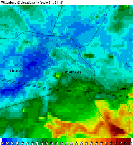
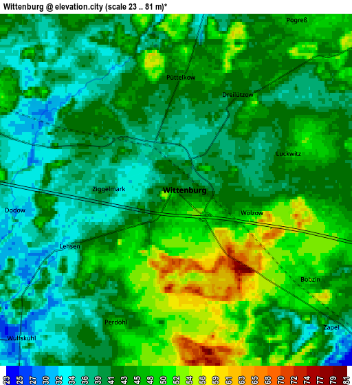
| \ | Map #1 | Map #2 | Topo.Map |
| Scale [m] | 31..81 m | 23..81 m | × |
| Scale [ft] | 102..266 ft | 75..266 ft | × |
| Average | 44.4 m = 146 ft | 43.4 m = 142 ft | × |
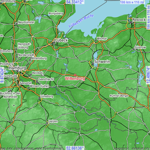
| Width | 5.81 km = 3.6 mi | 11.62 km = 7.2 mi | 186 km = 115.6 mi |
| Height | 5.81 km = 3.6 mi | 11.62 km = 7.2 mi | 186 km = 115.6 mi |
| ↑Max Latitude | 53.532118° | 53.55823° | 54.33412° |
| Latitude at center | 53.50599° | 53.50599° | 53.50599° |
| ↓Min Latitude | 53.479846° | 53.453686° | 52.66136° |
| ← Min Longitude | 11.036545° | 10.992599° | 9.67424° |
| Longitude center | 11.08049° | 11.08049° | 11.08049° |
| →Max Longitude | 11.124435° | 11.168381° | 12.48674° |
Nearby cities:
Cities around Wittenburg sort by population:
• Hagenow elevation 26 m
11.1 km,  138°
138°
• Gadebusch 35 m
21.9 km,  6°
6°
• Zarrentin 46 m
12 km,  294°
294°
• Wittenförden 67 m
21.4 km,  50°
50°
• Brüsewitz 54 m
21.7 km,  29°
29°
• Gudow 31 m
21.2 km, 285°
• Lützow 61 m
17.6 km,  20°
20°
• Stralendorf 59 m
16.6 km,  62°
62°
• Dümmer 49 m
11.3 km, 46°
• Klein Rogahn 46 m
20.7 km, 57°
• Roggendorf 59 m
21.2 km,  348°
348°
• Sülstorf 45 m
19.5 km,  88°
88°
Multilingual:
 En español:
Wittenburg elevación 43 m.
 En France:
Wittenburg élévation 43 m.
 Auf Deutsch:
Wittenburg höhe über dem Meeresspiegel ist 43 m.

Sources and notes:
- [note 1] Map square and city borders are not equal. Map elevation data is calculated only from area inside that square.
- [src 1] Elevation data from geonames database provided with same terms of usage.
- [src 2] The elevation map of Wittenburg is generated using elevation data from NASA's 3 arcsec (90m) resolution SRTM data.
- [src 3] Base (background) map © OpenStreetMap contributors tiles are generated by Geofabrik and OpenTopoMap.
Copyright & License:
This Wittenburg Elevation Map is licensed under CC BY-SA. You may reuse any part from this page, if you give a proper credit by linking to this URL:
 More info on terms of use page.