Mainhardt elevation
Mainhardt (Baden-Württemberg, Regierungsbezirk Stuttgart), Germany elevation is 492 meters and Mainhardt elevation in feet is 1614 ft above sea level [src 1]. Mainhardt is a seat of a fourth-order administrative division (feature code) with elevation that is 234 meters (768 ft) bigger than average city elevation in Germany.
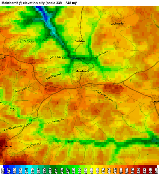
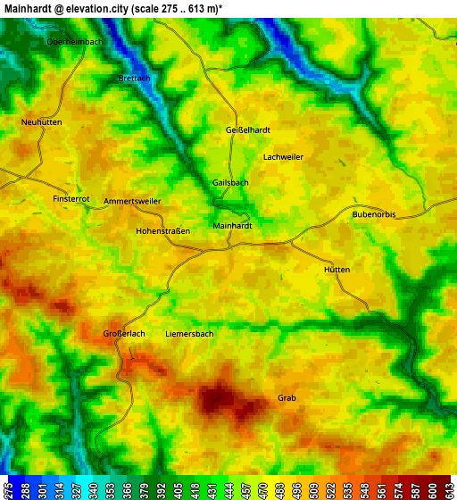
Below is the Elevation map of Mainhardt, which displays elevation range with different colors. Scale of the first map is from 339 to 548 m (1112 to 1798 ft) with average elevation of 473.7 meters (=1554 ft) [note 1]
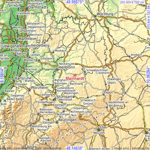
These maps also provides idea of topography and contour of this city, they are displayed at different zoom levels. More info about maps, scale and edge coordinates you can find below images.
| \ | Map #1 | Map #2 | Topo.Map |
| Scale [m] | 339..548 m | 275..613 m | × |
| Scale [ft] | 1112..1798 ft | 902..2011 ft | × |
| Average | 473.7 m = 1554 ft | 465.7 m = 1528 ft | × |
| Width | 6.4 km = 4 mi | 12.8 km = 8 mi | 204.9 km = 127.3 mi |
| Height | 6.4 km = 4 mi | 12.8 km = 8 mi | 204.8 km = 127.3 mi |
| ↑Max Latitude | 49.104888° | 49.13365° | 49.98875° |
| Latitude at center | 49.07611° | 49.07611° | 49.07611° |
| ↓Min Latitude | 49.047315° | 49.018503° | 48.14638° |
| ← Min Longitude | 9.512445° | 9.468499° | 8.15014° |
| Longitude center | 9.55639° | 9.55639° | 9.55639° |
| →Max Longitude | 9.600335° | 9.644281° | 10.96264° |
Nearby cities:
Cities around Mainhardt sort by population:
• Schwäbisch Hall elevation 322 m
13.9 km,  73°
73°
• Murrhardt 286 m
10.5 km,  174°
174°
• Pfedelbach 238 m
11.9 km,  341°
341°
• Wüstenrot 495 m
7 km,  274°
274°
• Sulzbach an der Murr 278 m
9.1 km,  206°
206°
• Oppenweiler 264 m
12.6 km, 214°
• Oberrot 358 m
10.6 km,  130°
130°
• Michelfeld 362 m
9.2 km,  75°
75°
• Waldenburg 503 m
13.5 km,  26°
26°
• Löwenstein 367 m
13 km,  279°
279°
• Großerlach 522 m
4 km,  231°
231°
• Spiegelberg 352 m
9.1 km,  244°
244°
Multilingual:
 En español:
Mainhardt elevación 492 m.
 En France:
Mainhardt élévation 492 m.
 Auf Deutsch:
Mainhardt höhe über dem Meeresspiegel ist 492 m.

Sources and notes:
- [note 1] Map square and city borders are not equal. Map elevation data is calculated only from area inside that square.
- [src 1] Elevation data from geonames database provided with same terms of usage.
- [src 2] The elevation map of Mainhardt is generated using elevation data from NASA's 3 arcsec (90m) resolution SRTM data.
- [src 3] Base (background) map © OpenStreetMap contributors tiles are generated by Geofabrik and OpenTopoMap.
Copyright & License:
This Mainhardt Elevation Map is licensed under CC BY-SA. You may reuse any part from this page, if you give a proper credit by linking to this URL:
 More info on terms of use page.