Michelfeld elevation
Michelfeld (Baden-Württemberg, Regierungsbezirk Stuttgart), Germany elevation is 362 meters and Michelfeld elevation in feet is 1188 ft above sea level [src 1]. Michelfeld is a seat of a fourth-order administrative division (feature code) with elevation that is 104 meters (341 ft) bigger than average city elevation in Germany.
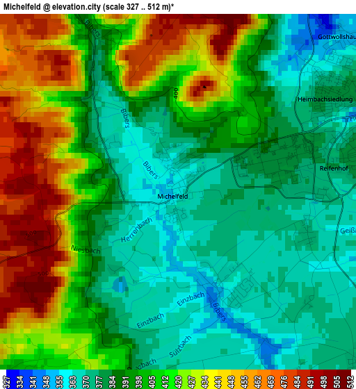
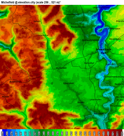
Below is the Elevation map of Michelfeld, which displays elevation range with different colors. Scale of the first map is from 327 to 512 m (1073 to 1680 ft) with average elevation of 400.6 meters (=1314 ft) [note 1]
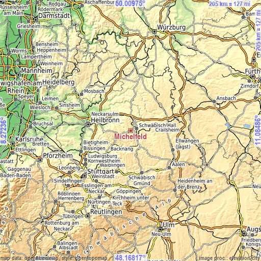
These maps also provides idea of topography and contour of this city, they are displayed at different zoom levels. More info about maps, scale and edge coordinates you can find below images.
| \ | Map #1 | Map #2 | Topo.Map |
| Scale [m] | 327..512 m | 256..521 m | × |
| Scale [ft] | 1073..1680 ft | 840..1709 ft | × |
| Average | 400.6 m = 1314 ft | 409 m = 1342 ft | × |
| Width | 6.4 km = 4 mi | 12.8 km = 8 mi | 204.8 km = 127.3 mi |
| Height | 6.4 km = 4 mi | 12.8 km = 8 mi | 204.7 km = 127.2 mi |
| ↑Max Latitude | 49.126266° | 49.155015° | 50.00975° |
| Latitude at center | 49.0975° | 49.0975° | 49.0975° |
| ↓Min Latitude | 49.068717° | 49.039918° | 48.16817° |
| ← Min Longitude | 9.634665° | 9.590719° | 8.27236° |
| Longitude center | 9.67861° | 9.67861° | 9.67861° |
| →Max Longitude | 9.722555° | 9.766501° | 11.08486° |
Nearby cities:
Cities around Michelfeld sort by population:
• Schwäbisch Hall elevation 322 m
4.7 km,  70°
70°
• Gaildorf 337 m
12.7 km,  148°
148°
• Neuenstein 286 m
13.9 km,  329°
329°
• Mainhardt 492 m
9.2 km,  255°
255°
• Oberrot 358 m
9.3 km,  185°
185°
• Michelbach an der Bilz 364 m
6.8 km,  116°
116°
• Waldenburg 503 m
10.1 km,  343°
343°
• Untermünkheim 265 m
7.3 km,  33°
33°
• Fichtenberg 345 m
12.6 km,  168°
168°
• Großerlach 522 m
13 km,  247°
247°
• Braunsbach 248 m
13.9 km,  35°
35°
• Wolpertshausen 443 m
14.4 km,  57°
57°
Multilingual:
 En español:
Michelfeld elevación 362 m.
 En France:
Michelfeld élévation 362 m.
 Auf Deutsch:
Michelfeld höhe über dem Meeresspiegel ist 362 m.

Sources and notes:
- [note 1] Map square and city borders are not equal. Map elevation data is calculated only from area inside that square.
- [src 1] Elevation data from geonames database provided with same terms of usage.
- [src 2] The elevation map of Michelfeld is generated using elevation data from NASA's 3 arcsec (90m) resolution SRTM data.
- [src 3] Base (background) map © OpenStreetMap contributors tiles are generated by Geofabrik and OpenTopoMap.
Copyright & License:
This Michelfeld Elevation Map is licensed under CC BY-SA. You may reuse any part from this page, if you give a proper credit by linking to this URL:
 More info on terms of use page.