Malchow elevation
Malchow (Mecklenburg-Vorpommern), Germany elevation is 77 meters and Malchow elevation in feet is 253 ft above sea level [src 1]. Malchow is a populated place (feature code) with elevation that is 181 meters (594 ft) smaller than average city elevation in Germany.
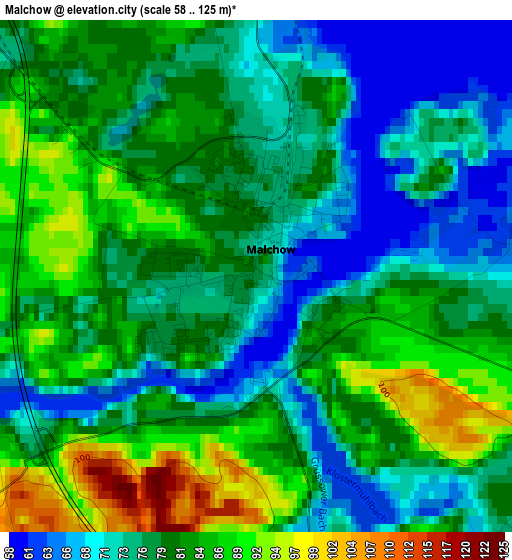
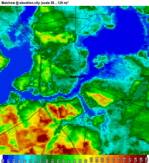
Below is the Elevation map of Malchow, which displays elevation range with different colors. Scale of the first map is from 58 to 125 m (190 to 410 ft) with average elevation of 79.2 meters (=260 ft) [note 1]
These maps also provides idea of topography and contour of this city, they are displayed at different zoom levels. More info about maps, scale and edge coordinates you can find below images.
| \ | Map #1 | Map #2 | Topo.Map |
| Scale [m] | 58..125 m | 58..129 m | × |
| Scale [ft] | 190..410 ft | 190..423 ft | × |
| Average | 79.2 m = 260 ft | 79.7 m = 261 ft | × |
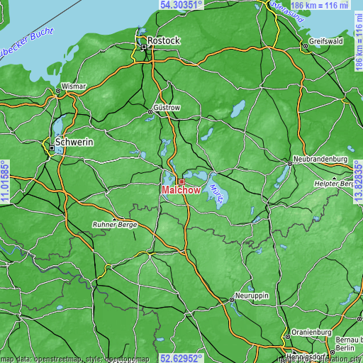
| Width | 5.82 km = 3.6 mi | 11.63 km = 7.2 mi | 186.1 km = 115.6 mi |
| Height | 5.82 km = 3.6 mi | 11.63 km = 7.2 mi | 186.1 km = 115.6 mi |
| ↑Max Latitude | 53.500917° | 53.527048° | 54.30351° |
| Latitude at center | 53.47477° | 53.47477° | 53.47477° |
| ↓Min Latitude | 53.448607° | 53.422427° | 52.62952° |
| ← Min Longitude | 12.378155° | 12.334209° | 11.01585° |
| Longitude center | 12.4221° | 12.4221° | 12.4221° |
| →Max Longitude | 12.466045° | 12.509991° | 13.82835° |
Nearby cities:
Cities around Malchow sort by population:
• Waren elevation 66 m
17.8 km,  73°
73°
• Lübz 51 m
26 km,  267°
267°
• Plau am See 74 m
10.7 km,  260°
260°
• Röbel 67 m
16.3 km,  132°
132°
• Goldberg 51 m
25.4 km,  299°
299°
• Krakow am See 51 m
22.1 km,  332°
332°
• Lalendorf 36 m
31.5 km,  356°
356°
• Rechlin 67 m
25.4 km, 127°
• Dobbertin 51 m
28.3 km,  305°
305°
• Groß Wokern 47 m
31.1 km,  8°
8°
• Klink 73 m
13.2 km,  88°
88°
• Grabowhöfe 74 m
15.5 km,  47°
47°
Multilingual:
 En español:
Malchow elevación 77 m.
 En France:
Malchow élévation 77 m.


Sources and notes:
- [note 1] Map square and city borders are not equal. Map elevation data is calculated only from area inside that square.
- [src 1] Elevation data from geonames database provided with same terms of usage.
- [src 2] The elevation map of Malchow is generated using elevation data from NASA's 3 arcsec (90m) resolution SRTM data.
- [src 3] Base (background) map © OpenStreetMap contributors tiles are generated by Geofabrik and OpenTopoMap.
Copyright & License:
This Malchow Elevation Map is licensed under CC BY-SA. You may reuse any part from this page, if you give a proper credit by linking to this URL:
 More info on terms of use page.