Waren elevation
Waren (Mecklenburg-Vorpommern), Germany elevation is 66 meters and Waren elevation in feet is 217 ft above sea level [src 1]. Waren is a populated place (feature code) with elevation that is 192 meters (630 ft) smaller than average city elevation in Germany.
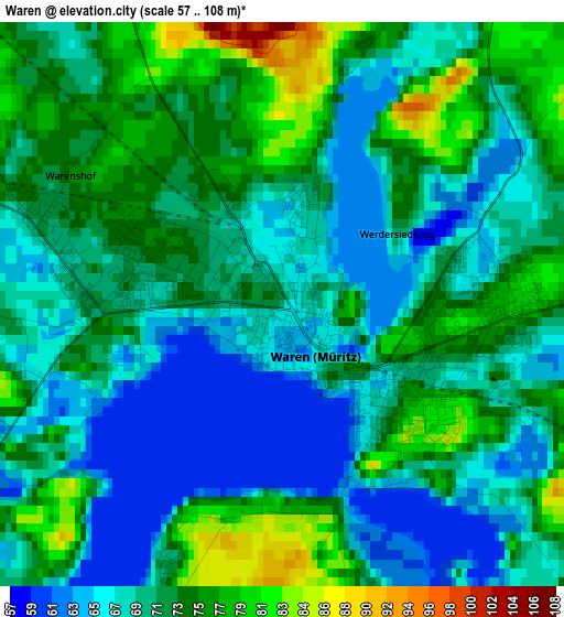
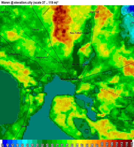
Below is the Elevation map of Waren, which displays elevation range with different colors. Scale of the first map is from 57 to 108 m (187 to 354 ft) with average elevation of 70.5 meters (=231 ft) [note 1]
These maps also provides idea of topography and contour of this city, they are displayed at different zoom levels. More info about maps, scale and edge coordinates you can find below images.
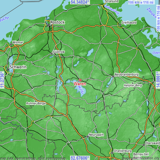
| \ | Map #1 | Map #2 | Topo.Map |
| Scale [m] | 57..108 m | 37..119 m | × |
| Scale [ft] | 187..354 ft | 121..390 ft | × |
| Average | 70.5 m = 231 ft | 72.9 m = 239 ft | × |
| Width | 5.81 km = 3.6 mi | 11.62 km = 7.2 mi | 185.9 km = 115.5 mi |
| Height | 5.81 km = 3.6 mi | 11.62 km = 7.2 mi | 185.9 km = 115.5 mi |
| ↑Max Latitude | 53.546519° | 53.572622° | 54.34824° |
| Latitude at center | 53.5204° | 53.5204° | 53.5204° |
| ↓Min Latitude | 53.494265° | 53.468114° | 52.67606° |
| ← Min Longitude | 12.635905° | 12.591959° | 11.2736° |
| Longitude center | 12.67985° | 12.67985° | 12.67985° |
| →Max Longitude | 12.723795° | 12.767741° | 14.0861° |
Nearby cities:
Cities around Waren sort by population:
• Malchin elevation 10 m
25 km,  13°
13°
• Malchow 77 m
17.8 km,  253°
253°
• Röbel 67 m
16.9 km,  197°
197°
• Pampow 43 m
26.5 km,  349°
349°
• Penzlin 51 m
26.8 km,  93°
93°
• Rechlin 67 m
20.8 km,  171°
171°
• Möllenhagen 89 m
16.5 km, 88°
• Gielow 18 m
20.2 km, 12°
• Wackerow 74 m
26.4 km,  48°
48°
• Rosenow 71 m
26.6 km,  62°
62°
• Klink 73 m
6.1 km,  219°
219°
• Grabowhöfe 74 m
7.8 km,  313°
313°
Multilingual:
 En español:
Waren elevación 66 m.
 En France:
Waren élévation 66 m.


Sources and notes:
- [note 1] Map square and city borders are not equal. Map elevation data is calculated only from area inside that square.
- [src 1] Elevation data from geonames database provided with same terms of usage.
- [src 2] The elevation map of Waren is generated using elevation data from NASA's 3 arcsec (90m) resolution SRTM data.
- [src 3] Base (background) map © OpenStreetMap contributors tiles are generated by Geofabrik and OpenTopoMap.
Copyright & License:
This Waren Elevation Map is licensed under CC BY-SA. You may reuse any part from this page, if you give a proper credit by linking to this URL:
 More info on terms of use page.