Marienberg elevation
Marienberg (Saxony), Germany elevation is 614 meters and Marienberg elevation in feet is 2014 ft above sea level [src 1]. Marienberg is a populated place (feature code) with elevation that is 356 meters (1168 ft) bigger than average city elevation in Germany.
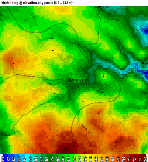
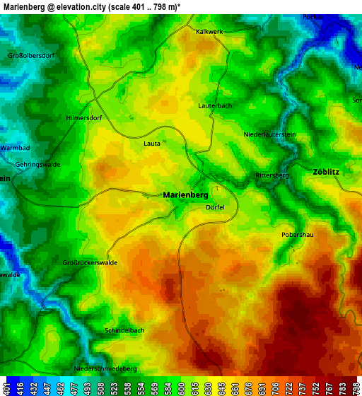
Below is the Elevation map of Marienberg, which displays elevation range with different colors. Scale of the first map is from 512 to 742 m (1680 to 2434 ft) with average elevation of 636.1 meters (=2087 ft) [note 1]
These maps also provides idea of topography and contour of this city, they are displayed at different zoom levels. More info about maps, scale and edge coordinates you can find below images.
| \ | Map #1 | Map #2 | Topo.Map |
| Scale [m] | 512..742 m | 401..798 m | × |
| Scale [ft] | 1680..2434 ft | 1316..2618 ft | × |
| Average | 636.1 m = 2087 ft | 607.2 m = 1992 ft | × |
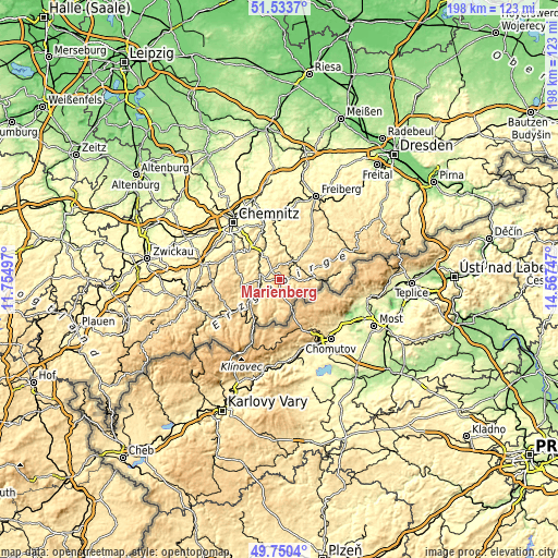
| Width | 6.2 km = 3.9 mi | 12.39 km = 7.7 mi | 198.3 km = 123.2 mi |
| Height | 6.2 km = 3.9 mi | 12.39 km = 7.7 mi | 198.3 km = 123.2 mi |
| ↑Max Latitude | 50.678365° | 50.706204° | 51.5337° |
| Latitude at center | 50.65051° | 50.65051° | 50.65051° |
| ↓Min Latitude | 50.622638° | 50.59475° | 49.7504° |
| ← Min Longitude | 13.117275° | 13.073329° | 11.75497° |
| Longitude center | 13.16122° | 13.16122° | 13.16122° |
| →Max Longitude | 13.205165° | 13.249111° | 14.56747° |
Nearby cities:
Cities around Marienberg sort by population:
• Lengefeld elevation 487 m
7.9 km,  16°
16°
• Wolkenstein 504 m
6.4 km,  275°
275°
• Pockau 408 m
7.5 km,  42°
42°
• Großrückerswalde 615 m
3.7 km,  238°
238°
• Wiesa 458 m
11.3 km,  247°
247°
• Mildenau 583 m
9.4 km,  221°
221°
• Großolbersdorf 504 m
7.8 km,  315°
315°
• Zöblitz 588 m
4.9 km,  78°
78°
• Drebach 479 m
10.6 km,  285°
285°
• Pobershau 567 m
4.1 km,  105°
105°
• Börnichen 513 m
11.2 km,  352°
352°
• Scharfenstein 380 m
9.5 km,  308°
308°
Multilingual:
 En español:
Marienberg elevación 614 m.
 En France:
Marienberg élévation 614 m.
 Auf Deutsch:
Marienberg höhe über dem Meeresspiegel ist 614 m.

Sources and notes:
- [note 1] Map square and city borders are not equal. Map elevation data is calculated only from area inside that square.
- [src 1] Elevation data from geonames database provided with same terms of usage.
- [src 2] The elevation map of Marienberg is generated using elevation data from NASA's 3 arcsec (90m) resolution SRTM data.
- [src 3] Base (background) map © OpenStreetMap contributors tiles are generated by Geofabrik and OpenTopoMap.
Copyright & License:
This Marienberg Elevation Map is licensed under CC BY-SA. You may reuse any part from this page, if you give a proper credit by linking to this URL:
 More info on terms of use page.