Zöblitz elevation
Zöblitz (Saxony), Germany elevation is 588 meters and Zöblitz elevation in feet is 1929 ft above sea level [src 1]. Zöblitz is a populated place (feature code) with elevation that is 330 meters (1083 ft) bigger than average city elevation in Germany.
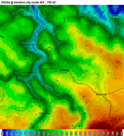
Below is the Elevation map of Zöblitz, which displays elevation range with different colors. Scale of the first map is from 424 to 795 m (1391 to 2608 ft) with average elevation of 602.1 meters (=1975 ft) [note 1]
These maps also provides idea of topography and contour of this city, they are displayed at different zoom levels. More info about maps, scale and edge coordinates you can find below images.
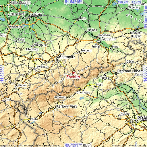
| \ | Map #1 | Topo.Map |
| Scale [m] | 424..795 m | × |
| Scale [ft] | 1391..2608 ft | × |
| Average | 602.1 m = 1975 ft | × |
| Width | 6.2 km = 3.9 mi | 198.2 km = 123.2 mi |
| Height | 6.2 km = 3.9 mi | 198.2 km = 123.2 mi |
| ↑Max Latitude | 50.68697° | 51.54215° |
| Latitude at center | 50.65912° | 50.65912° |
| ↓Min Latitude | 50.631253° | 49.75917° |
| ← Min Longitude | 13.185865° | 11.82356° |
| Longitude center | 13.22981° | 13.22981° |
| →Max Longitude | 13.273755° | 14.63606° |
Nearby cities:
Cities around Zöblitz sort by population:
• Marienberg elevation 614 m
4.9 km,  258°
258°
• Olbernhau 454 m
7.9 km,  90°
90°
• Lengefeld 487 m
7.2 km,  338°
338°
• Wolkenstein 504 m
11.2 km,  267°
267°
• Pockau 408 m
4.6 km,  3°
3°
• Großrückerswalde 615 m
8.5 km,  250°
250°
• Großolbersdorf 504 m
11.3 km,  293°
293°
• Pobershau 567 m
2.2 km,  202°
202°
• Grünhainichen 427 m
13.2 km, 335°
• Borstendorf 399 m
13.2 km, 344°
• Börnichen 513 m
11.9 km,  328°
328°
• Scharfenstein 380 m
13.2 km, 292°
Multilingual:
 En español:
Zöblitz elevación 588 m.
 En France:
Zöblitz élévation 588 m.


Sources and notes:
- [note 1] Map square and city borders are not equal. Map elevation data is calculated only from area inside that square.
- [src 1] Elevation data from geonames database provided with same terms of usage.
- [src 2] The elevation map of Zöblitz is generated using elevation data from NASA's 3 arcsec (90m) resolution SRTM data.
- [src 3] Base (background) map © OpenStreetMap contributors tiles are generated by Geofabrik and OpenTopoMap.
Copyright & License:
This Zöblitz Elevation Map is licensed under CC BY-SA. You may reuse any part from this page, if you give a proper credit by linking to this URL:
 More info on terms of use page.