Mücheln elevation
Mücheln (Saxony-Anhalt), Germany elevation is 180 meters and Mücheln elevation in feet is 591 ft above sea level [src 1]. Mücheln is a populated place (feature code) with elevation that is 78 meters (256 ft) smaller than average city elevation in Germany.
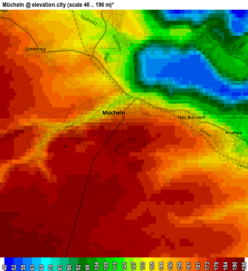
Below is the Elevation map of Mücheln, which displays elevation range with different colors. Scale of the first map is from 46 to 196 m (151 to 643 ft) with average elevation of 153.1 meters (=502 ft) [note 1]
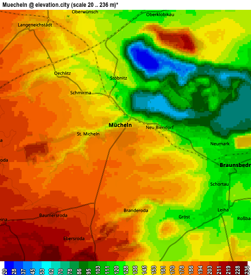
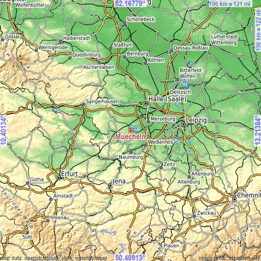
These maps also provides idea of topography and contour of this city, they are displayed at different zoom levels. More info about maps, scale and edge coordinates you can find below images.
| \ | Map #1 | Map #2 | Topo.Map |
| Scale [m] | 46..196 m | 20..236 m | × |
| Scale [ft] | 151..643 ft | 66..774 ft | × |
| Average | 153.1 m = 502 ft | 154.9 m = 508 ft | × |
| Width | 6.11 km = 3.8 mi | 12.22 km = 7.6 mi | 195.5 km = 121.5 mi |
| Height | 6.11 km = 3.8 mi | 12.22 km = 7.6 mi | 195.5 km = 121.5 mi |
| ↑Max Latitude | 51.32435° | 51.351804° | 52.16779° |
| Latitude at center | 51.29688° | 51.29688° | 51.29688° |
| ↓Min Latitude | 51.269393° | 51.24189° | 50.40913° |
| ← Min Longitude | 11.763645° | 11.719699° | 10.40134° |
| Longitude center | 11.80759° | 11.80759° | 11.80759° |
| →Max Longitude | 11.851535° | 11.895481° | 13.21384° |
Nearby cities:
Cities around Mücheln sort by population:
• Braunsbedra elevation 118 m
5.8 km,  101°
101°
• Bad Lauchstädt 115 m
10.9 km,  23°
23°
• Freyburg 117 m
9.7 km,  196°
196°
• Schafstädt 147 m
9.7 km,  345°
345°
• Karsdorf 122 m
10.8 km,  254°
254°
• Frankleben 100 m
8.6 km,  79°
79°
• Langeneichstädt 169 m
7 km,  320°
320°
• Geusa 97 m
10.6 km,  63°
63°
• Reichardtswerben 140 m
11.5 km,  117°
117°
• Krumpa 123 m
2.5 km,  89°
89°
• Großkayna 112 m
8.7 km, 94°
• Beuna 104 m
10.1 km, 77°
Multilingual:
 En español:
Mücheln elevación 180 m.
 En France:
Mücheln élévation 180 m.


Sources and notes:
- [note 1] Map square and city borders are not equal. Map elevation data is calculated only from area inside that square.
- [src 1] Elevation data from geonames database provided with same terms of usage.
- [src 2] The elevation map of Mücheln is generated using elevation data from NASA's 3 arcsec (90m) resolution SRTM data.
- [src 3] Base (background) map © OpenStreetMap contributors tiles are generated by Geofabrik and OpenTopoMap.
Copyright & License:
This Mücheln Elevation Map is licensed under CC BY-SA. You may reuse any part from this page, if you give a proper credit by linking to this URL:
 More info on terms of use page.