Bad Lauchstädt elevation
Bad Lauchstädt (Saxony-Anhalt), Germany elevation is 115 meters and Bad Lauchstädt elevation in feet is 377 ft above sea level [src 1]. Bad Lauchstädt is a populated place (feature code) with elevation that is 143 meters (469 ft) smaller than average city elevation in Germany.
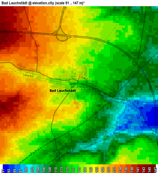
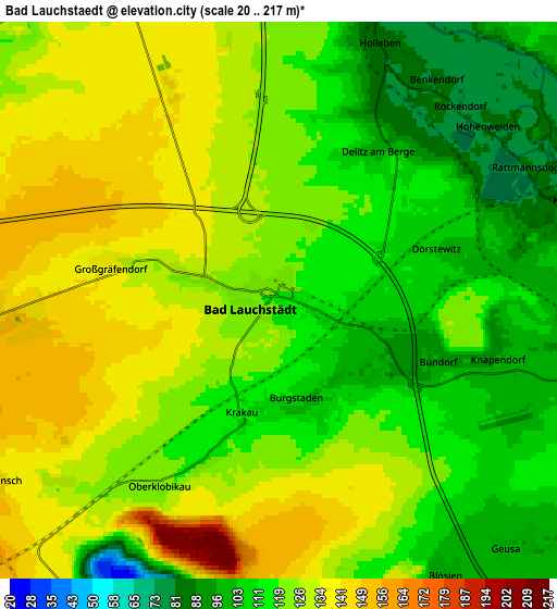
Below is the Elevation map of Bad Lauchstädt, which displays elevation range with different colors. Scale of the first map is from 91 to 147 m (299 to 482 ft) with average elevation of 119.7 meters (=393 ft) [note 1]
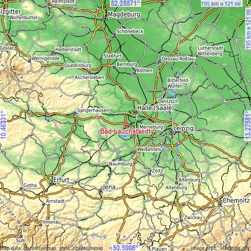
These maps also provides idea of topography and contour of this city, they are displayed at different zoom levels. More info about maps, scale and edge coordinates you can find below images.
| \ | Map #1 | Map #2 | Topo.Map |
| Scale [m] | 91..147 m | 20..217 m | × |
| Scale [ft] | 299..482 ft | 66..712 ft | × |
| Average | 119.7 m = 393 ft | 121.3 m = 398 ft | × |
| Width | 6.1 km = 3.8 mi | 12.2 km = 7.6 mi | 195.2 km = 121.3 mi |
| Height | 6.1 km = 3.8 mi | 12.2 km = 7.6 mi | 195.1 km = 121.2 mi |
| ↑Max Latitude | 51.413936° | 51.441336° | 52.25571° |
| Latitude at center | 51.38652° | 51.38652° | 51.38652° |
| ↓Min Latitude | 51.359087° | 51.331638° | 50.5005° |
| ← Min Longitude | 11.825615° | 11.781669° | 10.46331° |
| Longitude center | 11.86956° | 11.86956° | 11.86956° |
| →Max Longitude | 11.913505° | 11.957451° | 13.27581° |
Nearby cities:
Cities around Bad Lauchstädt sort by population:
• Merseburg elevation 101 m
9 km,  113°
113°
• Teutschenthal 119 m
8.5 km,  325°
325°
• Schkopau 101 m
5.8 km,  84°
84°
• Schafstädt 147 m
6.7 km,  265°
265°
• Holleben 83 m
6.3 km,  18°
18°
• Frankleben 100 m
9.3 km,  153°
153°
• Zscherben 93 m
9 km,  129°
129°
• Zscherben 106 m
9 km,  0°
0°
• Langeneichstädt 169 m
9.9 km,  242°
242°
• Geusa 97 m
7.4 km,  135°
135°
• Angersdorf 88 m
8.6 km, 17°
• Beuna 104 m
9.6 km, 144°
Multilingual:
 En español:
Bad Lauchstädt elevación 115 m.
 En France:
Bad Lauchstädt élévation 115 m.
 Auf Deutsch:
Bad Lauchstädt höhe über dem Meeresspiegel ist 115 m.

Sources and notes:
- [note 1] Map square and city borders are not equal. Map elevation data is calculated only from area inside that square.
- [src 1] Elevation data from geonames database provided with same terms of usage.
- [src 2] The elevation map of Bad Lauchstädt is generated using elevation data from NASA's 3 arcsec (90m) resolution SRTM data.
- [src 3] Base (background) map © OpenStreetMap contributors tiles are generated by Geofabrik and OpenTopoMap.
Copyright & License:
This Bad Lauchstädt Elevation Map is licensed under CC BY-SA. You may reuse any part from this page, if you give a proper credit by linking to this URL:
 More info on terms of use page.