Teutschenthal elevation
Teutschenthal (Saxony-Anhalt), Germany elevation is 119 meters and Teutschenthal elevation in feet is 390 ft above sea level [src 1]. Teutschenthal is a seat of a fourth-order administrative division (feature code) with elevation that is 139 meters (456 ft) smaller than average city elevation in Germany.
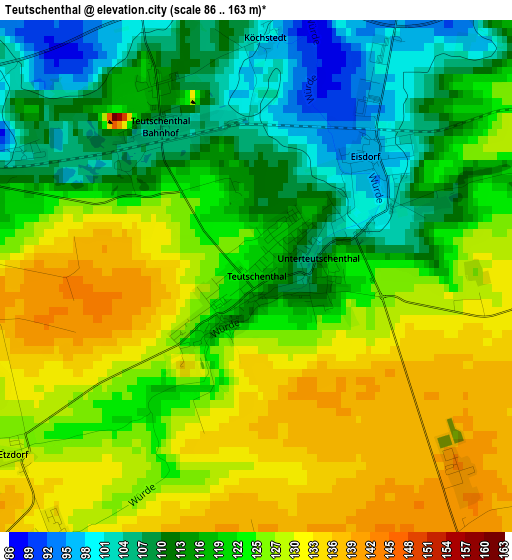
Below is the Elevation map of Teutschenthal, which displays elevation range with different colors. Scale of the first map is from 86 to 163 m (282 to 535 ft) with average elevation of 121.5 meters (=399 ft) [note 1]
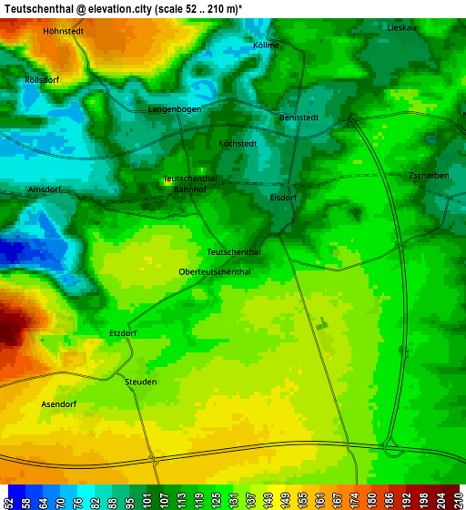
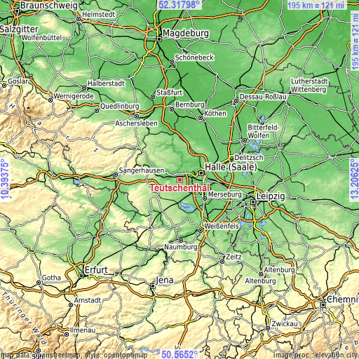
These maps also provides idea of topography and contour of this city, they are displayed at different zoom levels. More info about maps, scale and edge coordinates you can find below images.
| \ | Map #1 | Map #2 | Topo.Map |
| Scale [m] | 86..163 m | 52..210 m | × |
| Scale [ft] | 282..535 ft | 171..689 ft | × |
| Average | 121.5 m = 399 ft | 122.8 m = 403 ft | × |
| Width | 6.09 km = 3.8 mi | 12.18 km = 7.6 mi | 194.9 km = 121.1 mi |
| Height | 6.09 km = 3.8 mi | 12.18 km = 7.6 mi | 194.9 km = 121.1 mi |
| ↑Max Latitude | 51.477378° | 51.50474° | 52.31798° |
| Latitude at center | 51.45° | 51.45° | 51.45° |
| ↓Min Latitude | 51.422605° | 51.395194° | 50.5652° |
| ← Min Longitude | 11.756055° | 11.712109° | 10.39375° |
| Longitude center | 11.8° | 11.8° | 11.8° |
| →Max Longitude | 11.843945° | 11.887891° | 13.20625° |
Nearby cities:
Cities around Teutschenthal sort by population:
• Röblingen am See elevation 94 m
8.2 km,  277°
277°
• Lieskau 102 m
7.4 km,  35°
35°
• Schafstädt 147 m
7.9 km,  193°
193°
• Langenbogen 91 m
4 km,  337°
337°
• Wansleben 109 m
3.6 km,  288°
288°
• Holleben 83 m
7 km,  98°
98°
• Höhnstedt 160 m
7.2 km,  323°
323°
• Zscherben 106 m
5.2 km,  68°
68°
• Zappendorf 89 m
6.7 km,  357°
357°
• Bennstedt 90 m
4 km,  27°
27°
• Angersdorf 88 m
7.5 km,  81°
81°
• Stedten 111 m
7.5 km,  264°
264°
Multilingual:
 En español:
Teutschenthal elevación 119 m.
 En France:
Teutschenthal élévation 119 m.
 Auf Deutsch:
Teutschenthal höhe über dem Meeresspiegel ist 119 m.

Sources and notes:
- [note 1] Map square and city borders are not equal. Map elevation data is calculated only from area inside that square.
- [src 1] Elevation data from geonames database provided with same terms of usage.
- [src 2] The elevation map of Teutschenthal is generated using elevation data from NASA's 3 arcsec (90m) resolution SRTM data.
- [src 3] Base (background) map © OpenStreetMap contributors tiles are generated by Geofabrik and OpenTopoMap.
Copyright & License:
This Teutschenthal Elevation Map is licensed under CC BY-SA. You may reuse any part from this page, if you give a proper credit by linking to this URL:
 More info on terms of use page.