Münchhausen elevation
Münchhausen (Hesse, Regierungsbezirk Gießen), Germany elevation is 243 meters and Münchhausen elevation in feet is 797 ft above sea level [src 1]. Münchhausen is a seat of a fourth-order administrative division (feature code) with elevation that is 15 meters (49 ft) smaller than average city elevation in Germany.
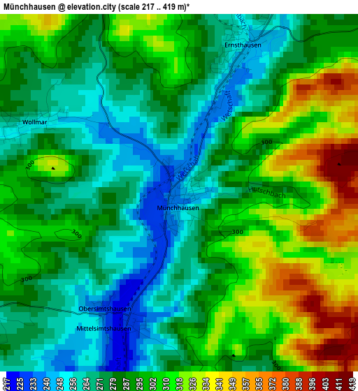
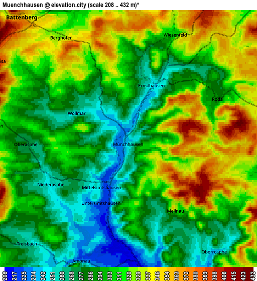
Below is the Elevation map of Münchhausen, which displays elevation range with different colors. Scale of the first map is from 217 to 419 m (712 to 1375 ft) with average elevation of 290.7 meters (=954 ft) [note 1]
These maps also provides idea of topography and contour of this city, they are displayed at different zoom levels. More info about maps, scale and edge coordinates you can find below images.
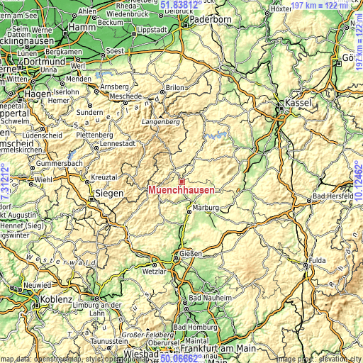
| \ | Map #1 | Map #2 | Topo.Map |
| Scale [m] | 217..419 m | 208..432 m | × |
| Scale [ft] | 712..1375 ft | 682..1417 ft | × |
| Average | 290.7 m = 954 ft | 305.7 m = 1003 ft | × |
| Width | 6.16 km = 3.8 mi | 12.31 km = 7.6 mi | 197 km = 122.4 mi |
| Height | 6.16 km = 3.8 mi | 12.31 km = 7.6 mi | 197 km = 122.4 mi |
| ↑Max Latitude | 50.988481° | 51.016135° | 51.83812° |
| Latitude at center | 50.96081° | 50.96081° | 50.96081° |
| ↓Min Latitude | 50.933123° | 50.905419° | 50.06662° |
| ← Min Longitude | 8.674425° | 8.630479° | 7.31212° |
| Longitude center | 8.71837° | 8.71837° | 8.71837° |
| →Max Longitude | 8.762315° | 8.806261° | 10.12462° |
Nearby cities:
Cities around Münchhausen sort by population:
• Marburg an der Lahn elevation 220 m
17.3 km,  167°
167°
• Frankenberg 314 m
12.3 km,  27°
27°
• Biedenkopf 280 m
14.3 km,  247°
247°
• Wetter 213 m
6.5 km,  176°
176°
• Cölbe 213 m
13 km,  160°
160°
• Allendorf 310 m
8.3 km,  337°
337°
• Battenberg 360 m
7.8 km,  319°
319°
• Rauschenberg 247 m
16.5 km,  121°
121°
• Gemünden an der Wohra 249 m
17.6 km,  85°
85°
• Hatzfeld 348 m
12.6 km,  286°
286°
• Rosenthal 276 m
10.5 km,  81°
81°
• Bromskirchen 449 m
16.1 km, 336°
Multilingual:
 En español:
Münchhausen elevación 243 m.
 En France:
Münchhausen élévation 243 m.
 Auf Deutsch:
Münchhausen höhe über dem Meeresspiegel ist 243 m.

Sources and notes:
- [note 1] Map square and city borders are not equal. Map elevation data is calculated only from area inside that square.
- [src 1] Elevation data from geonames database provided with same terms of usage.
- [src 2] The elevation map of Münchhausen is generated using elevation data from NASA's 3 arcsec (90m) resolution SRTM data.
- [src 3] Base (background) map © OpenStreetMap contributors tiles are generated by Geofabrik and OpenTopoMap.
Copyright & License:
This Münchhausen Elevation Map is licensed under CC BY-SA. You may reuse any part from this page, if you give a proper credit by linking to this URL:
 More info on terms of use page.