Allendorf elevation
Allendorf (Hesse, Regierungsbezirk Kassel), Germany elevation is 310 meters and Allendorf elevation in feet is 1017 ft above sea level [src 1]. Allendorf is a populated place (feature code) with elevation that is 52 meters (171 ft) bigger than average city elevation in Germany.
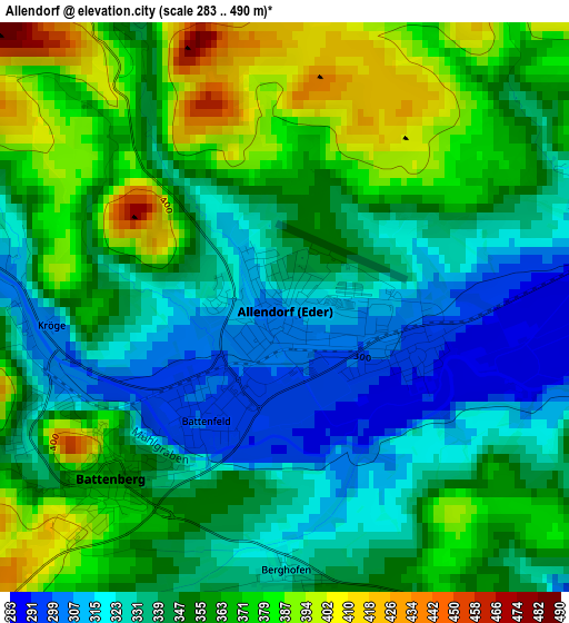
Below is the Elevation map of Allendorf, which displays elevation range with different colors. Scale of the first map is from 283 to 490 m (928 to 1608 ft) with average elevation of 349.9 meters (=1148 ft) [note 1]
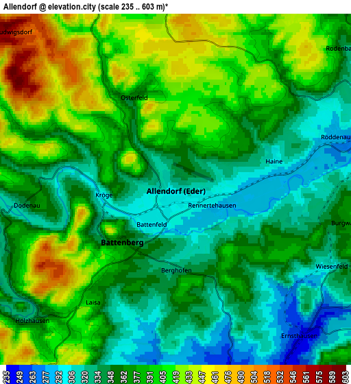
These maps also provides idea of topography and contour of this city, they are displayed at different zoom levels. More info about maps, scale and edge coordinates you can find below images.
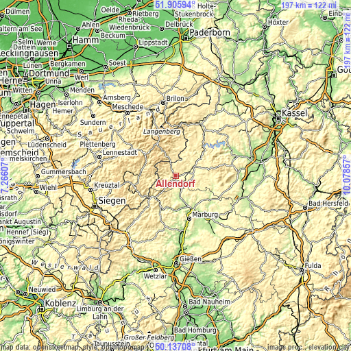
| \ | Map #1 | Map #2 | Topo.Map |
| Scale [m] | 283..490 m | 235..603 m | × |
| Scale [ft] | 928..1608 ft | 771..1978 ft | × |
| Average | 349.9 m = 1148 ft | 371.8 m = 1220 ft | × |
| Width | 6.15 km = 3.8 mi | 12.29 km = 7.6 mi | 196.7 km = 122.2 mi |
| Height | 6.15 km = 3.8 mi | 12.29 km = 7.6 mi | 196.7 km = 122.2 mi |
| ↑Max Latitude | 51.05758° | 51.085193° | 51.90594° |
| Latitude at center | 51.02995° | 51.02995° | 51.02995° |
| ↓Min Latitude | 51.002304° | 50.974641° | 50.13708° |
| ← Min Longitude | 8.628375° | 8.584429° | 7.26607° |
| Longitude center | 8.67232° | 8.67232° | 8.67232° |
| →Max Longitude | 8.716265° | 8.760211° | 10.07857° |
Nearby cities:
Cities around Allendorf sort by population:
• Bad Berleburg elevation 420 m
19.7 km,  277°
277°
• Frankenberg 314 m
9.5 km,  70°
70°
• Biedenkopf 280 m
16.5 km,  217°
217°
• Wetter 213 m
14.6 km,  165°
165°
• Medebach 410 m
18.7 km,  7°
7°
• Battenberg 360 m
2.6 km,  225°
225°
• Hallenberg 425 m
9.7 km,  337°
337°
• Münchhausen 243 m
8.3 km,  157°
157°
• Frankenau 434 m
19.6 km, 69°
• Hatzfeld 348 m
9.7 km,  245°
245°
• Rosenthal 276 m
15 km,  114°
114°
• Bromskirchen 449 m
7.8 km, 335°
Multilingual:
 En español:
Allendorf elevación 310 m.
 En France:
Allendorf élévation 310 m.
 Auf Deutsch:
Allendorf höhe über dem Meeresspiegel ist 310 m.

Sources and notes:
- [note 1] Map square and city borders are not equal. Map elevation data is calculated only from area inside that square.
- [src 1] Elevation data from geonames database provided with same terms of usage.
- [src 2] The elevation map of Allendorf is generated using elevation data from NASA's 3 arcsec (90m) resolution SRTM data.
- [src 3] Base (background) map © OpenStreetMap contributors tiles are generated by Geofabrik and OpenTopoMap.
Copyright & License:
This Allendorf Elevation Map is licensed under CC BY-SA. You may reuse any part from this page, if you give a proper credit by linking to this URL:
 More info on terms of use page.