Northeim elevation
Northeim (Lower Saxony), Germany elevation is 127 meters and Northeim elevation in feet is 417 ft above sea level [src 1]. Northeim is a seat of a third-order administrative division (feature code) with elevation that is 131 meters (430 ft) smaller than average city elevation in Germany.
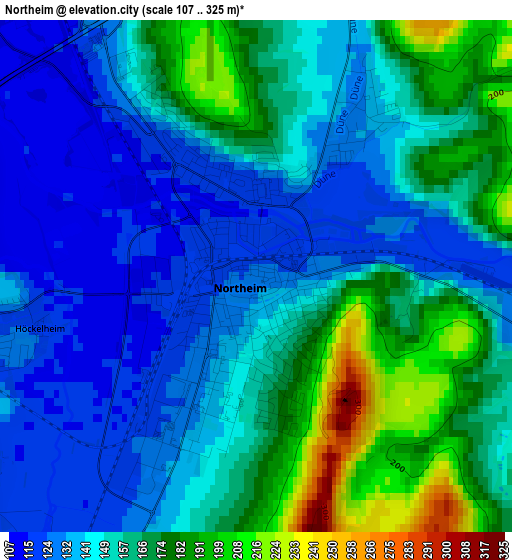
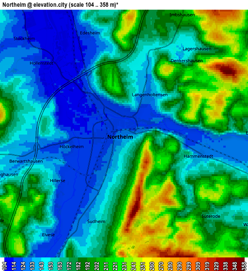
Below is the Elevation map of Northeim, which displays elevation range with different colors. Scale of the first map is from 107 to 325 m (351 to 1066 ft) with average elevation of 152.9 meters (=502 ft) [note 1]
These maps also provides idea of topography and contour of this city, they are displayed at different zoom levels. More info about maps, scale and edge coordinates you can find below images.
| \ | Map #1 | Map #2 | Topo.Map |
| Scale [m] | 107..325 m | 104..358 m | × |
| Scale [ft] | 351..1066 ft | 341..1175 ft | × |
| Average | 152.9 m = 502 ft | 173.4 m = 569 ft | × |
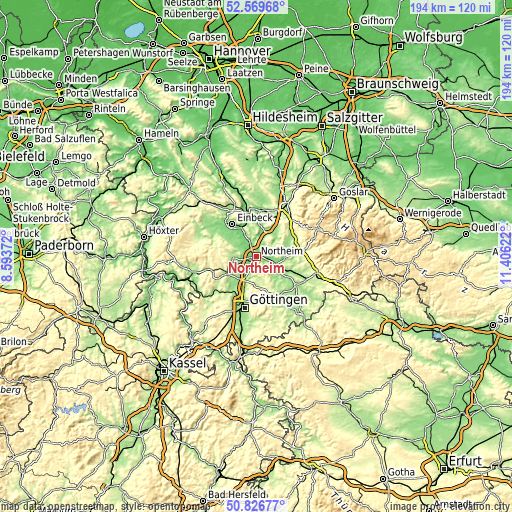
| Width | 6.06 km = 3.8 mi | 12.11 km = 7.5 mi | 193.8 km = 120.4 mi |
| Height | 6.06 km = 3.8 mi | 12.11 km = 7.5 mi | 193.8 km = 120.4 mi |
| ↑Max Latitude | 51.733844° | 51.761052° | 52.56968° |
| Latitude at center | 51.70662° | 51.70662° | 51.70662° |
| ↓Min Latitude | 51.679379° | 51.652122° | 50.82677° |
| ← Min Longitude | 9.956025° | 9.912079° | 8.59372° |
| Longitude center | 9.99997° | 9.99997° | 9.99997° |
| →Max Longitude | 10.043915° | 10.087861° | 11.40622° |
Nearby cities:
Cities around Northeim sort by population:
• Einbeck elevation 115 m
15.5 km,  324°
324°
• Bovenden 142 m
14.2 km,  202°
202°
• Hardegsen 184 m
13.2 km,  242°
242°
• Nörten-Hardenberg 135 m
9.7 km,  207°
207°
• Katlenburg-Lindau 137 m
7.4 km,  110°
110°
• Moringen 179 m
8.9 km,  264°
264°
• Kalefeld 129 m
10.6 km,  12°
12°
• Hillerse 139 m
4.2 km, 235°
• Bilshausen 156 m
13.9 km,  128°
128°
• Wulften 158 m
13.1 km, 113°
• Badenhausen 176 m
15.8 km,  63°
63°
• Eisdorf am Harz 164 m
13.6 km, 63°
Multilingual:
 En español:
Northeim elevación 127 m.
 En France:
Northeim élévation 127 m.
 Auf Deutsch:
Northeim höhe über dem Meeresspiegel ist 127 m.

Sources and notes:
- [note 1] Map square and city borders are not equal. Map elevation data is calculated only from area inside that square.
- [src 1] Elevation data from geonames database provided with same terms of usage.
- [src 2] The elevation map of Northeim is generated using elevation data from NASA's 3 arcsec (90m) resolution SRTM data.
- [src 3] Base (background) map © OpenStreetMap contributors tiles are generated by Geofabrik and OpenTopoMap.
Copyright & License:
This Northeim Elevation Map is licensed under CC BY-SA. You may reuse any part from this page, if you give a proper credit by linking to this URL:
 More info on terms of use page.