Eisdorf am Harz elevation
Eisdorf am Harz (Lower Saxony), Germany elevation is 164 meters and Eisdorf am Harz elevation in feet is 538 ft above sea level [src 1]. Eisdorf am Harz is a populated place (feature code) with elevation that is 94 meters (308 ft) smaller than average city elevation in Germany.
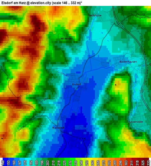
Below is the Elevation map of Eisdorf am Harz, which displays elevation range with different colors. Scale of the first map is from 146 to 332 m (479 to 1089 ft) with average elevation of 212.9 meters (=698 ft) [note 1]
These maps also provides idea of topography and contour of this city, they are displayed at different zoom levels. More info about maps, scale and edge coordinates you can find below images.
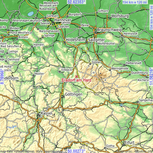
| \ | Map #1 | Topo.Map |
| Scale [m] | 146..332 m | × |
| Scale [ft] | 479..1089 ft | × |
| Average | 212.9 m = 698 ft | × |
| Width | 6.05 km = 3.8 mi | 193.6 km = 120.3 mi |
| Height | 6.05 km = 3.8 mi | 193.5 km = 120.2 mi |
| ↑Max Latitude | 51.788711° | 52.62353° |
| Latitude at center | 51.76152° | 51.76152° |
| ↓Min Latitude | 51.734312° | 50.88273° |
| ← Min Longitude | 10.131965° | 8.76966° |
| Longitude center | 10.17591° | 10.17591° |
| →Max Longitude | 10.219855° | 11.58216° |
Nearby cities:
Cities around Eisdorf am Harz sort by population:
• Clausthal-Zellerfeld elevation 556 m
12.4 km,  64°
64°
• Katlenburg-Lindau 137 m
10.1 km,  211°
211°
• Kalefeld 129 m
10.7 km,  293°
293°
• Hattorf 179 m
13.1 km,  161°
161°
• Bad Grund 308 m
6.9 km,  37°
37°
• Wulften 158 m
11.3 km,  180°
180°
• Gittelde 196 m
4.2 km,  11°
11°
• Badenhausen 176 m
2.2 km, 64°
• Hörden 202 m
12.7 km,  144°
144°
• Wildemann 389 m
10.4 km, 44°
• Windhausen 214 m
3.6 km, 43°
• Osterode am Harz 223 m
6.4 km,  126°
126°
Multilingual:
 En español:
Eisdorf am Harz elevación 164 m.
 En France:
Eisdorf am Harz élévation 164 m.
 Auf Deutsch:
Eisdorf am Harz höhe über dem Meeresspiegel ist 164 m.

Sources and notes:
- [note 1] Map square and city borders are not equal. Map elevation data is calculated only from area inside that square.
- [src 1] Elevation data from geonames database provided with same terms of usage.
- [src 2] The elevation map of Eisdorf am Harz is generated using elevation data from NASA's 3 arcsec (90m) resolution SRTM data.
- [src 3] Base (background) map © OpenStreetMap contributors tiles are generated by Geofabrik and OpenTopoMap.
Copyright & License:
This Eisdorf am Harz Elevation Map is licensed under CC BY-SA. You may reuse any part from this page, if you give a proper credit by linking to this URL:
 More info on terms of use page.