Hattorf elevation
Hattorf (Lower Saxony), Germany elevation is 179 meters and Hattorf elevation in feet is 587 ft above sea level [src 1]. Hattorf is a seat of a fourth-order administrative division (feature code) with elevation that is 79 meters (259 ft) smaller than average city elevation in Germany.
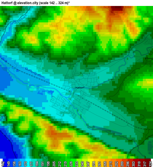
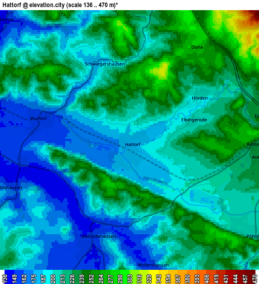
Below is the Elevation map of Hattorf, which displays elevation range with different colors. Scale of the first map is from 142 to 324 m (466 to 1063 ft) with average elevation of 206.2 meters (=677 ft) [note 1]
These maps also provides idea of topography and contour of this city, they are displayed at different zoom levels. More info about maps, scale and edge coordinates you can find below images.
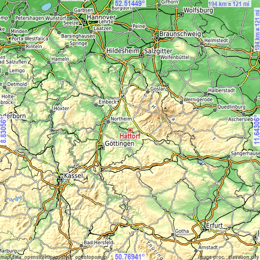
| \ | Map #1 | Map #2 | Topo.Map |
| Scale [m] | 142..324 m | 136..470 m | × |
| Scale [ft] | 466..1063 ft | 446..1542 ft | × |
| Average | 206.2 m = 677 ft | 209.9 m = 689 ft | × |
| Width | 6.06 km = 3.8 mi | 12.13 km = 7.5 mi | 194 km = 120.5 mi |
| Height | 6.06 km = 3.8 mi | 12.13 km = 7.5 mi | 194 km = 120.5 mi |
| ↑Max Latitude | 51.677608° | 51.70485° | 52.51449° |
| Latitude at center | 51.65035° | 51.65035° | 51.65035° |
| ↓Min Latitude | 51.623076° | 51.595785° | 50.76941° |
| ← Min Longitude | 10.192865° | 10.148919° | 8.83056° |
| Longitude center | 10.23681° | 10.23681° | 10.23681° |
| →Max Longitude | 10.280755° | 10.324701° | 11.64306° |
Nearby cities:
Cities around Hattorf sort by population:
• Herzberg am Harz elevation 240 m
7.1 km,  85°
85°
• Katlenburg-Lindau 137 m
10.1 km,  291°
291°
• Gieboldehausen 162 m
4.7 km,  197°
197°
• Bilshausen 156 m
5.9 km,  246°
246°
• Wulften 158 m
4.4 km,  283°
283°
• Rhumspringe 168 m
8.6 km,  149°
149°
• Ebergötzen 192 m
12.6 km,  225°
225°
• Seeburg 178 m
11.1 km,  212°
212°
• Krebeck 218 m
11.2 km, 228°
• Hörden 202 m
3.8 km,  58°
58°
• Obernfeld 158 m
11.2 km,  181°
181°
• Osterode am Harz 223 m
8.6 km,  6°
6°
Multilingual:
 En español:
Hattorf elevación 179 m.
 En France:
Hattorf élévation 179 m.


Sources and notes:
- [note 1] Map square and city borders are not equal. Map elevation data is calculated only from area inside that square.
- [src 1] Elevation data from geonames database provided with same terms of usage.
- [src 2] The elevation map of Hattorf is generated using elevation data from NASA's 3 arcsec (90m) resolution SRTM data.
- [src 3] Base (background) map © OpenStreetMap contributors tiles are generated by Geofabrik and OpenTopoMap.
Copyright & License:
This Hattorf Elevation Map is licensed under CC BY-SA. You may reuse any part from this page, if you give a proper credit by linking to this URL:
 More info on terms of use page.