Oberstdorf elevation
Oberstdorf (Bavaria, Swabia), Germany elevation is 819 meters and Oberstdorf elevation in feet is 2687 ft above sea level [src 1]. Oberstdorf is a populated place (feature code) with elevation that is 561 meters (1841 ft) bigger than average city elevation in Germany.
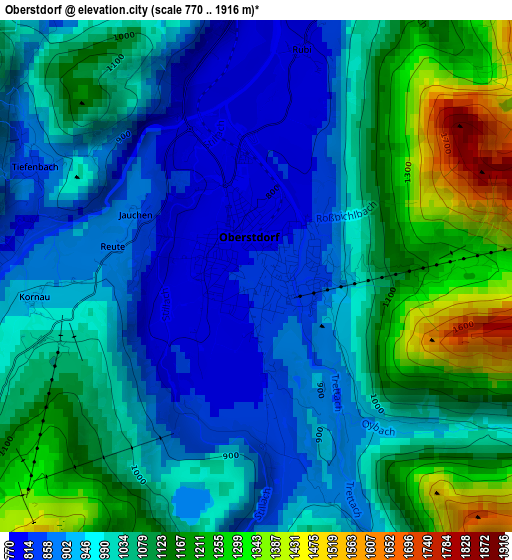
Below is the Elevation map of Oberstdorf, which displays elevation range with different colors. Scale of the first map is from 770 to 1916 m (2526 to 6286 ft) with average elevation of 1028.8 meters (=3375 ft) [note 1]
These maps also provides idea of topography and contour of this city, they are displayed at different zoom levels. More info about maps, scale and edge coordinates you can find below images.
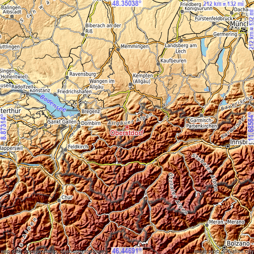
| \ | Map #1 | Map #2 | Topo.Map |
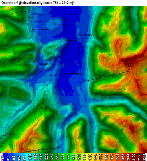
| Scale [m] | 770..1916 m | 754..2212 m | × |
| Scale [ft] | 2526..6286 ft | 2474..7257 ft | × |
| Average | 1028.8 m = 3375 ft | 1239.2 m = 4066 ft | × |
| Width | 6.61 km = 4.1 mi | 13.23 km = 8.2 mi | 211.6 km = 131.5 mi |
| Height | 6.61 km = 4.1 mi | 13.23 km = 8.2 mi | 211.6 km = 131.5 mi |
| ↑Max Latitude | 47.436973° | 47.466689° | 48.35038° |
| Latitude at center | 47.40724° | 47.40724° | 47.40724° |
| ↓Min Latitude | 47.37749° | 47.347724° | 46.44691° |
| ← Min Longitude | 10.235445° | 10.191499° | 8.87314° |
| Longitude center | 10.27939° | 10.27939° | 10.27939° |
| →Max Longitude | 10.323335° | 10.367281° | 11.68564° |
Nearby cities:
Cities around Oberstdorf sort by population:
• Sonthofen elevation 746 m
12.3 km,  1°
1°
• Immenstadt im Allgäu 733 m
17.7 km,  343°
343°
• Pfronten 867 m
28.1 km,  46°
46°
• Oberstaufen 790 m
25.4 km,  310°
310°
• Blaichach 731 m
15.1 km,  354°
354°
• Oy-Mittelberg 977 m
27.7 km,  24°
24°
• Rettenberg 800 m
18.6 km, 2°
• Burgberg 775 m
14.4 km, 2°
• Wertach 905 m
23.9 km, 24°
• Ofterschwang 910 m
10.9 km, 341°
• Missen-Wilhams 839 m
24.7 km,  330°
330°
• Bolsterlang 881 m
7.5 km, 332°
Multilingual:
 En español:
Oberstdorf elevación 819 m.
 En France:
Oberstdorf élévation 819 m.
 Auf Deutsch:
Oberstdorf höhe über dem Meeresspiegel ist 819 m.

Sources and notes:
- [note 1] Map square and city borders are not equal. Map elevation data is calculated only from area inside that square.
- [src 1] Elevation data from geonames database provided with same terms of usage.
- [src 2] The elevation map of Oberstdorf is generated using elevation data from NASA's 3 arcsec (90m) resolution SRTM data.
- [src 3] Base (background) map © OpenStreetMap contributors tiles are generated by Geofabrik and OpenTopoMap.
Copyright & License:
This Oberstdorf Elevation Map is licensed under CC BY-SA. You may reuse any part from this page, if you give a proper credit by linking to this URL:
 More info on terms of use page.