Wertach elevation
Wertach (Bavaria, Swabia), Germany elevation is 905 meters and Wertach elevation in feet is 2969 ft above sea level [src 1]. Wertach is a populated place (feature code) with elevation that is 647 meters (2123 ft) bigger than average city elevation in Germany.
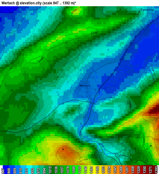
Below is the Elevation map of Wertach, which displays elevation range with different colors. Scale of the first map is from 847 to 1392 m (2779 to 4567 ft) with average elevation of 1005.3 meters (=3298 ft) [note 1]
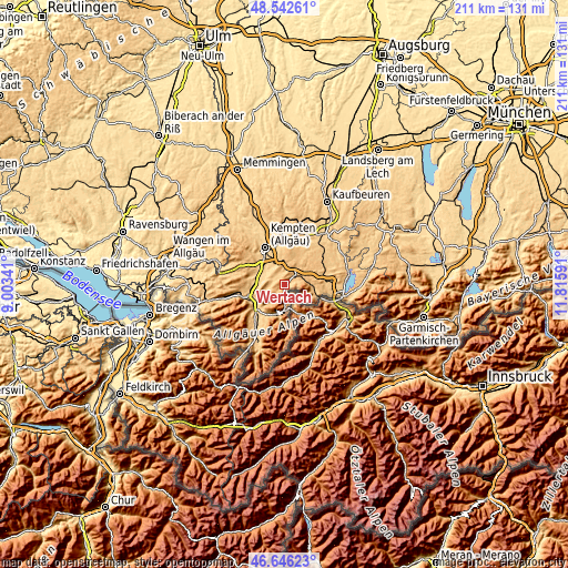
These maps also provides idea of topography and contour of this city, they are displayed at different zoom levels. More info about maps, scale and edge coordinates you can find below images.
| \ | Map #1 | Topo.Map |
| Scale [m] | 847..1392 m | × |
| Scale [ft] | 2779..4567 ft | × |
| Average | 1005.3 m = 3298 ft | × |
| Width | 6.59 km = 4.1 mi | 210.9 km = 131 mi |
| Height | 6.59 km = 4.1 mi | 210.8 km = 131 mi |
| ↑Max Latitude | 47.632632° | 48.54261° |
| Latitude at center | 47.60301° | 47.60301° |
| ↓Min Latitude | 47.573371° | 46.64623° |
| ← Min Longitude | 10.365715° | 9.00341° |
| Longitude center | 10.40966° | 10.40966° |
| →Max Longitude | 10.453605° | 11.81591° |
Nearby cities:
Cities around Wertach sort by population:
• Sonthofen elevation 746 m
13.4 km,  225°
225°
• Waltenhofen 716 m
11 km,  315°
315°
• Pfronten 867 m
10.7 km,  102°
102°
• Durach 718 m
11.3 km,  334°
334°
• Blaichach 731 m
13.2 km,  239°
239°
• Sulzberg 714 m
7.8 km, 324°
• Oy-Mittelberg 977 m
3.8 km,  27°
27°
• Rettenberg 800 m
9.4 km,  250°
250°
• Nesselwang 861 m
7.3 km,  71°
71°
• Burgberg 775 m
11.7 km, 230°
• Betzigau 737 m
14.6 km,  352°
352°
• Görisried 803 m
13.8 km, 33°
Multilingual:
 En español:
Wertach elevación 905 m.
 En France:
Wertach élévation 905 m.


Sources and notes:
- [note 1] Map square and city borders are not equal. Map elevation data is calculated only from area inside that square.
- [src 1] Elevation data from geonames database provided with same terms of usage.
- [src 2] The elevation map of Wertach is generated using elevation data from NASA's 3 arcsec (90m) resolution SRTM data.
- [src 3] Base (background) map © OpenStreetMap contributors tiles are generated by Geofabrik and OpenTopoMap.
Copyright & License:
This Wertach Elevation Map is licensed under CC BY-SA. You may reuse any part from this page, if you give a proper credit by linking to this URL:
 More info on terms of use page.