Rettenberg elevation
Rettenberg (Bavaria, Swabia), Germany elevation is 800 meters and Rettenberg elevation in feet is 2625 ft above sea level [src 1]. Rettenberg is a seat of a fourth-order administrative division (feature code) with elevation that is 542 meters (1778 ft) bigger than average city elevation in Germany.
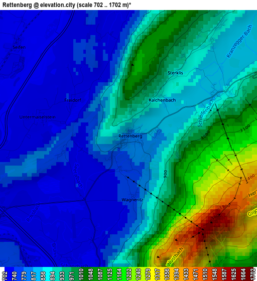
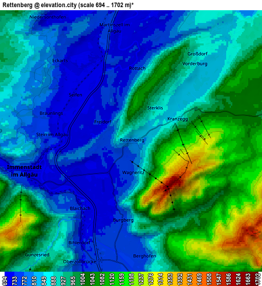
Below is the Elevation map of Rettenberg, which displays elevation range with different colors. Scale of the first map is from 702 to 1702 m (2303 to 5584 ft) with average elevation of 895 meters (=2936 ft) [note 1]
These maps also provides idea of topography and contour of this city, they are displayed at different zoom levels. More info about maps, scale and edge coordinates you can find below images.
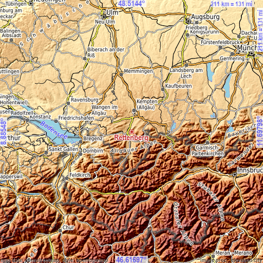
| \ | Map #1 | Map #2 | Topo.Map |
| Scale [m] | 702..1702 m | 694..1702 m | × |
| Scale [ft] | 2303..5584 ft | 2277..5584 ft | × |
| Average | 895 m = 2936 ft | 920.3 m = 3019 ft | × |
| Width | 6.59 km = 4.1 mi | 13.19 km = 8.2 mi | 211 km = 131.1 mi |
| Height | 6.59 km = 4.1 mi | 13.19 km = 8.2 mi | 211 km = 131.1 mi |
| ↑Max Latitude | 47.603919° | 47.63354° | 48.5144° |
| Latitude at center | 47.57428° | 47.57428° | 47.57428° |
| ↓Min Latitude | 47.544625° | 47.514952° | 46.61697° |
| ← Min Longitude | 10.247785° | 10.203839° | 8.88548° |
| Longitude center | 10.29173° | 10.29173° | 10.29173° |
| →Max Longitude | 10.335675° | 10.379621° | 11.69798° |
Nearby cities:
Cities around Rettenberg sort by population:
• Sonthofen elevation 746 m
6.3 km,  186°
186°
• Immenstadt im Allgäu 733 m
6 km,  254°
254°
• Waltenhofen 716 m
11.1 km,  5°
5°
• Durach 718 m
13.9 km,  16°
16°
• Blaichach 731 m
4.4 km,  214°
214°
• Sulzberg 714 m
10.5 km, 24°
• Oy-Mittelberg 977 m
12.5 km,  58°
58°
• Burgberg 775 m
4.2 km,  182°
182°
• Wertach 905 m
9.4 km,  70°
70°
• Ofterschwang 910 m
9.4 km, 207°
• Missen-Wilhams 839 m
13.4 km,  282°
282°
• Bolsterlang 881 m
12.7 km,  200°
200°
Multilingual:
 En español:
Rettenberg elevación 800 m.
 En France:
Rettenberg élévation 800 m.
 Auf Deutsch:
Rettenberg höhe über dem Meeresspiegel ist 800 m.

Sources and notes:
- [note 1] Map square and city borders are not equal. Map elevation data is calculated only from area inside that square.
- [src 1] Elevation data from geonames database provided with same terms of usage.
- [src 2] The elevation map of Rettenberg is generated using elevation data from NASA's 3 arcsec (90m) resolution SRTM data.
- [src 3] Base (background) map © OpenStreetMap contributors tiles are generated by Geofabrik and OpenTopoMap.
Copyright & License:
This Rettenberg Elevation Map is licensed under CC BY-SA. You may reuse any part from this page, if you give a proper credit by linking to this URL:
 More info on terms of use page.