Obersüßbach elevation
Obersüßbach (Bavaria, Lower Bavaria), Germany elevation is 478 meters and Obersüßbach elevation in feet is 1568 ft above sea level [src 1]. Obersüßbach is a seat of a fourth-order administrative division (feature code) with elevation that is 220 meters (722 ft) bigger than average city elevation in Germany.
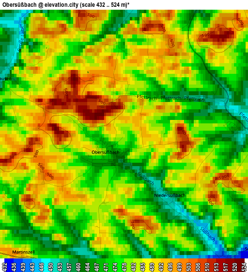
Below is the Elevation map of Obersüßbach, which displays elevation range with different colors. Scale of the first map is from 432 to 524 m (1417 to 1719 ft) with average elevation of 480.8 meters (=1577 ft) [note 1]
These maps also provides idea of topography and contour of this city, they are displayed at different zoom levels. More info about maps, scale and edge coordinates you can find below images.
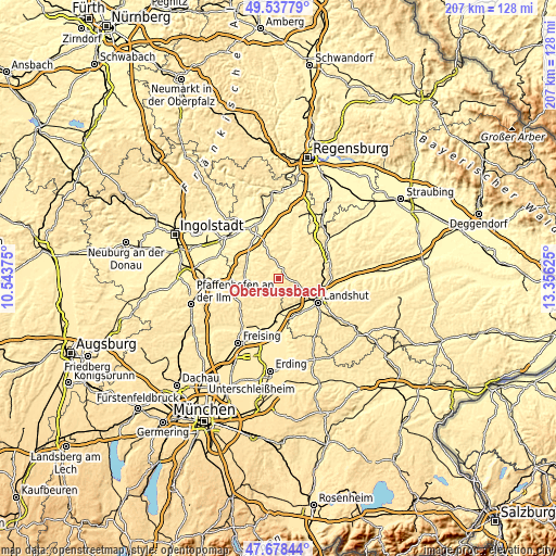
| \ | Map #1 | Topo.Map |
| Scale [m] | 432..524 m | × |
| Scale [ft] | 1417..1719 ft | × |
| Average | 480.8 m = 1577 ft | × |
| Width | 6.46 km = 4 mi | 206.7 km = 128.4 mi |
| Height | 6.46 km = 4 mi | 206.7 km = 128.4 mi |
| ↑Max Latitude | 48.645714° | 49.53779° |
| Latitude at center | 48.61667° | 48.61667° |
| ↓Min Latitude | 48.58761° | 47.67844° |
| ← Min Longitude | 11.906055° | 10.54375° |
| Longitude center | 11.95° | 11.95° |
| →Max Longitude | 11.993945° | 13.35625° |
Nearby cities:
Cities around Obersüßbach sort by population:
• Mainburg elevation 423 m
12.7 km,  282°
282°
• Rottenburg an der Laaber 446 m
11.1 km,  30°
30°
• Bruckberg 422 m
11 km,  162°
162°
• Pfeffenhausen 440 m
5.5 km,  12°
12°
• Hohenthann 478 m
11.6 km,  64°
64°
• Mauern 444 m
11.7 km,  198°
198°
• Weihmichl 435 m
7.6 km,  104°
104°
• Hörgertshausen 457 m
9.6 km,  219°
219°
• Volkenschwand 503 m
5.2 km,  249°
249°
• Gammelsdorf 493 m
7.4 km,  180°
180°
• Wildenberg 414 m
13.1 km,  343°
343°
• Attenhofen 458 m
8.4 km,  296°
296°
Multilingual:
 En español:
Obersüßbach elevación 478 m.
 En France:
Obersüßbach élévation 478 m.
 Auf Deutsch:
Obersüßbach höhe über dem Meeresspiegel ist 478 m.

Sources and notes:
- [note 1] Map square and city borders are not equal. Map elevation data is calculated only from area inside that square.
- [src 1] Elevation data from geonames database provided with same terms of usage.
- [src 2] The elevation map of Obersüßbach is generated using elevation data from NASA's 3 arcsec (90m) resolution SRTM data.
- [src 3] Base (background) map © OpenStreetMap contributors tiles are generated by Geofabrik and OpenTopoMap.
Copyright & License:
This Obersüßbach Elevation Map is licensed under CC BY-SA. You may reuse any part from this page, if you give a proper credit by linking to this URL:
 More info on terms of use page.