Mainburg elevation
Mainburg (Bavaria, Lower Bavaria), Germany elevation is 423 meters and Mainburg elevation in feet is 1388 ft above sea level [src 1]. Mainburg is a populated place (feature code) with elevation that is 165 meters (541 ft) bigger than average city elevation in Germany.
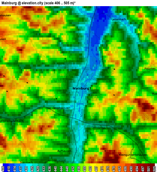
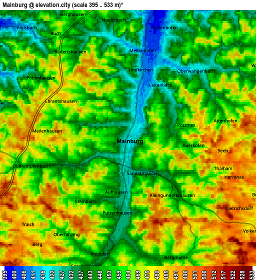
Below is the Elevation map of Mainburg, which displays elevation range with different colors. Scale of the first map is from 406 to 505 m (1332 to 1657 ft) with average elevation of 451.7 meters (=1482 ft) [note 1]
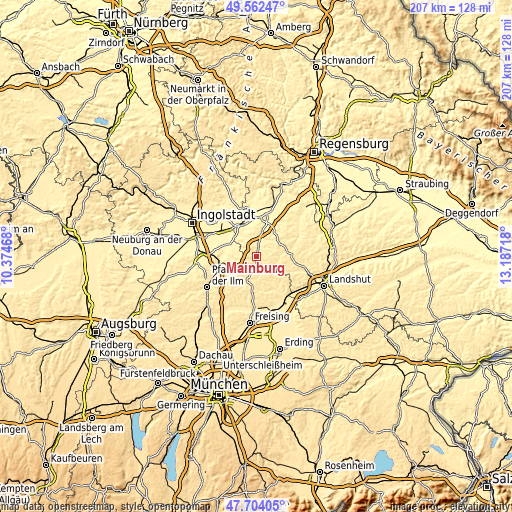
These maps also provides idea of topography and contour of this city, they are displayed at different zoom levels. More info about maps, scale and edge coordinates you can find below images.
| \ | Map #1 | Map #2 | Topo.Map |
| Scale [m] | 406..505 m | 395..533 m | × |
| Scale [ft] | 1332..1657 ft | 1296..1749 ft | × |
| Average | 451.7 m = 1482 ft | 461.1 m = 1513 ft | × |
| Width | 6.46 km = 4 mi | 12.91 km = 8 mi | 206.6 km = 128.4 mi |
| Height | 6.46 km = 4 mi | 12.91 km = 8 mi | 206.6 km = 128.4 mi |
| ↑Max Latitude | 48.670849° | 48.699862° | 49.56247° |
| Latitude at center | 48.64182° | 48.64182° | 48.64182° |
| ↓Min Latitude | 48.612774° | 48.583712° | 47.70405° |
| ← Min Longitude | 11.736985° | 11.693039° | 10.37468° |
| Longitude center | 11.78093° | 11.78093° | 11.78093° |
| →Max Longitude | 11.824875° | 11.868821° | 13.18718° |
Nearby cities:
Cities around Mainburg sort by population:
• Wolnzach elevation 413 m
12.2 km,  249°
249°
• Au in der Hallertau 455 m
9.7 km,  197°
197°
• Nandlstadt 471 m
11.9 km,  170°
170°
• Rudelzhausen 462 m
4.8 km,  192°
192°
• Elsendorf 402 m
7.6 km,  16°
16°
• Hörgertshausen 457 m
12 km,  148°
148°
• Train 416 m
10.9 km, 20°
• Obersüßbach 478 m
12.7 km,  102°
102°
• Aiglsbach 411 m
7.7 km,  316°
316°
• Volkenschwand 503 m
8.8 km,  121°
121°
• Wildenberg 414 m
13 km,  41°
41°
• Attenhofen 458 m
5.1 km,  78°
78°
Multilingual:
 En español:
Mainburg elevación 423 m.
 En France:
Mainburg élévation 423 m.
 Auf Deutsch:
Mainburg höhe über dem Meeresspiegel ist 423 m.

Sources and notes:
- [note 1] Map square and city borders are not equal. Map elevation data is calculated only from area inside that square.
- [src 1] Elevation data from geonames database provided with same terms of usage.
- [src 2] The elevation map of Mainburg is generated using elevation data from NASA's 3 arcsec (90m) resolution SRTM data.
- [src 3] Base (background) map © OpenStreetMap contributors tiles are generated by Geofabrik and OpenTopoMap.
Copyright & License:
This Mainburg Elevation Map is licensed under CC BY-SA. You may reuse any part from this page, if you give a proper credit by linking to this URL:
 More info on terms of use page.