Polch elevation
Polch (Rheinland-Pfalz), Germany elevation is 214 meters and Polch elevation in feet is 702 ft above sea level [src 1]. Polch is a populated place (feature code) with elevation that is 44 meters (144 ft) smaller than average city elevation in Germany.
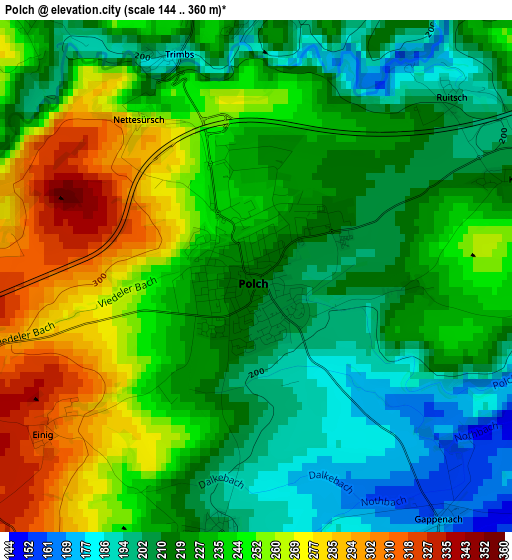
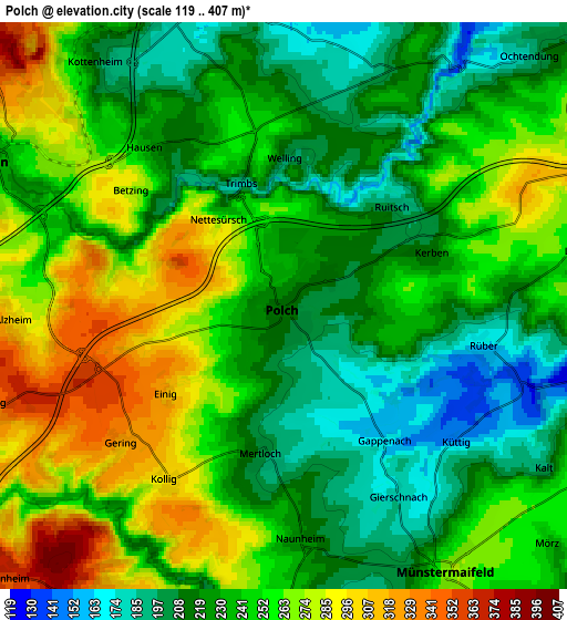
Below is the Elevation map of Polch, which displays elevation range with different colors. Scale of the first map is from 144 to 360 m (472 to 1181 ft) with average elevation of 232 meters (=761 ft) [note 1]
These maps also provides idea of topography and contour of this city, they are displayed at different zoom levels. More info about maps, scale and edge coordinates you can find below images.
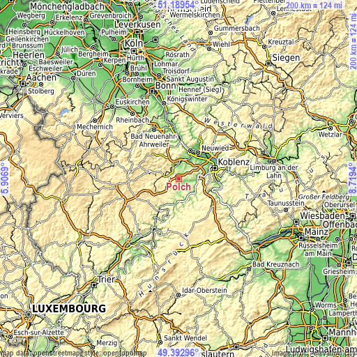
| \ | Map #1 | Map #2 | Topo.Map |
| Scale [m] | 144..360 m | 119..407 m | × |
| Scale [ft] | 472..1181 ft | 390..1335 ft | × |
| Average | 232 m = 761 ft | 242.8 m = 797 ft | × |
| Width | 6.24 km = 3.9 mi | 12.48 km = 7.8 mi | 199.8 km = 124.1 mi |
| Height | 6.24 km = 3.9 mi | 12.48 km = 7.8 mi | 199.7 km = 124.1 mi |
| ↑Max Latitude | 50.327793° | 50.355839° | 51.18954° |
| Latitude at center | 50.29973° | 50.29973° | 50.29973° |
| ↓Min Latitude | 50.271651° | 50.243555° | 49.39296° |
| ← Min Longitude | 7.269205° | 7.225259° | 5.9069° |
| Longitude center | 7.31315° | 7.31315° | 7.31315° |
| →Max Longitude | 7.357095° | 7.401041° | 8.7194° |
Nearby cities:
Cities around Polch sort by population:
• Mayen elevation 238 m
7.1 km,  296°
296°
• Mendig 195 m
7.7 km,  344°
344°
• Ochtendung 182 m
7.5 km,  41°
41°
• Kruft 156 m
9.4 km,  8°
8°
• Münstermaifeld 266 m
6.9 km,  149°
149°
• Ettringen 388 m
8.8 km,  309°
309°
• Kottenheim 231 m
7.2 km,  321°
321°
• Mertloch 196 m
3.4 km,  186°
186°
• Lehmen 139 m
9.9 km,  100°
100°
• Thür 191 m
6.9 km, 337°
• Lonnig 250 m
6.6 km,  80°
80°
• Kehrig 362 m
7.1 km,  255°
255°
Multilingual:
 En español:
Polch elevación 214 m.
 En France:
Polch élévation 214 m.


Sources and notes:
- [note 1] Map square and city borders are not equal. Map elevation data is calculated only from area inside that square.
- [src 1] Elevation data from geonames database provided with same terms of usage.
- [src 2] The elevation map of Polch is generated using elevation data from NASA's 3 arcsec (90m) resolution SRTM data.
- [src 3] Base (background) map © OpenStreetMap contributors tiles are generated by Geofabrik and OpenTopoMap.
Copyright & License:
This Polch Elevation Map is licensed under CC BY-SA. You may reuse any part from this page, if you give a proper credit by linking to this URL:
 More info on terms of use page.