Ochtendung elevation
Ochtendung (Rheinland-Pfalz), Germany elevation is 182 meters and Ochtendung elevation in feet is 597 ft above sea level [src 1]. Ochtendung is a seat of a fourth-order administrative division (feature code) with elevation that is 76 meters (249 ft) smaller than average city elevation in Germany.
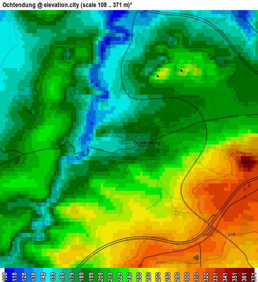
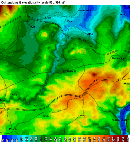
Below is the Elevation map of Ochtendung, which displays elevation range with different colors. Scale of the first map is from 108 to 371 m (354 to 1217 ft) with average elevation of 216.1 meters (=709 ft) [note 1]
These maps also provides idea of topography and contour of this city, they are displayed at different zoom levels. More info about maps, scale and edge coordinates you can find below images.
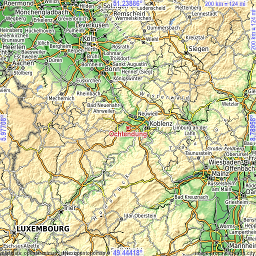
| \ | Map #1 | Map #2 | Topo.Map |
| Scale [m] | 108..371 m | 56..396 m | × |
| Scale [ft] | 354..1217 ft | 184..1299 ft | × |
| Average | 216.1 m = 709 ft | 202.6 m = 665 ft | × |
| Width | 6.24 km = 3.9 mi | 12.47 km = 7.7 mi | 199.5 km = 124 mi |
| Height | 6.24 km = 3.9 mi | 12.47 km = 7.7 mi | 199.5 km = 124 mi |
| ↑Max Latitude | 50.378033° | 50.40605° | 51.23886° |
| Latitude at center | 50.35° | 50.35° | 50.35° |
| ↓Min Latitude | 50.32195° | 50.293884° | 49.44418° |
| ← Min Longitude | 7.339385° | 7.295439° | 5.97708° |
| Longitude center | 7.38333° | 7.38333° | 7.38333° |
| →Max Longitude | 7.427275° | 7.471221° | 8.78958° |
Nearby cities:
Cities around Ochtendung sort by population:
• Mendig elevation 195 m
7.3 km,  284°
284°
• Polch 214 m
7.5 km,  221°
221°
• Plaidt 115 m
4.8 km,  7°
7°
• Kruft 156 m
5.1 km,  316°
316°
• Kettig 74 m
8.1 km,  46°
46°
• Kobern-Gondorf 139 m
7.4 km,  135°
135°
• Bassenheim 173 m
5.5 km,  80°
80°
• Dieblich 106 m
7.5 km,  122°
122°
• Saffig 104 m
4.4 km,  32°
32°
• Thür 191 m
7.6 km, 275°
• Lonnig 250 m
4.7 km,  160°
160°
• Wolken 242 m
6.2 km,  107°
107°
Multilingual:
 En español:
Ochtendung elevación 182 m.
 En France:
Ochtendung élévation 182 m.
 Auf Deutsch:
Ochtendung höhe über dem Meeresspiegel ist 182 m.

Sources and notes:
- [note 1] Map square and city borders are not equal. Map elevation data is calculated only from area inside that square.
- [src 1] Elevation data from geonames database provided with same terms of usage.
- [src 2] The elevation map of Ochtendung is generated using elevation data from NASA's 3 arcsec (90m) resolution SRTM data.
- [src 3] Base (background) map © OpenStreetMap contributors tiles are generated by Geofabrik and OpenTopoMap.
Copyright & License:
This Ochtendung Elevation Map is licensed under CC BY-SA. You may reuse any part from this page, if you give a proper credit by linking to this URL:
 More info on terms of use page.