Pressath elevation
Pressath (Bavaria, Upper Palatinate), Germany elevation is 441 meters and Pressath elevation in feet is 1447 ft above sea level [src 1]. Pressath is a populated place (feature code) with elevation that is 183 meters (600 ft) bigger than average city elevation in Germany.
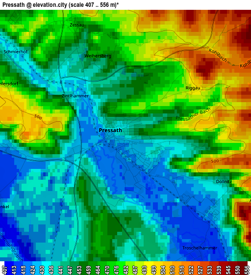
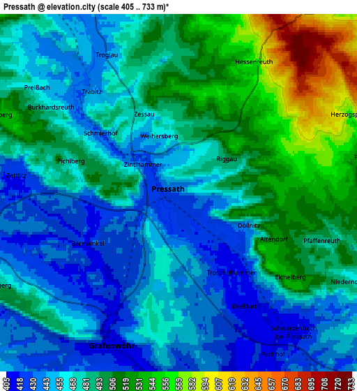
Below is the Elevation map of Pressath, which displays elevation range with different colors. Scale of the first map is from 407 to 556 m (1335 to 1824 ft) with average elevation of 459 meters (=1506 ft) [note 1]
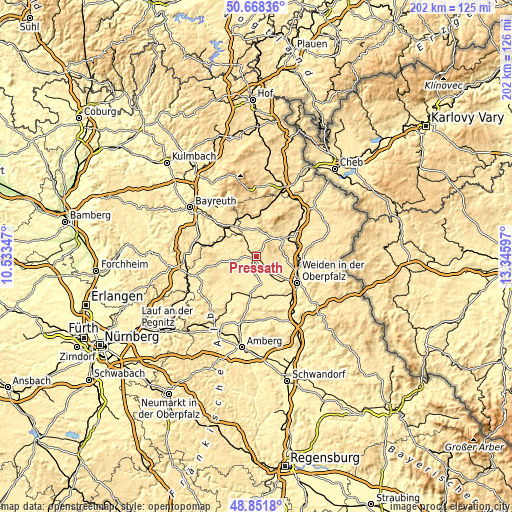
These maps also provides idea of topography and contour of this city, they are displayed at different zoom levels. More info about maps, scale and edge coordinates you can find below images.
| \ | Map #1 | Map #2 | Topo.Map |
| Scale [m] | 407..556 m | 405..733 m | × |
| Scale [ft] | 1335..1824 ft | 1329..2405 ft | × |
| Average | 459 m = 1506 ft | 480.6 m = 1577 ft | × |
| Width | 6.31 km = 3.9 mi | 12.62 km = 7.8 mi | 202 km = 125.5 mi |
| Height | 6.31 km = 3.9 mi | 12.62 km = 7.8 mi | 202 km = 125.5 mi |
| ↑Max Latitude | 49.796965° | 49.825323° | 50.66836° |
| Latitude at center | 49.76859° | 49.76859° | 49.76859° |
| ↓Min Latitude | 49.740198° | 49.71179° | 48.8518° |
| ← Min Longitude | 11.895775° | 11.851829° | 10.53347° |
| Longitude center | 11.93972° | 11.93972° | 11.93972° |
| →Max Longitude | 11.983665° | 12.027611° | 13.34597° |
Nearby cities:
Cities around Pressath sort by population:
• Berg elevation 493 m
15.4 km,  70°
70°
• Grafenwöhr 415 m
6.2 km,  202°
202°
• Erbendorf 492 m
11 km,  43°
43°
• Kemnath 462 m
11.8 km,  342°
342°
• Mantel 402 m
14.7 km,  150°
150°
• Kulmain 500 m
14.9 km,  348°
348°
• Parkstein 511 m
10.2 km,  115°
115°
• Immenreuth 502 m
15.5 km, 340°
• Krummennaab 484 m
13.6 km,  57°
57°
• Kastl 477 m
7.7 km, 338°
• Trabitz 443 m
4.5 km,  320°
320°
• Speinshart 430 m
9 km,  285°
285°
Multilingual:
 En español:
Pressath elevación 441 m.
 En France:
Pressath élévation 441 m.
 Auf Deutsch:
Pressath höhe über dem Meeresspiegel ist 441 m.

Sources and notes:
- [note 1] Map square and city borders are not equal. Map elevation data is calculated only from area inside that square.
- [src 1] Elevation data from geonames database provided with same terms of usage.
- [src 2] The elevation map of Pressath is generated using elevation data from NASA's 3 arcsec (90m) resolution SRTM data.
- [src 3] Base (background) map © OpenStreetMap contributors tiles are generated by Geofabrik and OpenTopoMap.
Copyright & License:
This Pressath Elevation Map is licensed under CC BY-SA. You may reuse any part from this page, if you give a proper credit by linking to this URL:
 More info on terms of use page.