Ratingen elevation
Ratingen (North Rhine-Westphalia, Düsseldorf District), Germany elevation is 64 meters and Ratingen elevation in feet is 210 ft above sea level [src 1]. Ratingen is a populated place (feature code) with elevation that is 194 meters (636 ft) smaller than average city elevation in Germany.
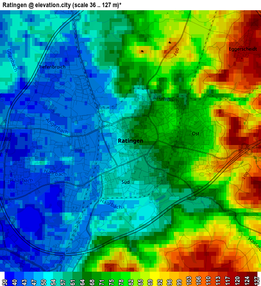
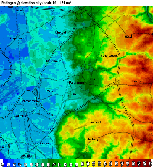
Below is the Elevation map of Ratingen, which displays elevation range with different colors. Scale of the first map is from 36 to 127 m (118 to 417 ft) with average elevation of 66.4 meters (=218 ft) [note 1]
These maps also provides idea of topography and contour of this city, they are displayed at different zoom levels. More info about maps, scale and edge coordinates you can find below images.
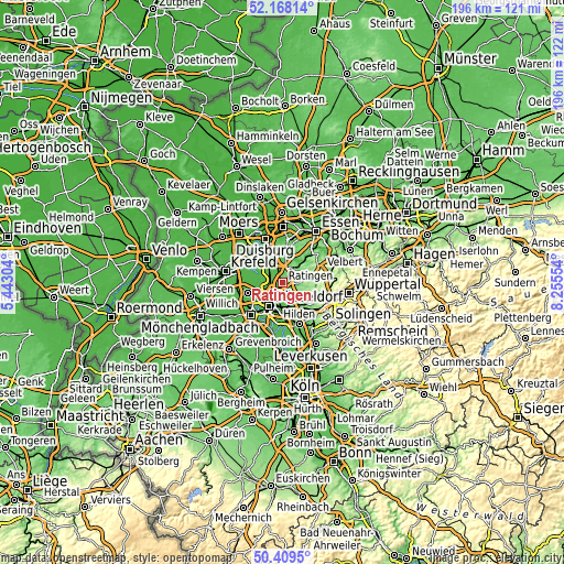
| \ | Map #1 | Map #2 | Topo.Map |
| Scale [m] | 36..127 m | 19..171 m | × |
| Scale [ft] | 118..417 ft | 62..561 ft | × |
| Average | 66.4 m = 218 ft | 77.4 m = 254 ft | × |
| Width | 6.11 km = 3.8 mi | 12.22 km = 7.6 mi | 195.5 km = 121.5 mi |
| Height | 6.11 km = 3.8 mi | 12.22 km = 7.6 mi | 195.5 km = 121.5 mi |
| ↑Max Latitude | 51.32471° | 51.352163° | 52.16814° |
| Latitude at center | 51.29724° | 51.29724° | 51.29724° |
| ↓Min Latitude | 51.269754° | 51.242251° | 50.4095° |
| ← Min Longitude | 6.805345° | 6.761399° | 5.44304° |
| Longitude center | 6.84929° | 6.84929° | 6.84929° |
| →Max Longitude | 6.893235° | 6.937181° | 8.25554° |
Nearby cities:
Cities around Ratingen sort by population:
• Düsseldorf elevation 45 m
9.8 km,  211°
211°
• Mülheim 40 m
15.2 km,  8°
8°
• Neuss 44 m
15.9 km,  226°
226°
• Velbert 245 m
14.1 km,  72°
72°
• Hilden 52 m
15.4 km,  158°
158°
• Meerbusch 34 m
12.3 km,  246°
246°
• Erkrath 56 m
9.3 km,  153°
153°
• Mettmann 132 m
10.2 km,  120°
120°
• Düsseldorf-Pempelfort 43 m
7.9 km, 213°
• Heiligenhaus 180 m
9.1 km, 68°
• Wülfrath 189 m
13.2 km,  97°
97°
• Hochfeld 36 m
15.1 km,  334°
334°
Multilingual:
 En español:
Ratingen elevación 64 m.
 En France:
Ratingen élévation 64 m.


Sources and notes:
- [note 1] Map square and city borders are not equal. Map elevation data is calculated only from area inside that square.
- [src 1] Elevation data from geonames database provided with same terms of usage.
- [src 2] The elevation map of Ratingen is generated using elevation data from NASA's 3 arcsec (90m) resolution SRTM data.
- [src 3] Base (background) map © OpenStreetMap contributors tiles are generated by Geofabrik and OpenTopoMap.
Copyright & License:
This Ratingen Elevation Map is licensed under CC BY-SA. You may reuse any part from this page, if you give a proper credit by linking to this URL:
 More info on terms of use page.