Raunheim elevation
Raunheim (Hesse, Regierungsbezirk Darmstadt), Germany elevation is 91 meters and Raunheim elevation in feet is 299 ft above sea level [src 1]. Raunheim is a populated place (feature code) with elevation that is 167 meters (548 ft) smaller than average city elevation in Germany.
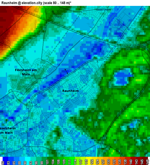
Below is the Elevation map of Raunheim, which displays elevation range with different colors. Scale of the first map is from 80 to 148 m (262 to 486 ft) with average elevation of 97.9 meters (=321 ft) [note 1]
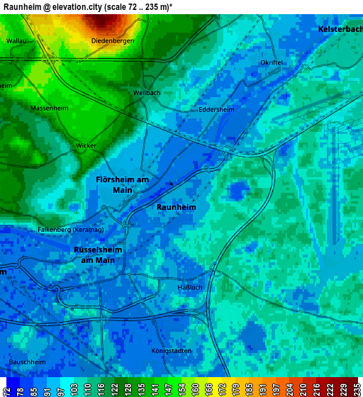
These maps also provides idea of topography and contour of this city, they are displayed at different zoom levels. More info about maps, scale and edge coordinates you can find below images.
| \ | Map #1 | Map #2 | Topo.Map |
| Scale [m] | 80..148 m | 72..235 m | × |
| Scale [ft] | 262..486 ft | 236..771 ft | × |
| Average | 97.9 m = 321 ft | 105.6 m = 346 ft | × |
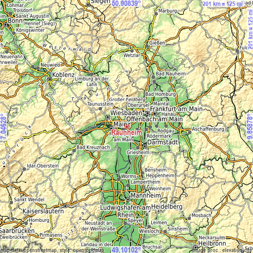
| Width | 6.28 km = 3.9 mi | 12.56 km = 7.8 mi | 201 km = 124.9 mi |
| Height | 6.28 km = 3.9 mi | 12.56 km = 7.8 mi | 200.9 km = 124.8 mi |
| ↑Max Latitude | 50.041431° | 50.069646° | 50.90839° |
| Latitude at center | 50.0132° | 50.0132° | 50.0132° |
| ↓Min Latitude | 49.984952° | 49.956687° | 49.10102° |
| ← Min Longitude | 8.408585° | 8.364639° | 7.04628° |
| Longitude center | 8.45253° | 8.45253° | 8.45253° |
| →Max Longitude | 8.496475° | 8.540421° | 9.85878° |
Nearby cities:
Cities around Raunheim sort by population:
• Rüsselsheim elevation 89 m
3.4 km,  219°
219°
• Hofheim am Taunus 145 m
8.6 km,  358°
358°
• Mörfelden-Walldorf 109 m
9.6 km,  102°
102°
• Hattersheim 108 m
7.4 km,  12°
12°
• Groß-Gerau 95 m
10.4 km,  168°
168°
• Flörsheim 94 m
1.8 km,  269°
269°
• Hochheim am Main 131 m
7.2 km, 271°
• Ginsheim-Gustavsburg 85 m
9 km,  238°
238°
• Kelsterbach 107 m
7.7 km,  45°
45°
• Trebur 89 m
10.2 km,  198°
198°
• Bischofsheim 86 m
6.5 km,  250°
250°
• Kriftel 118 m
8 km, 8°
Multilingual:
 En español:
Raunheim elevación 91 m.
 En France:
Raunheim élévation 91 m.


Sources and notes:
- [note 1] Map square and city borders are not equal. Map elevation data is calculated only from area inside that square.
- [src 1] Elevation data from geonames database provided with same terms of usage.
- [src 2] The elevation map of Raunheim is generated using elevation data from NASA's 3 arcsec (90m) resolution SRTM data.
- [src 3] Base (background) map © OpenStreetMap contributors tiles are generated by Geofabrik and OpenTopoMap.
Copyright & License:
This Raunheim Elevation Map is licensed under CC BY-SA. You may reuse any part from this page, if you give a proper credit by linking to this URL:
 More info on terms of use page.