Kelsterbach elevation
Kelsterbach (Hesse, Regierungsbezirk Darmstadt), Germany elevation is 107 meters and Kelsterbach elevation in feet is 351 ft above sea level [src 1]. Kelsterbach is a populated place (feature code) with elevation that is 151 meters (495 ft) smaller than average city elevation in Germany.
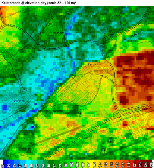
Below is the Elevation map of Kelsterbach, which displays elevation range with different colors. Scale of the first map is from 82 to 126 m (269 to 413 ft) with average elevation of 101.4 meters (=333 ft) [note 1]
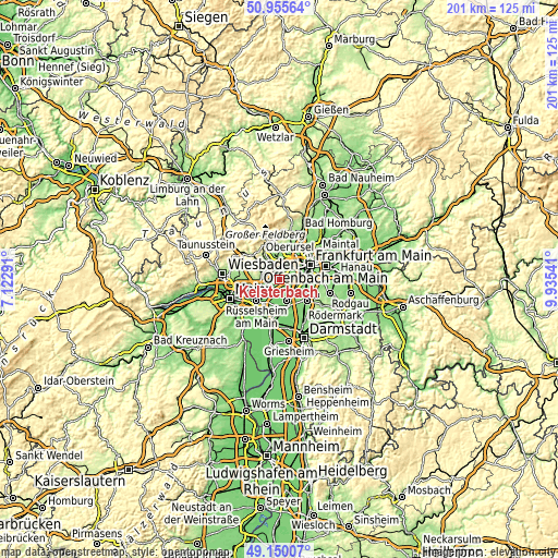
These maps also provides idea of topography and contour of this city, they are displayed at different zoom levels. More info about maps, scale and edge coordinates you can find below images.
| \ | Map #1 | Map #2 | Topo.Map |
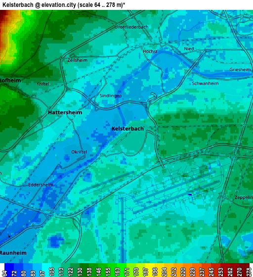
| Scale [m] | 82..126 m | 64..278 m | × |
| Scale [ft] | 269..413 ft | 210..912 ft | × |
| Average | 101.4 m = 333 ft | 108.1 m = 355 ft | × |
| Width | 6.27 km = 3.9 mi | 12.55 km = 7.8 mi | 200.8 km = 124.8 mi |
| Height | 6.27 km = 3.9 mi | 12.55 km = 7.8 mi | 200.7 km = 124.7 mi |
| ↑Max Latitude | 50.089553° | 50.11774° | 50.95564° |
| Latitude at center | 50.06135° | 50.06135° | 50.06135° |
| ↓Min Latitude | 50.03313° | 50.004894° | 49.15007° |
| ← Min Longitude | 8.485215° | 8.441269° | 7.12291° |
| Longitude center | 8.52916° | 8.52916° | 8.52916° |
| →Max Longitude | 8.573105° | 8.617051° | 9.93541° |
Nearby cities:
Cities around Kelsterbach sort by population:
• Gallus elevation 101 m
8.4 km,  58°
58°
• Hofheim am Taunus 145 m
6.5 km,  299°
299°
• Mörfelden-Walldorf 109 m
8.4 km,  152°
152°
• Hattersheim 108 m
4.3 km, 296°
• Niederrad 99 m
7.5 km,  71°
71°
• Bad Soden am Taunus 139 m
9 km,  348°
348°
• Eschborn 128 m
9.6 km,  18°
18°
• Flörsheim 94 m
9 km,  233°
233°
• Raunheim 91 m
7.7 km, 225°
• Kriftel 118 m
4.9 km, 300°
• Liederbach 145 m
7.2 km,  339°
339°
• Sulzbach 135 m
8.1 km,  359°
359°
Multilingual:
 En español:
Kelsterbach elevación 107 m.
 En France:
Kelsterbach élévation 107 m.
 Auf Deutsch:
Kelsterbach höhe über dem Meeresspiegel ist 107 m.

Sources and notes:
- [note 1] Map square and city borders are not equal. Map elevation data is calculated only from area inside that square.
- [src 1] Elevation data from geonames database provided with same terms of usage.
- [src 2] The elevation map of Kelsterbach is generated using elevation data from NASA's 3 arcsec (90m) resolution SRTM data.
- [src 3] Base (background) map © OpenStreetMap contributors tiles are generated by Geofabrik and OpenTopoMap.
Copyright & License:
This Kelsterbach Elevation Map is licensed under CC BY-SA. You may reuse any part from this page, if you give a proper credit by linking to this URL:
 More info on terms of use page.