Rosche elevation
Rosche (Lower Saxony), Germany elevation is 61 meters and Rosche elevation in feet is 200 ft above sea level [src 1]. Rosche is a seat of a fourth-order administrative division (feature code) with elevation that is 197 meters (646 ft) smaller than average city elevation in Germany.
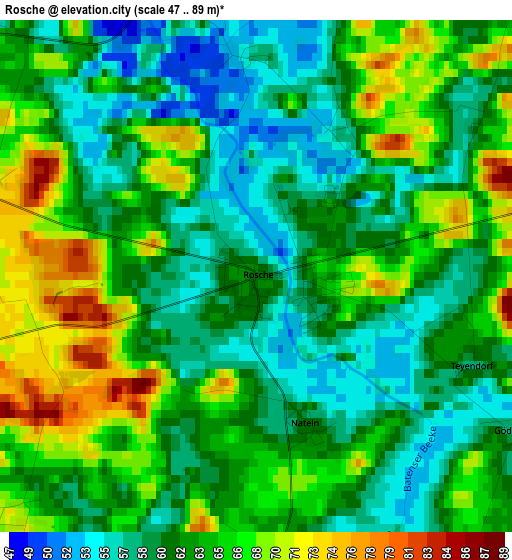
Below is the Elevation map of Rosche, which displays elevation range with different colors. Scale of the first map is from 47 to 89 m (154 to 292 ft) with average elevation of 62.6 meters (=205 ft) [note 1]
These maps also provides idea of topography and contour of this city, they are displayed at different zoom levels. More info about maps, scale and edge coordinates you can find below images.
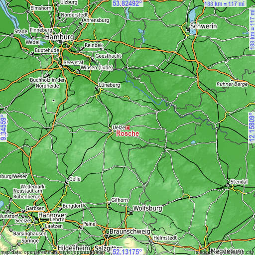
| \ | Map #1 | Topo.Map |
| Scale [m] | 47..89 m | × |
| Scale [ft] | 154..292 ft | × |
| Average | 62.6 m = 205 ft | × |
| Width | 5.88 km = 3.7 mi | 188.3 km = 117 mi |
| Height | 5.88 km = 3.7 mi | 188.2 km = 116.9 mi |
| ↑Max Latitude | 53.013077° | 53.82492° |
| Latitude at center | 52.98663° | 52.98663° |
| ↓Min Latitude | 52.960167° | 52.13175° |
| ← Min Longitude | 10.707895° | 9.34559° |
| Longitude center | 10.75184° | 10.75184° |
| →Max Longitude | 10.795785° | 12.15809° |
Nearby cities:
Cities around Rosche sort by population:
• Uelzen elevation 42 m
13 km,  259°
259°
• Bad Bevensen 34 m
15.4 km,  312°
312°
• Wrestedt 48 m
15 km,  232°
232°
• Wieren 56 m
12.9 km,  208°
208°
• Suhlendorf 62 m
6 km,  170°
170°
• Clenze 30 m
14.8 km,  111°
111°
• Himbergen 66 m
12.1 km,  352°
352°
• Zernien 85 m
12.6 km,  44°
44°
• Bergen an der Dumme 33 m
17.3 km,  127°
127°
• Schnega 40 m
14.2 km,  138°
138°
• Soltendieck 65 m
12.6 km,  177°
177°
• Weste 59 m
8.7 km,  337°
337°
Multilingual:
 En español:
Rosche elevación 61 m.
 En France:
Rosche élévation 61 m.


Sources and notes:
- [note 1] Map square and city borders are not equal. Map elevation data is calculated only from area inside that square.
- [src 1] Elevation data from geonames database provided with same terms of usage.
- [src 2] The elevation map of Rosche is generated using elevation data from NASA's 3 arcsec (90m) resolution SRTM data.
- [src 3] Base (background) map © OpenStreetMap contributors tiles are generated by Geofabrik and OpenTopoMap.
Copyright & License:
This Rosche Elevation Map is licensed under CC BY-SA. You may reuse any part from this page, if you give a proper credit by linking to this URL:
 More info on terms of use page.