Suhlendorf elevation
Suhlendorf (Lower Saxony), Germany elevation is 62 meters and Suhlendorf elevation in feet is 203 ft above sea level [src 1]. Suhlendorf is a seat of a fourth-order administrative division (feature code) with elevation that is 196 meters (643 ft) smaller than average city elevation in Germany.
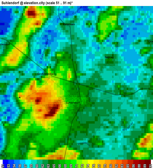
Below is the Elevation map of Suhlendorf, which displays elevation range with different colors. Scale of the first map is from 51 to 91 m (167 to 299 ft) with average elevation of 63.8 meters (=209 ft) [note 1]
These maps also provides idea of topography and contour of this city, they are displayed at different zoom levels. More info about maps, scale and edge coordinates you can find below images.
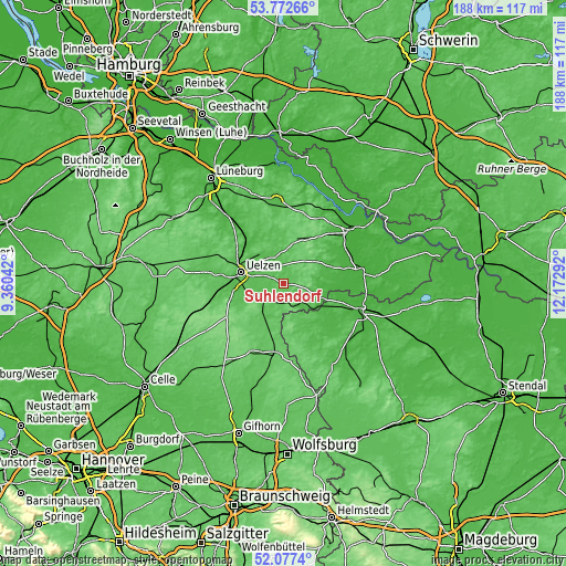
| \ | Map #1 | Topo.Map |
| Scale [m] | 51..91 m | × |
| Scale [ft] | 167..299 ft | × |
| Average | 63.8 m = 209 ft | × |
| Width | 5.89 km = 3.7 mi | 188.5 km = 117.1 mi |
| Height | 5.89 km = 3.7 mi | 188.5 km = 117.1 mi |
| ↑Max Latitude | 52.95981° | 53.77266° |
| Latitude at center | 52.93333° | 52.93333° |
| ↓Min Latitude | 52.906834° | 52.0774° |
| ← Min Longitude | 10.722725° | 9.36042° |
| Longitude center | 10.76667° | 10.76667° |
| →Max Longitude | 10.810615° | 12.17292° |
Nearby cities:
Cities around Suhlendorf sort by population:
• Uelzen elevation 42 m
14.2 km,  284°
284°
• Wrestedt 48 m
13.3 km,  255°
255°
• Wieren 56 m
9 km,  233°
233°
• Clenze 30 m
12.8 km,  88°
88°
• Rosche 61 m
6 km,  350°
350°
• Zernien 85 m
16.9 km,  27°
27°
• Bergen an der Dumme 33 m
13.6 km,  110°
110°
• Schnega 40 m
9.6 km,  119°
119°
• Stadensen 57 m
15.5 km,  245°
245°
• Lüder 68 m
15.4 km,  205°
205°
• Soltendieck 65 m
6.6 km,  182°
182°
• Weste 59 m
14.7 km,  343°
343°
Multilingual:
 En español:
Suhlendorf elevación 62 m.
 En France:
Suhlendorf élévation 62 m.
 Auf Deutsch:
Suhlendorf höhe über dem Meeresspiegel ist 62 m.

Sources and notes:
- [note 1] Map square and city borders are not equal. Map elevation data is calculated only from area inside that square.
- [src 1] Elevation data from geonames database provided with same terms of usage.
- [src 2] The elevation map of Suhlendorf is generated using elevation data from NASA's 3 arcsec (90m) resolution SRTM data.
- [src 3] Base (background) map © OpenStreetMap contributors tiles are generated by Geofabrik and OpenTopoMap.
Copyright & License:
This Suhlendorf Elevation Map is licensed under CC BY-SA. You may reuse any part from this page, if you give a proper credit by linking to this URL:
 More info on terms of use page.